It had been a while since we’d gone on an adventure, and while we both had tons of things to do, it was a pretty day–not too cold–and so we headed towards Nelson and Amherst Counties. We didn’t have a specific plan, and sometimes that works out perfectly!
We took back roads to Rt. 151 South in Nelson County, and followed it to the community of Piney River. As much as we’ve traveled around the state, this is one area we hadn’t visited! We passed a sign that said something about a trail, so we turned around and went back.

Very pretty trail, indeed!

Unfortunately, we quickly learned that pretty places are not always healthy places… According to a sign on the trail, a chemical company operated in the Piney River community for 40 years. While it was good for the local economy, it ultimately caused an environmental disaster.

Chemicals from the company leached into groundwater and into the Piney and Tye Rivers. The EPA designated it a Superfund Site in 1982, and another company related to American Cyanamid took over cleanup efforts in 1990. After a decade, these efforts were considered complete, but the area is still monitored and tested. (We passed “burial mounds” and other “containment” units along the trail behind tall fences–pretty creepy).
Over the years we’ve traveled along many of Virginia’s rivers, and the Piney and Tye Rivers aren’t the only ones that have been contaminated by industrial waste. Unfortunately, the damage that has been done to rivers–especially before stricter EPA regulations took effect–isn’t something that can be completely reversed. EVER.
Case in point, these are signs we’ve seen along the Maury and Shenandoah Rivers, as well as along all the James River…
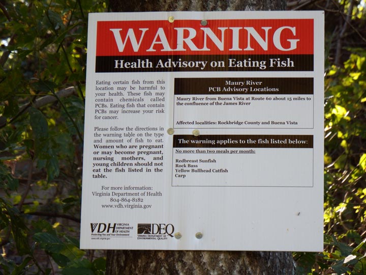


As we read the signs along the Railway Trail about the Piney and Tye Rivers, we had to wonder. What will happen if the EPA is, indeed, intentionally gutted for the sake of economic growth under our current political administration?

At any rate, the Piney River seemed to be a good place for one of our “blessing the water” crystals….


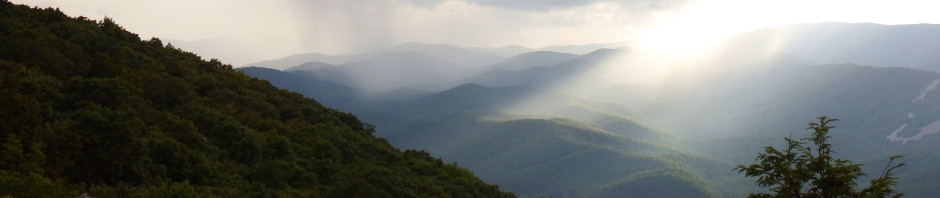
After we left the Railway Trail, we continued on Rt. 151 South until we reached Rt. 29 South. After a short drive on 29, we turned onto Rt. 60 West in Amherst, VA. Oh my–what wonderful views of the Blue Ridge Mountains!


Our plan was to follow Rt. 60 West until it met the Blue Ridge Parkway, just east of the town of Buena Vista. When we saw signs about a couple of parks, however, we impulsively turned onto Lowesville Road to check them out.
Enroute to the parks, there were beautiful pastures surrounded by mountains. Rural Amherst County is really quite lovely….


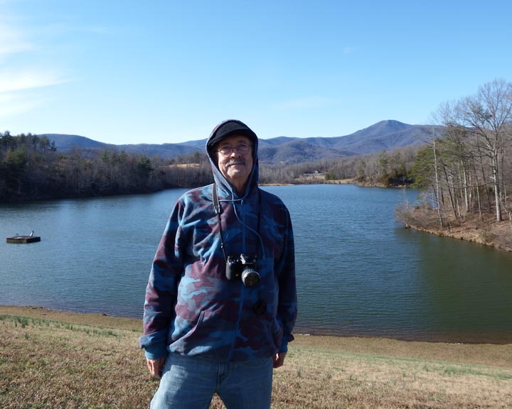
Our first stop was Stonehouse Lake Park:


Funny story to tell about our visit to this park…. We could see a couple of boats out on the water across the lake, but as I was looking toward the left, I caught a flash of something white and blue diving into the water to my right. What was that?!
A few minutes later, I saw it again, and my first thought was that it was some sort of small bird dropping down to grab a minnow or bug. But I didn’t see it come back up!
I mentioned it to Wayne, and he said he saw it drop into the water, too, but thought he saw it quickly fly back up. We were totally puzzled. What kind of bird would do this? And if it wasn’t a bird, what was it? Was something falling (at an angle) from a tree into the water?
We finally (and I do mean finally) noticed that there was a fisherman up on the bank behind the trees, casting his line into the water with its weighted white and blue bobber. Oh, geez…! No idea if he heard us discussing this “strange phenomenon” or not, but if so I guess he had a (well-deserved) laugh at our expense! Fortunately, we’re able to laugh at ourselves, too. 🙂
After leaving Stonehouse Lake Park, we went to Thrasher’s Lake Park. Another man-made lake (along the Buffalo River), it is 36 acres in size, and it was completed in 1977 by the Natural Resources Conservation Service, USDA. The views here were simply stunning.
As I walked up on the earthen dam, this is what I saw, looking to my left, and then to my right:


Unfortunately, the wind started picking up while we were at Thrasher’s Lake, which made it pretty darned cold. Wayne opted to stretch out on the side of the dam in the sunshine, and I put the hood of my sweatshirt up. Brrr!


We left the lake and made our way back to Rt. 60, and then to the Blue Ridge Parkway. As many times as we’ve driven this road along the crest of the mountain, we never fail to be awed by its beauty….
View in my passenger-side mirror as I was stopped at an overlook:


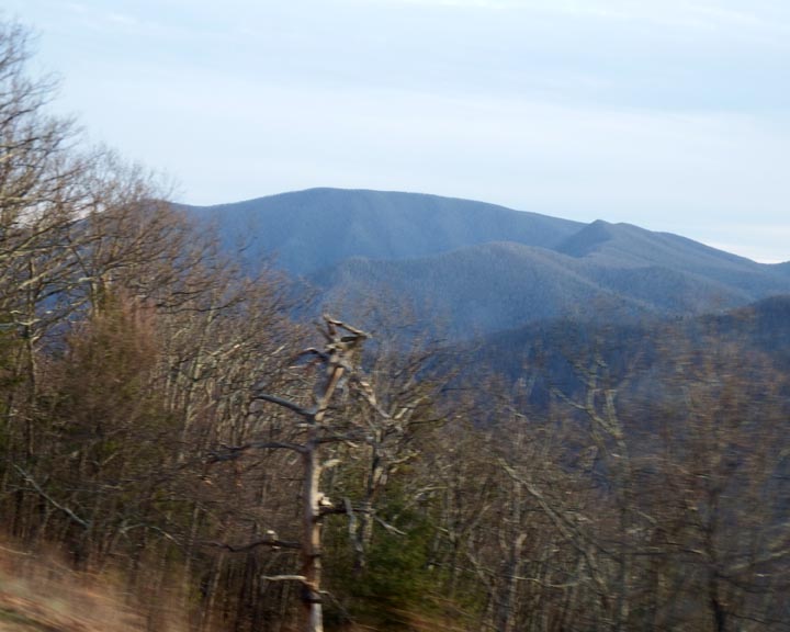
As we got closer to the north end of the Parkway, we saw ice on some of the rocks. Yes, it was definitely getting colder….


In the early evening as the sun began to dip behind one of the distant ridges, everything was bathed in a warm, orange light….


Such a nice day!

To view an interactive map of our route, click on the link: https://drive.google.com/open?id=16hBIQ8_Amty8SFdNcvv0cVH1oIc&usp=sharing
