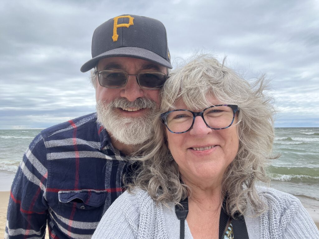
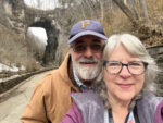
In July 2024 I did a solo road trip to Michigan and Indiana to visit family members. Fortunately, a long overdue return trip in June 2026 wasn’t a solo trip! 😊
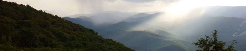
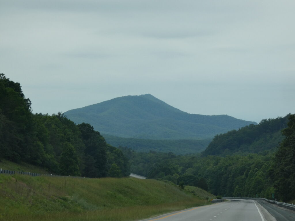
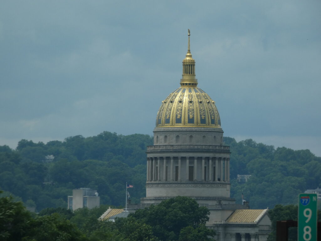
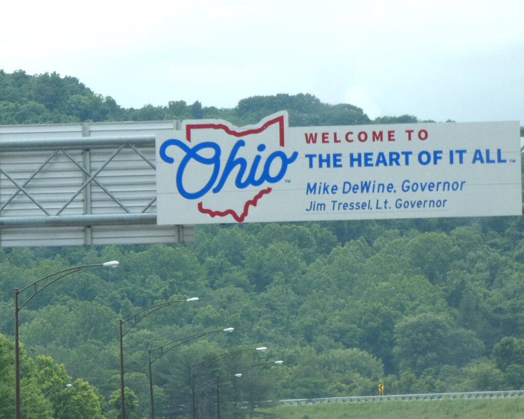
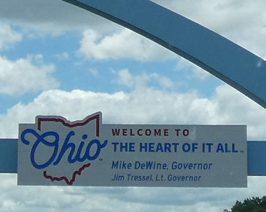
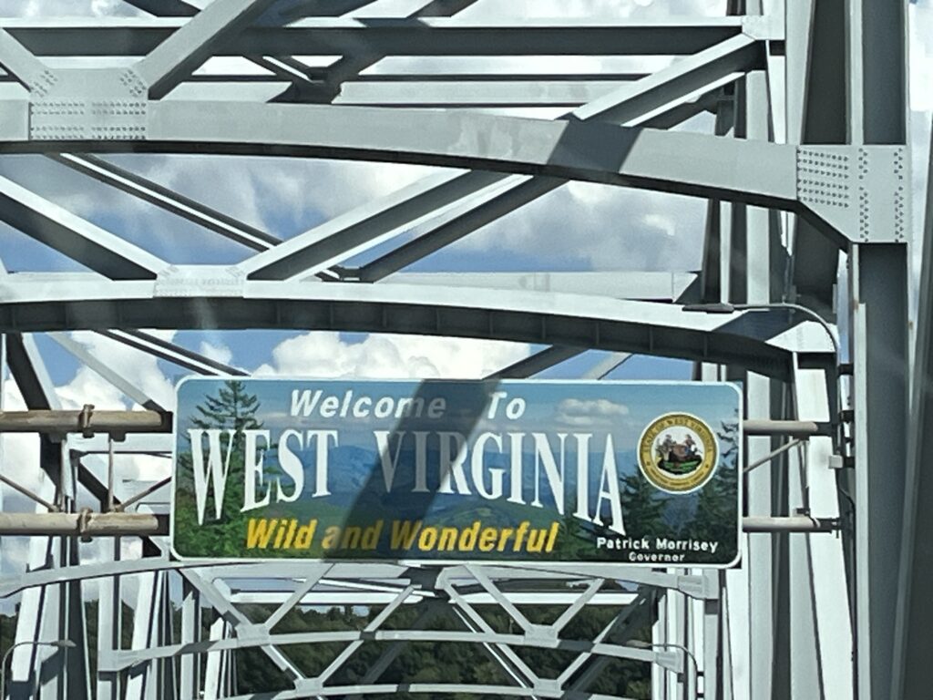
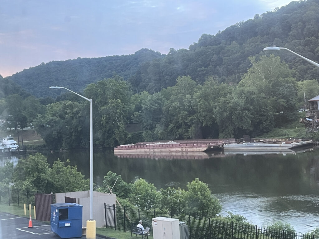
We drove a little over 400 miles the first day, passing through “wild and wonderful” West Virginia before stopping for the night in Marysville, Ohio.
West Virginia mountainsAn iconic landmark: the gold dome of the capitol building in Charleston, WV
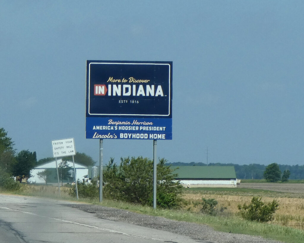
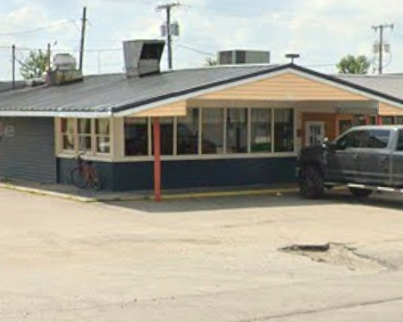
On June 10th we continued on to Indiana, and after lunch at a diner in the small town of Nappanee…
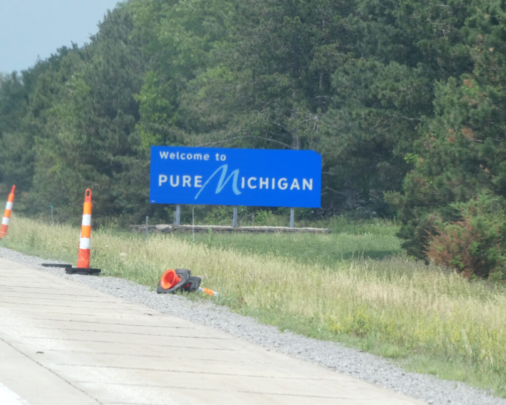
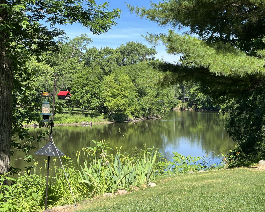
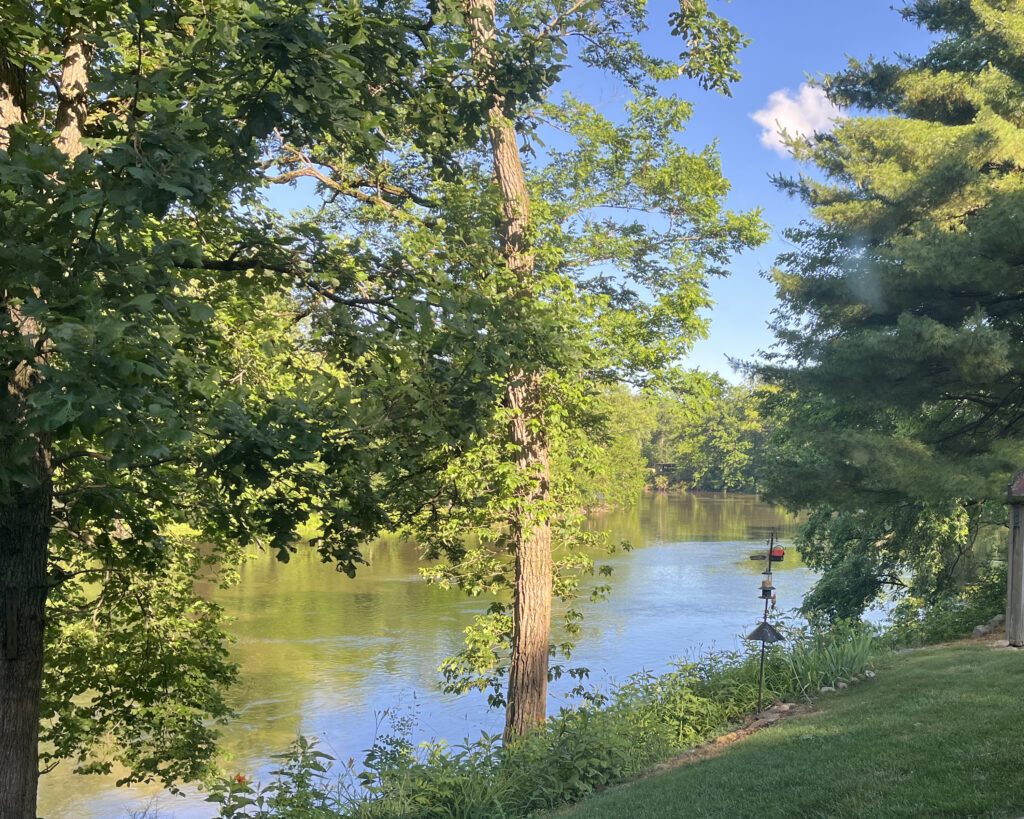
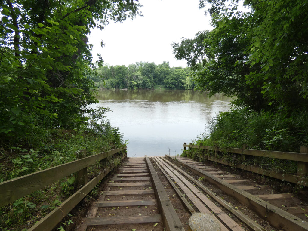
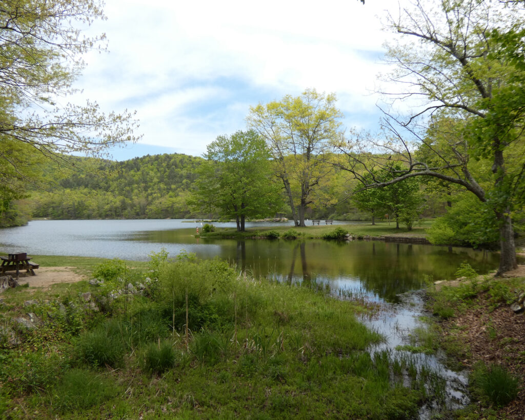
…we arrived at our first destination in Michigan. One of Lenny’s good friends and his wife graciously shared their beautiful home with us, and the view of the St. Joseph River from their backyard was stunning!
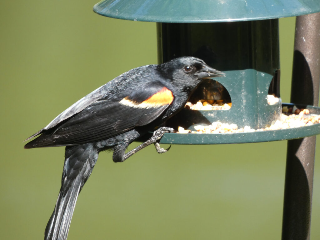
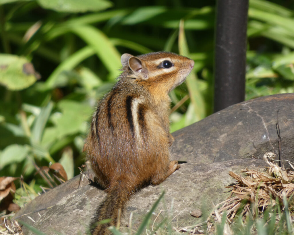
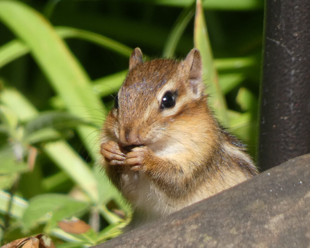
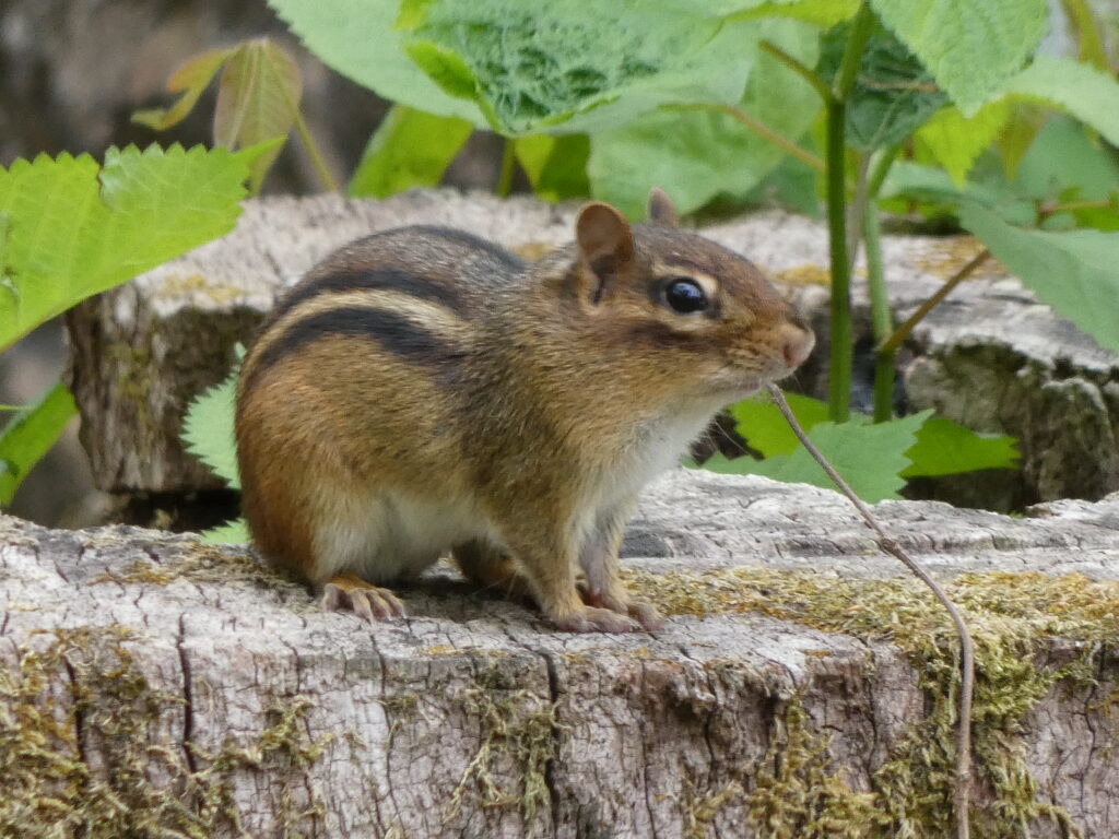
The next morning I had so much fun sitting out on the patio, watching and photographing birds and other wildlife.
I think it was at this point that I wondered if they’d notice if I simply moved in for the summer! 😉
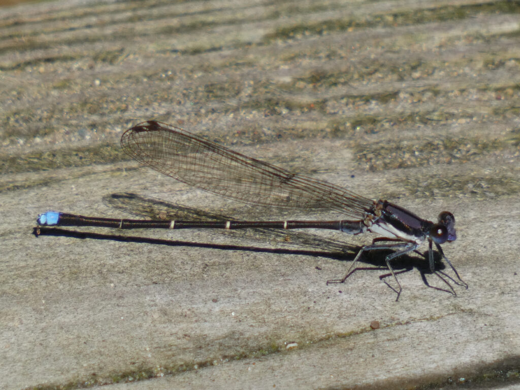
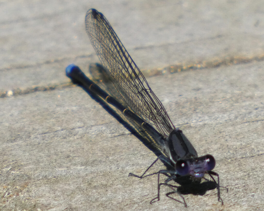
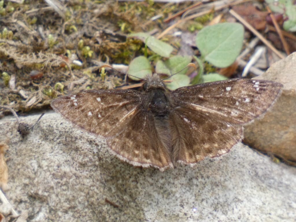
This little critter is a male “Dusky Dancer” damselfly. It seemed as curious about me as I was about it. Lookit those eyes!! 😯
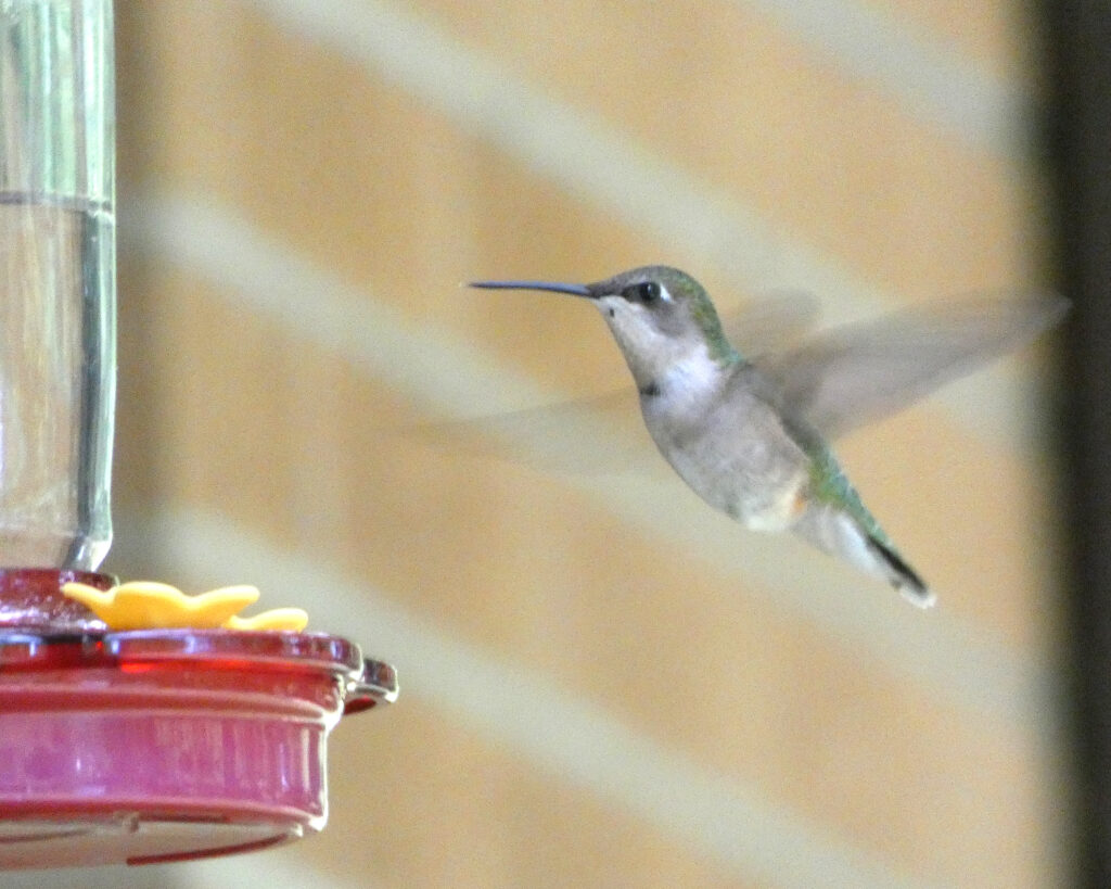
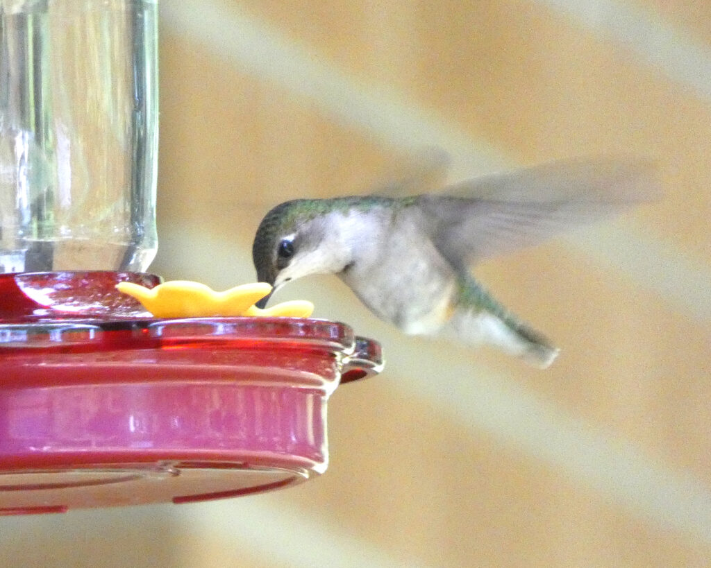
I also enjoyed watching a female Hummingbird who was a frequent visitor at the feeder.
For lunch, we went to an eclectic Japanese/Mexican restaurant. Really good food, and even better company!
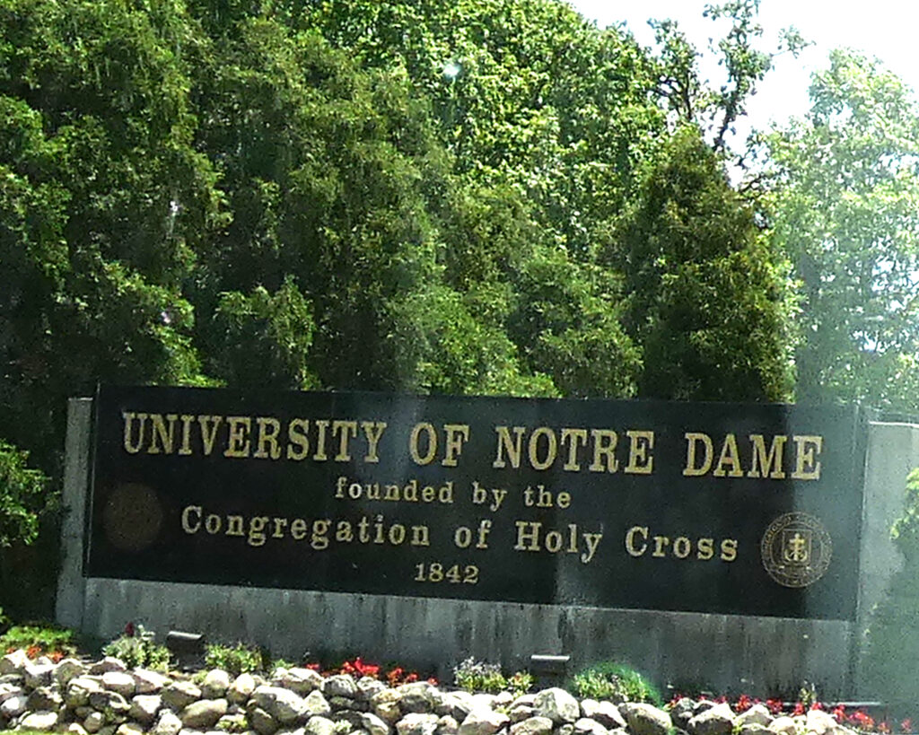
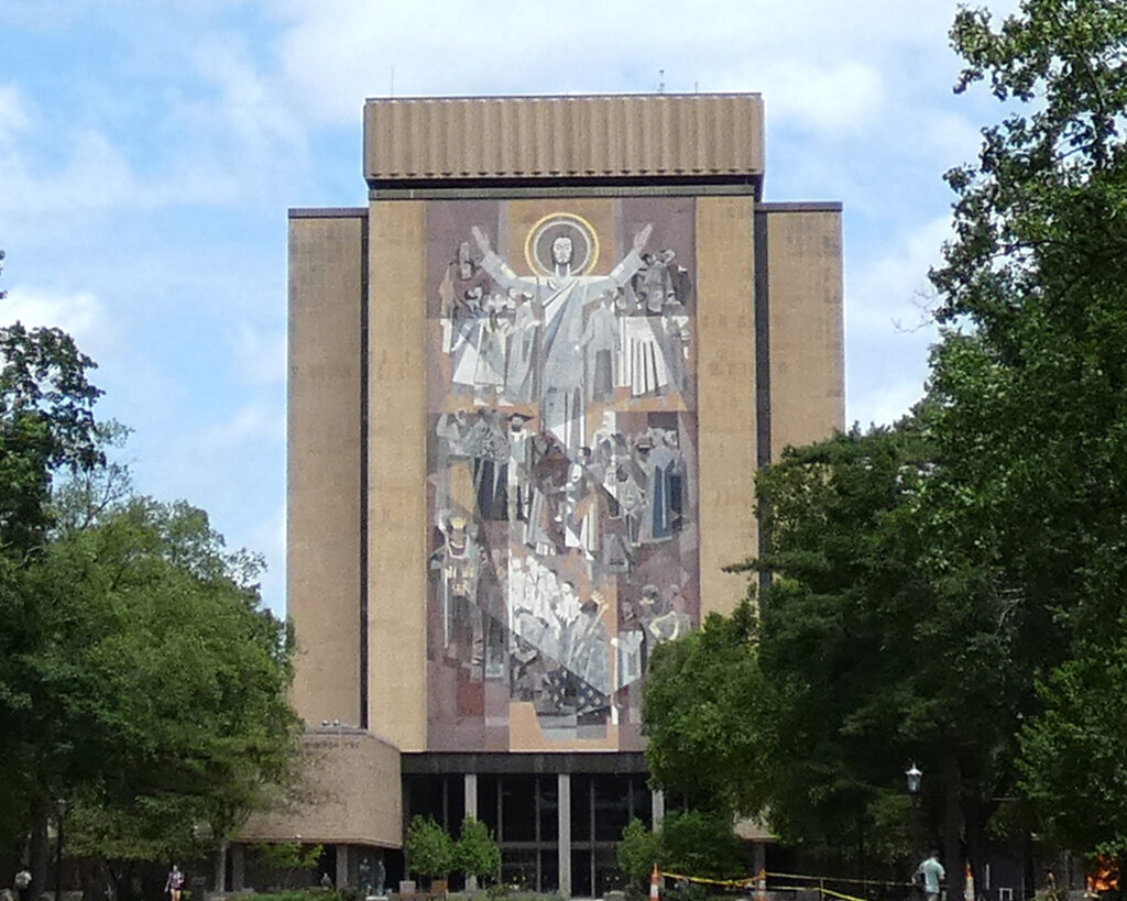
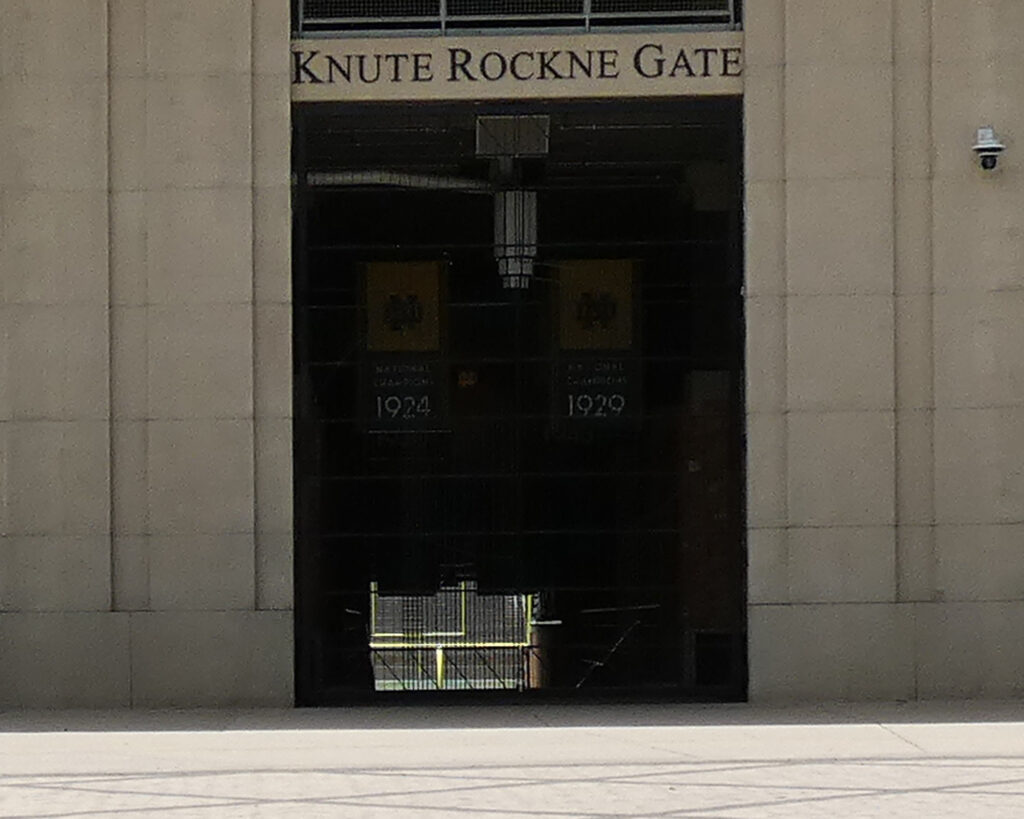
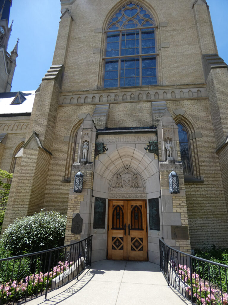
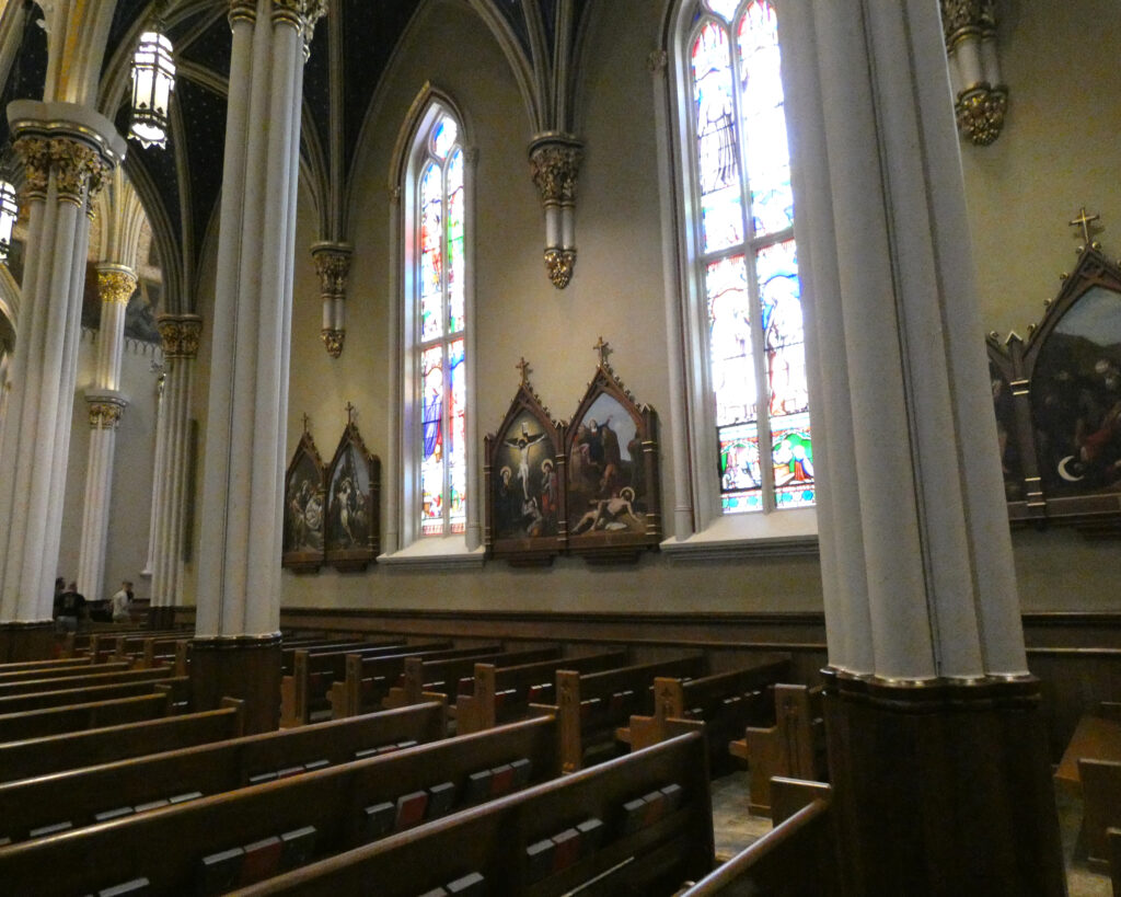
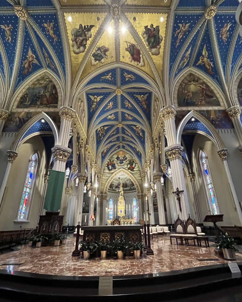
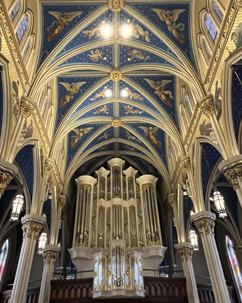
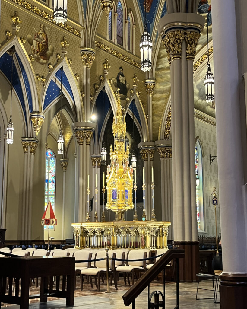
After lunch we were treated to a tour of the Notre Dame University campus near South Bend, Indiana.
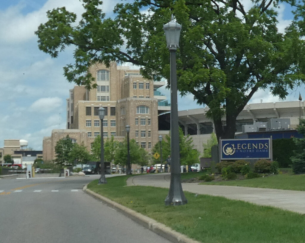
I’d never heard of “Touchdown Jesus” before, but there he was, right across from the end zone of the 80,000+ seat football stadium!
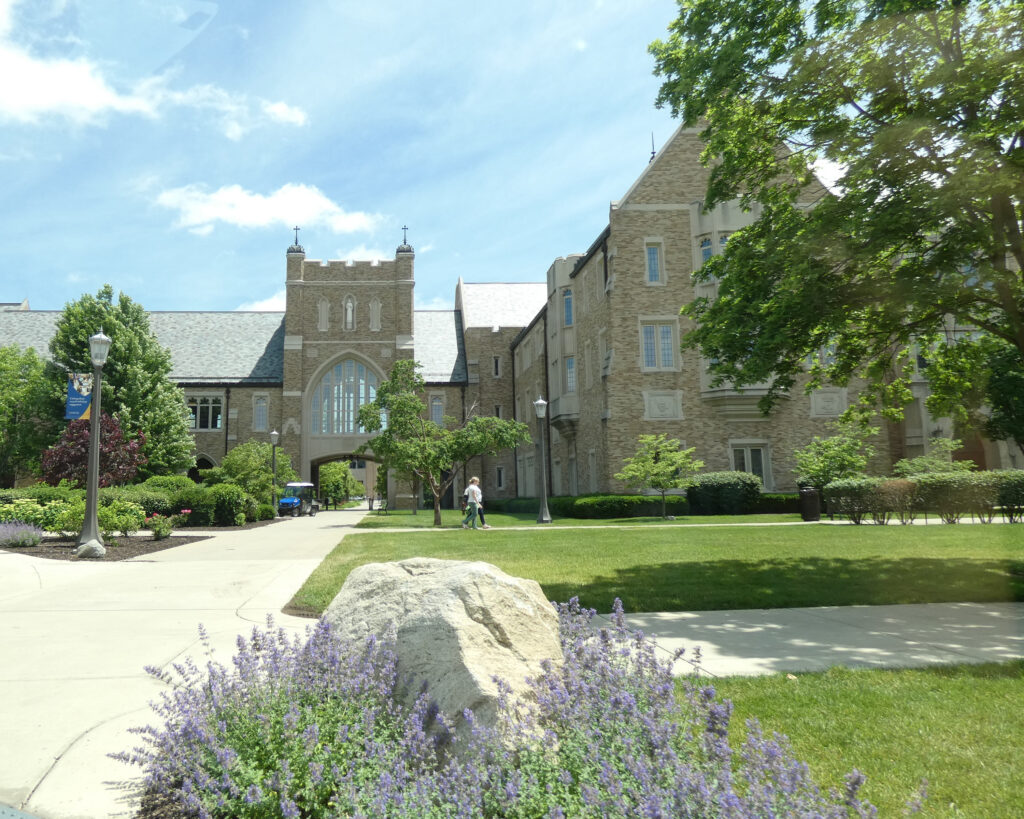
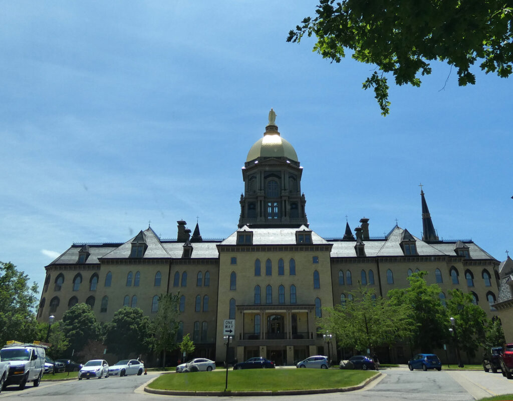
The Golden Dome building (also known as the Main Building) is topped with a 4000-lb, 19-ft tall statue of Mary. (By the way, “Notre Dame” means “Our Lady” and refers to Mary, mother of Jesus). This stately building houses administrative offices, classrooms, and meeting rooms.
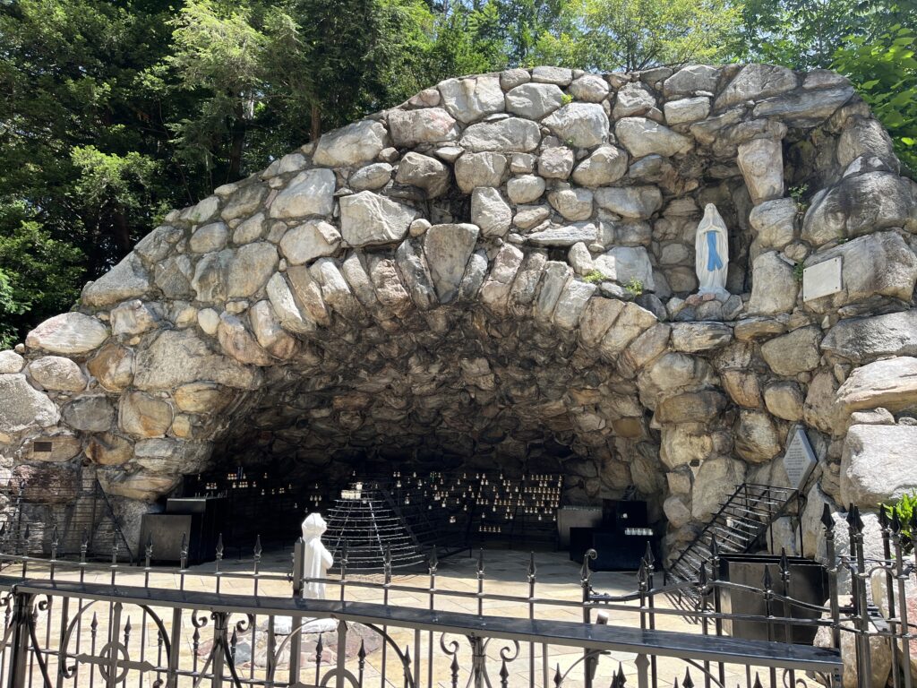
The Grotto of Our Lady of Lourdes at Notre Dame University was built in 1896. It is a one-seventh-scale replica of the famous shrine in France.
Shortly after returning to Michigan that afternoon, Lenny and I drove back across the border into Indiana so he could show me some special places from his teenage years.
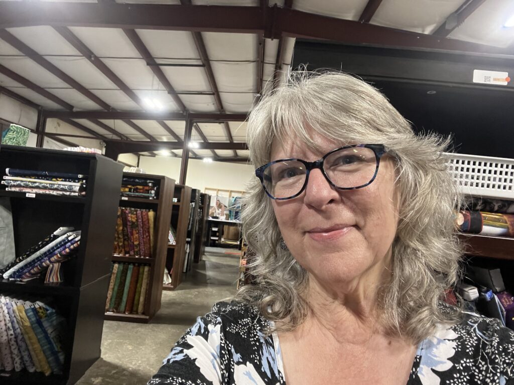
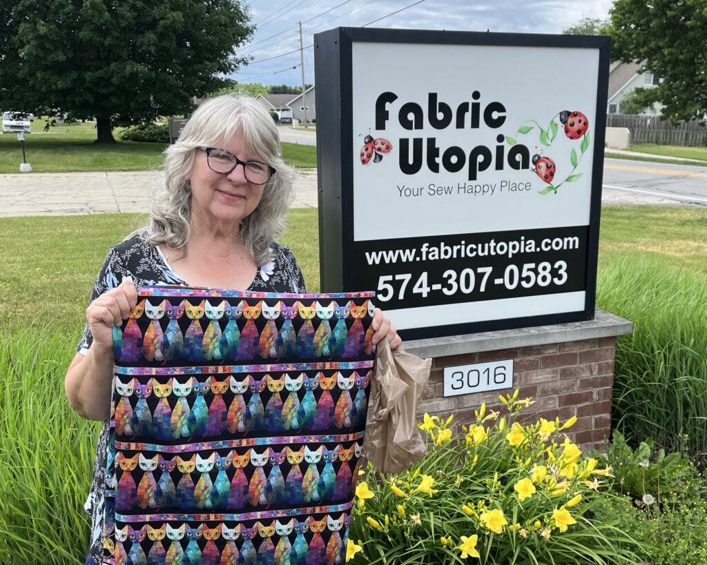
And after that, we visited the town of Goshen, Indiana. What’s in Goshen, you might ask? Why, Fabric Utopia, of course! I’d discovered this large fabric store years ago on Etsy–and I’d ordered from them several times–so I was looking forward to visiting, in person. Unfortunately, the air conditioning wasn’t working well (at all!) in the huge warehouse, so I didn’t stay too long–but I did buy some cute, cat-themed fabric while I was there. 😊
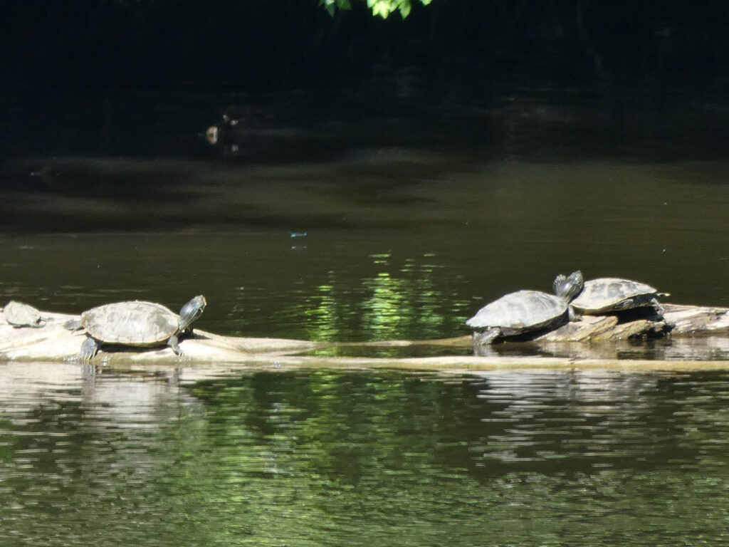
Back in Michigan, we spent another evening enjoying the river and wildlife…
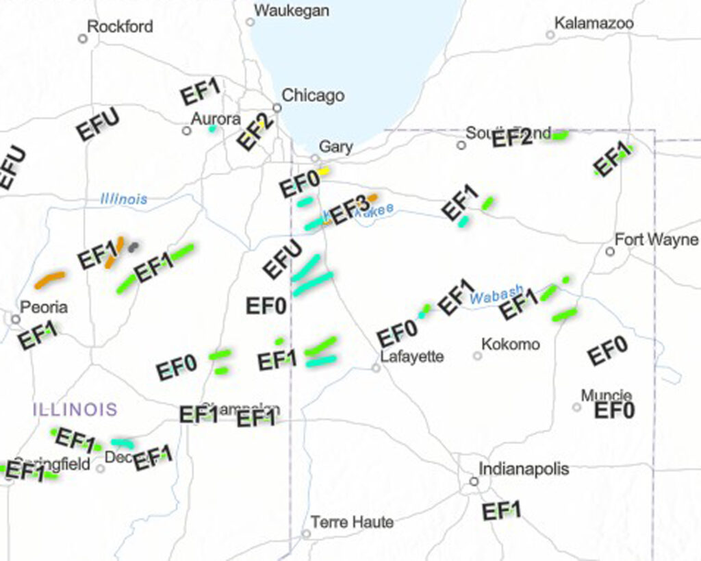
…until a tornado warning had us hanging out in the basement playing trivia games! Things were ultimately fine where we were, but there were multiples tornadoes reported that night. Ah, late spring in the Midwest!
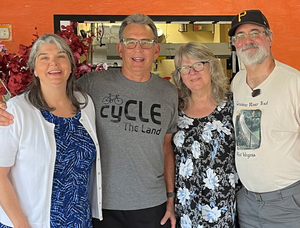
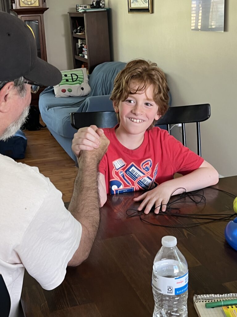
The next day, Friday, June 12th, we traveled further up the road to our second destination in Michigan. There we got together with some more special people! There were lots of smiles and hugs all around–as well as a wee bit of arm wrestling! 💖
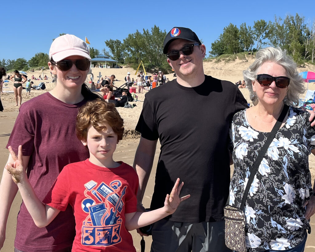
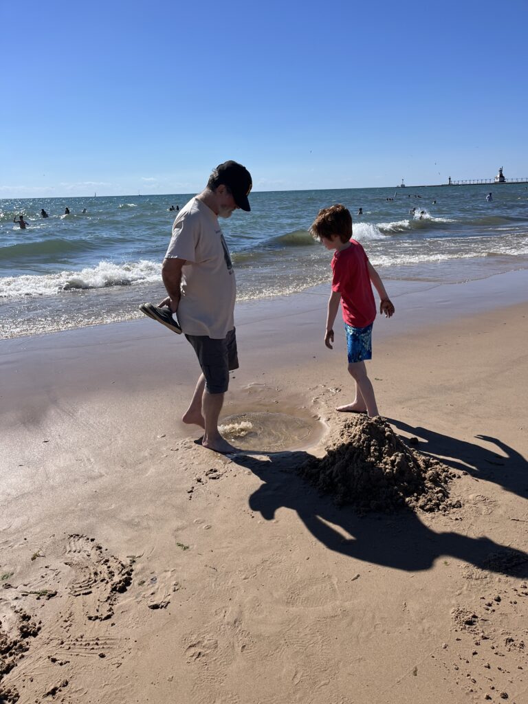
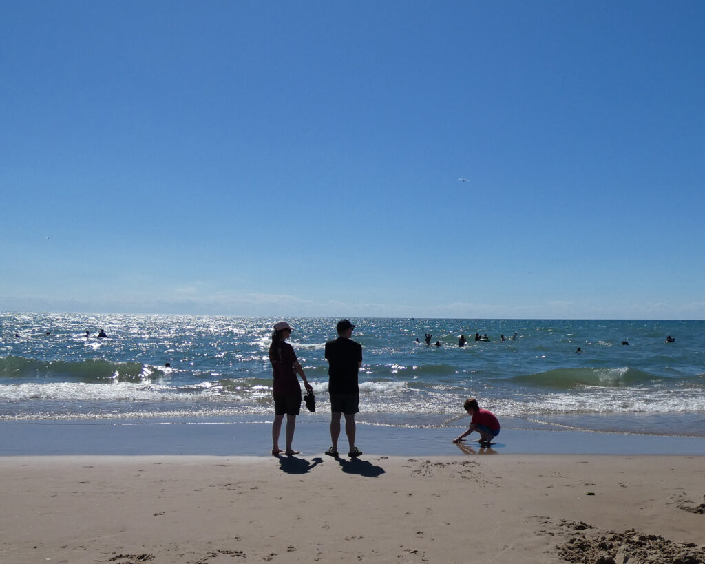
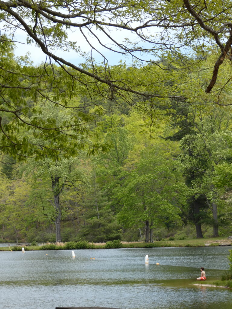
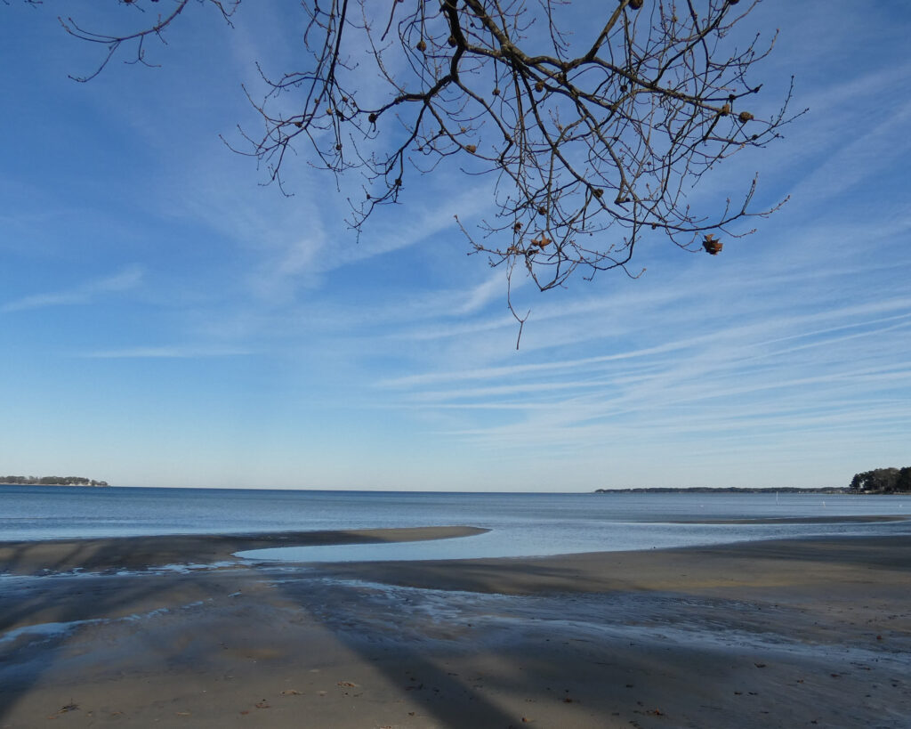
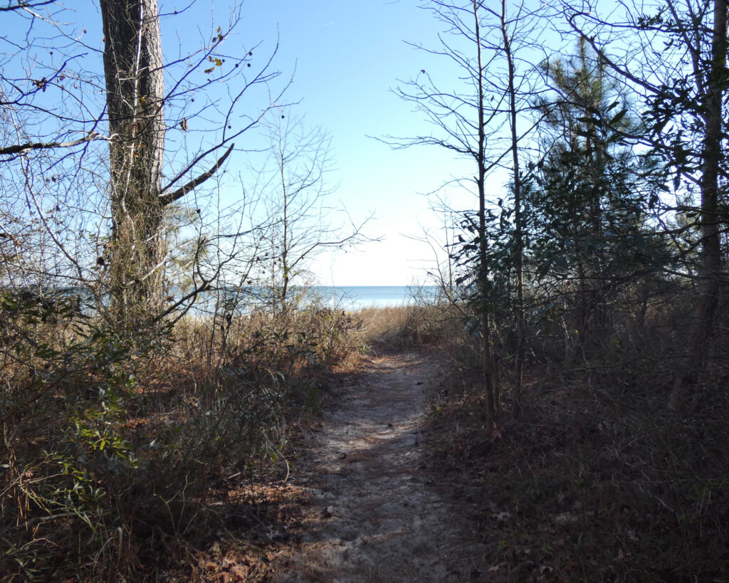
A little later in the day it was beach time! ❤️
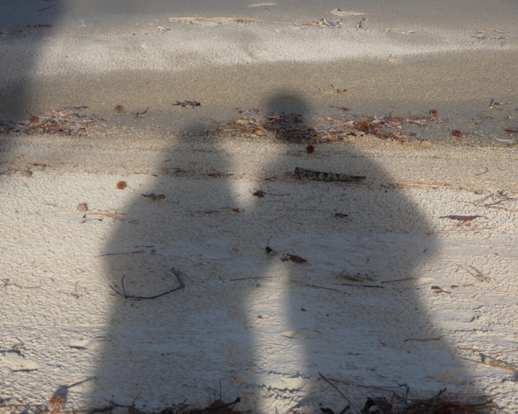
Love this picture! Lake Michigan behind us was so colorful and sparkly!
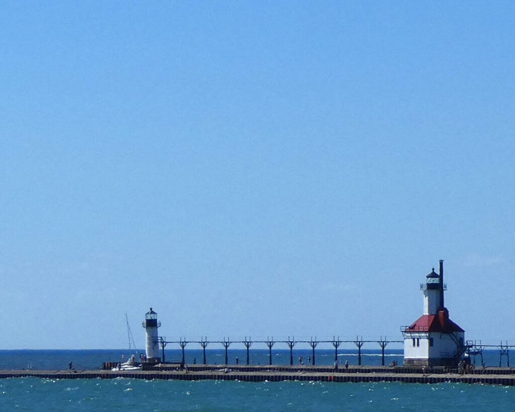
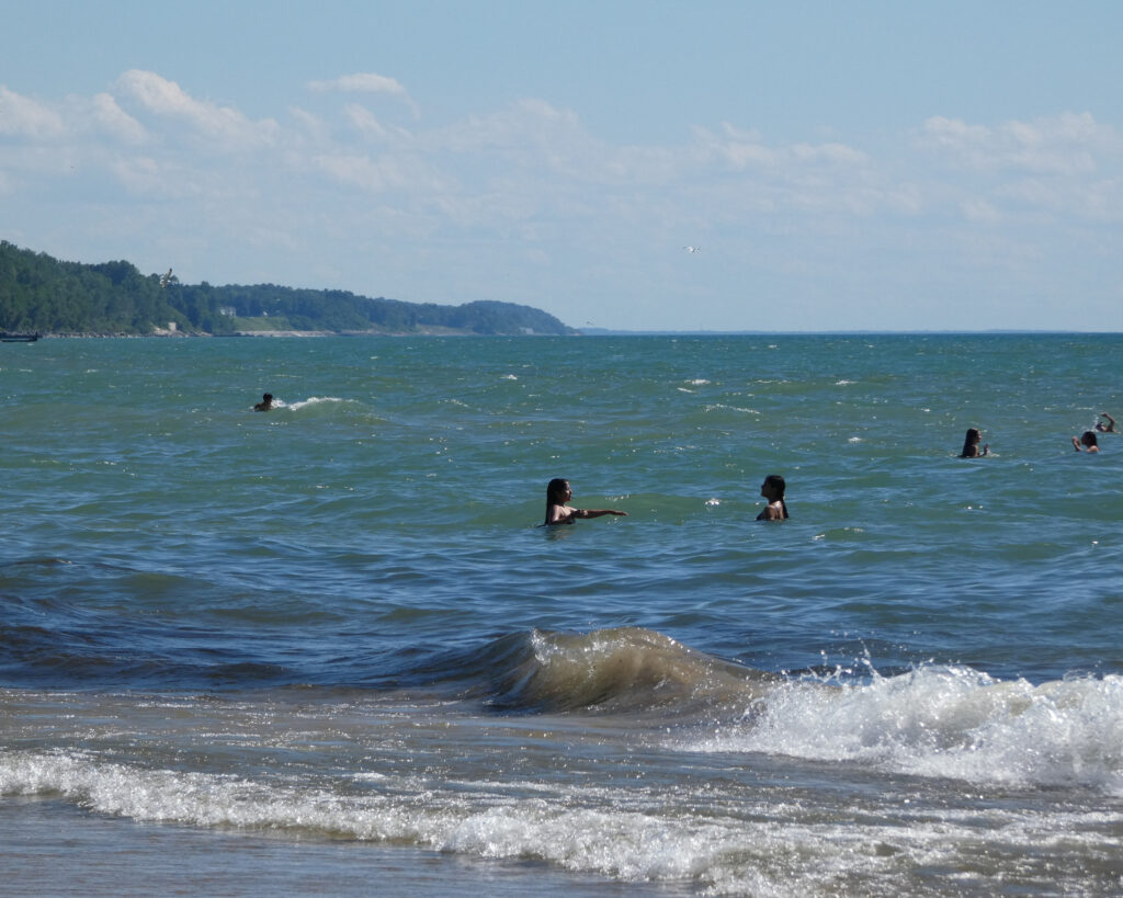
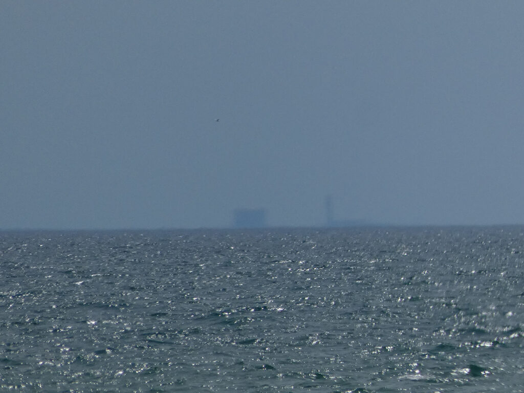
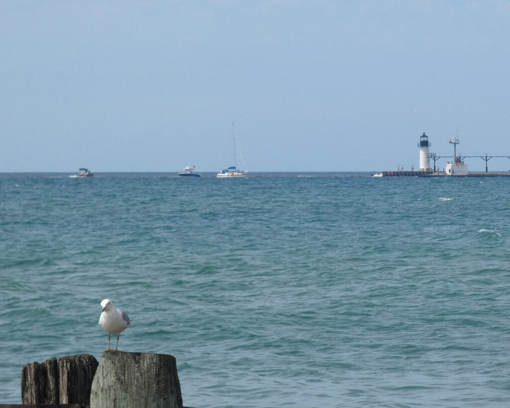
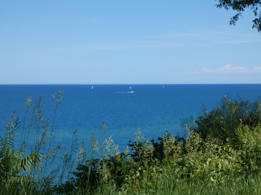
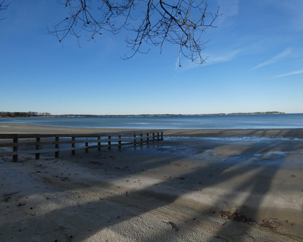
Saturday June 13th offered pretty weather, too, and we visited a different beach! While there, my camera picked up rather large structures across the lake. They seemed too big to be buildings in Chicago–approximately 55 miles away–but I don’t know what else we might have been seeing from that vantage point. Michigan City Pierhead, maybe?
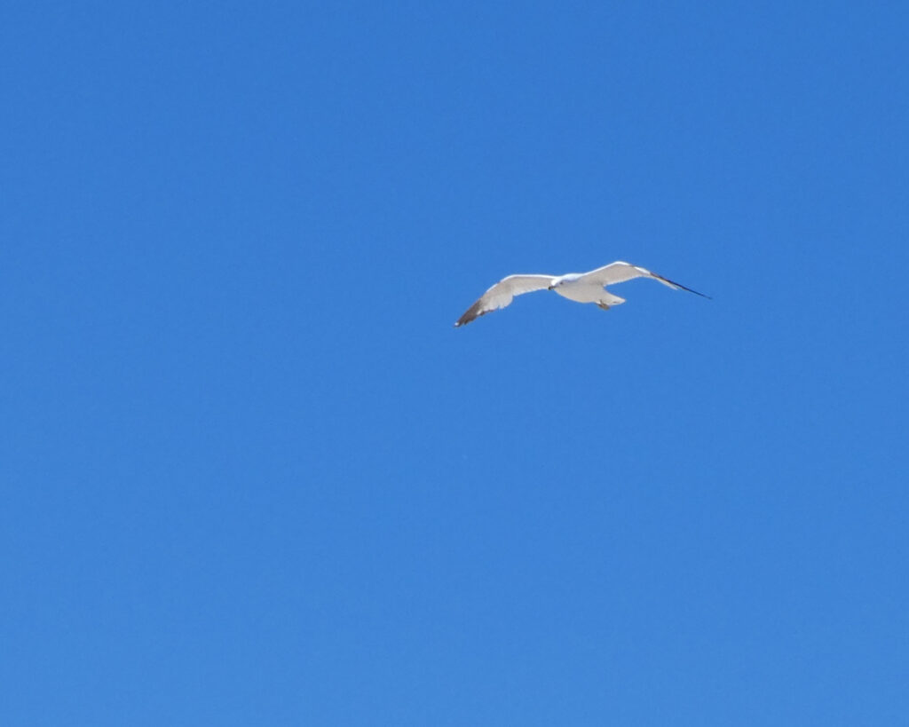
It was less windy than the day before, and there were more boats out on the lake.
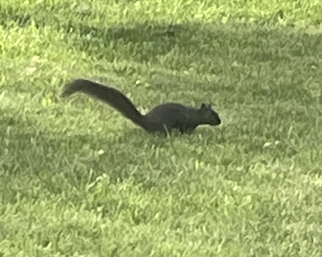
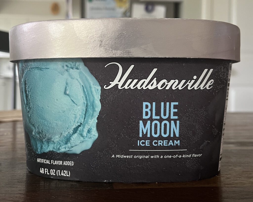
That evening I realized that some things are just kind of different in Michigan; their squirrels are black, and their ice cream is blue…. 😉
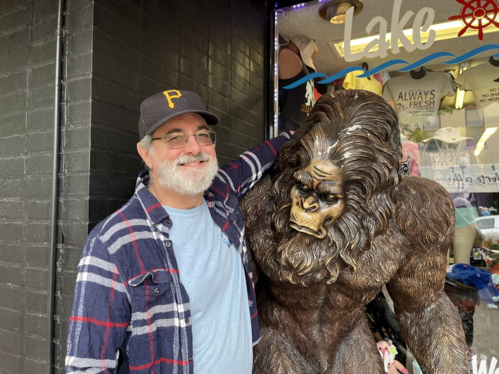
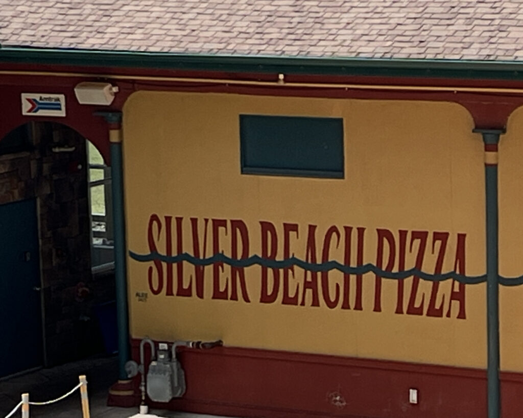
The next day, June 14th, it was much, much cooler than it had been the previous two days. We visited the downtown area (wearing flannel shirts and sweaters!), made some new friends (ha) and ate lunch at the very popular Silver Beach Pizza.
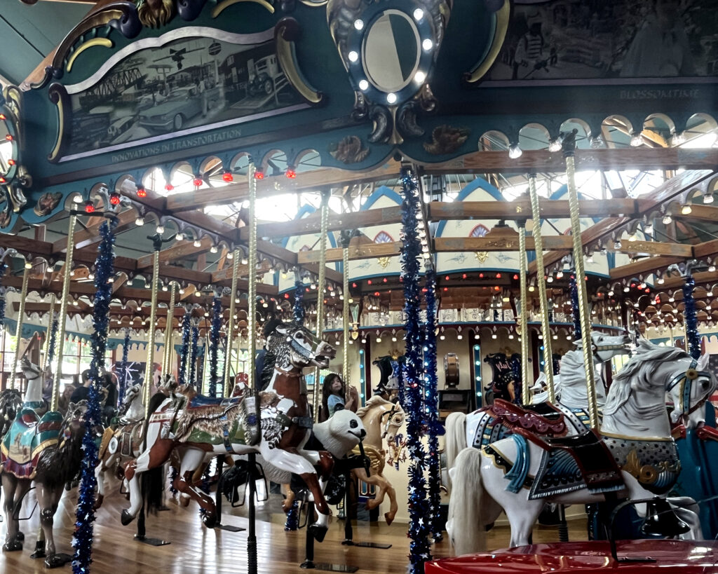
It’s always a pleasure to see this gorgeous carousel. While the horses and other creatures on the ride are not original to the 1910 carousel, the history of this location is pretty interesting.
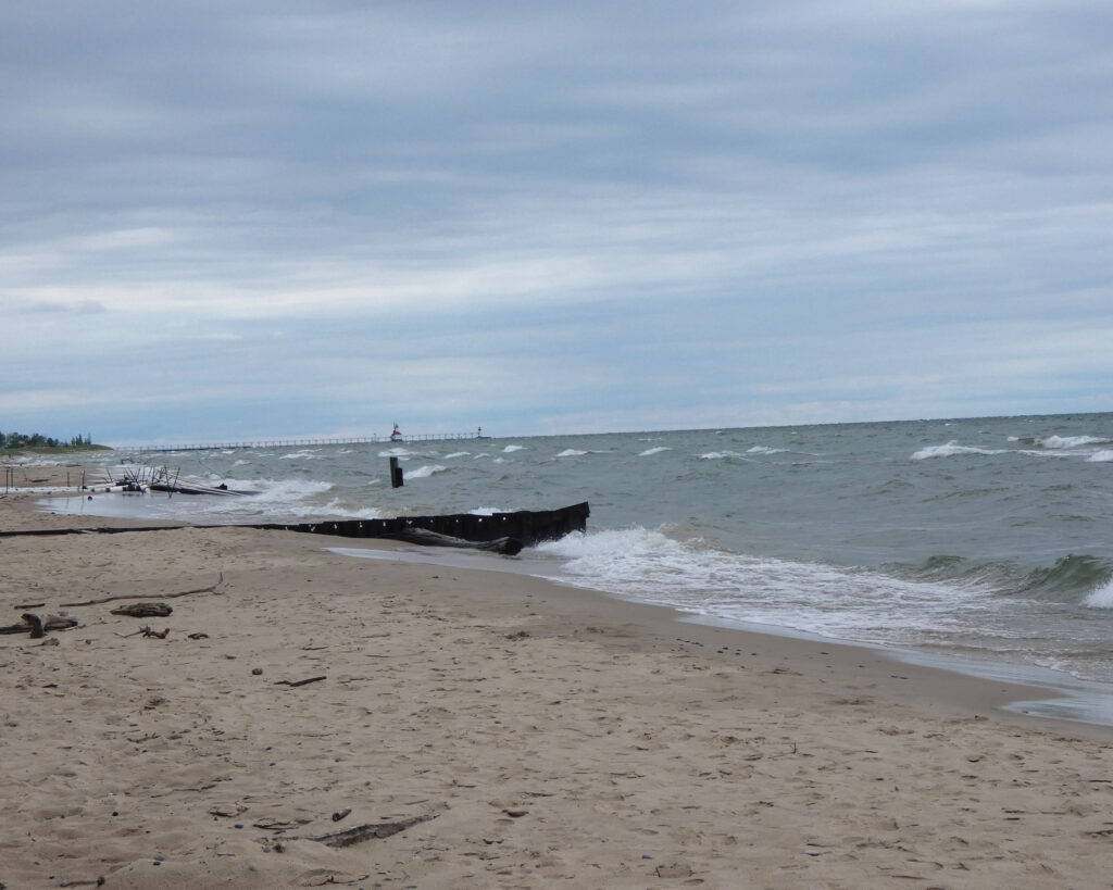
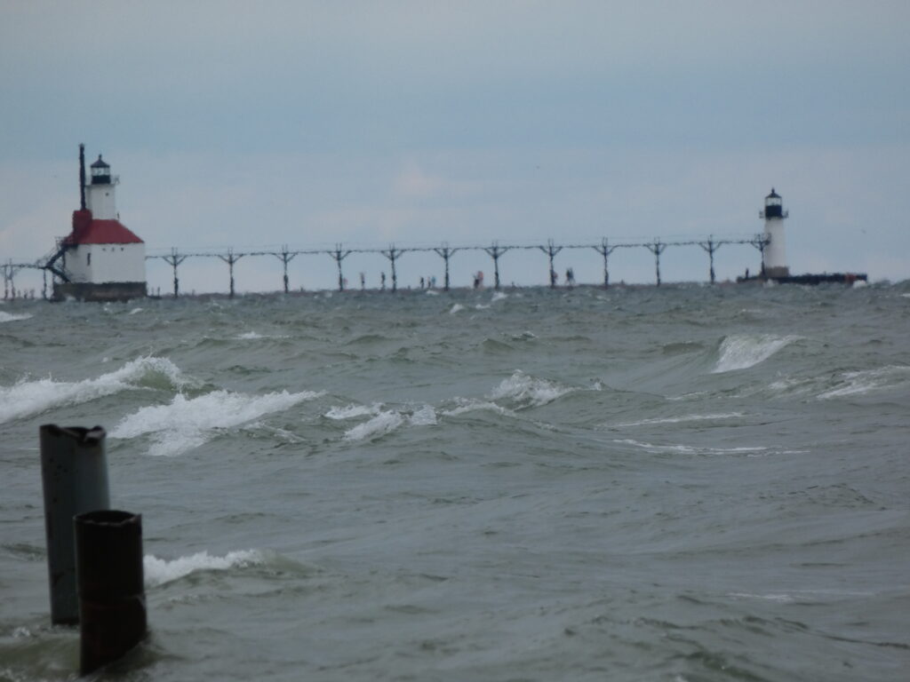
Later that afternoon we all went to another beach on Lake Michigan. By then it was overcast and quite cool, and red flag warnings were posted.
Safely playing in the sand at water’s edge.Rough surf and high waves with the North Pier lighthouse in the distance.I don’t think I’d want to be walking out there….I believe I mentioned that it was very windy and very chilly?!
Ah, but so much distance, and so little time for catching up between visits! I’m very, very thankful that we had the opportunity to make the trip this year! ❤️
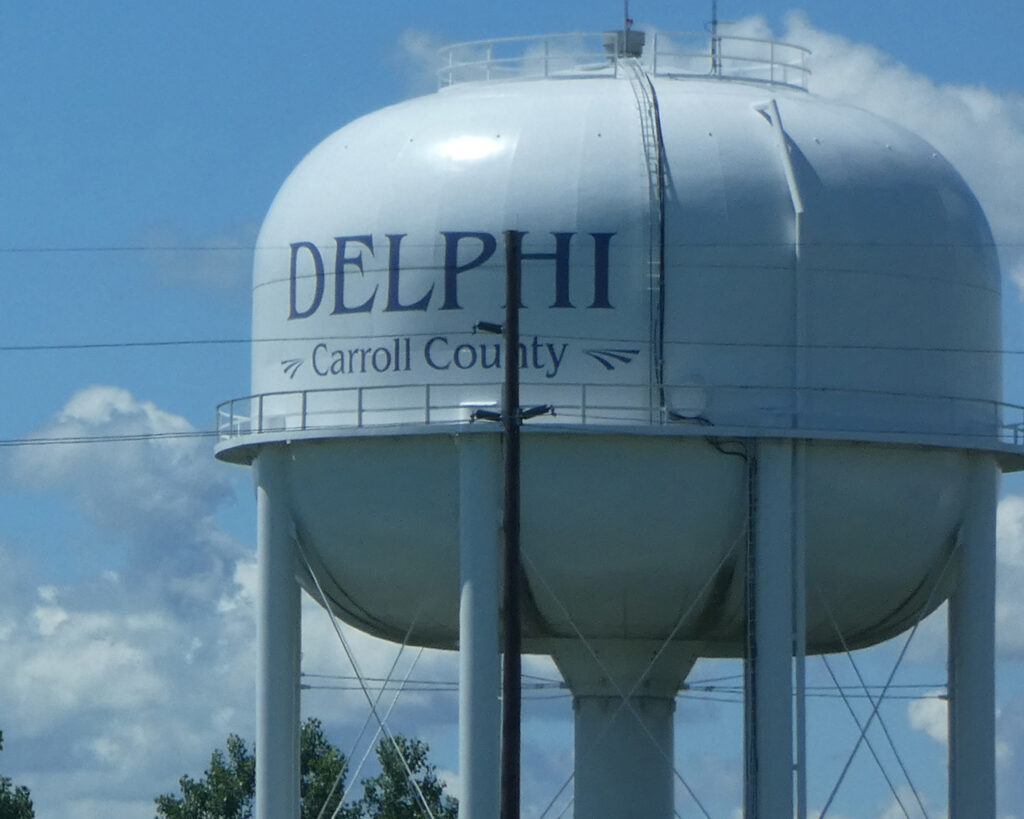
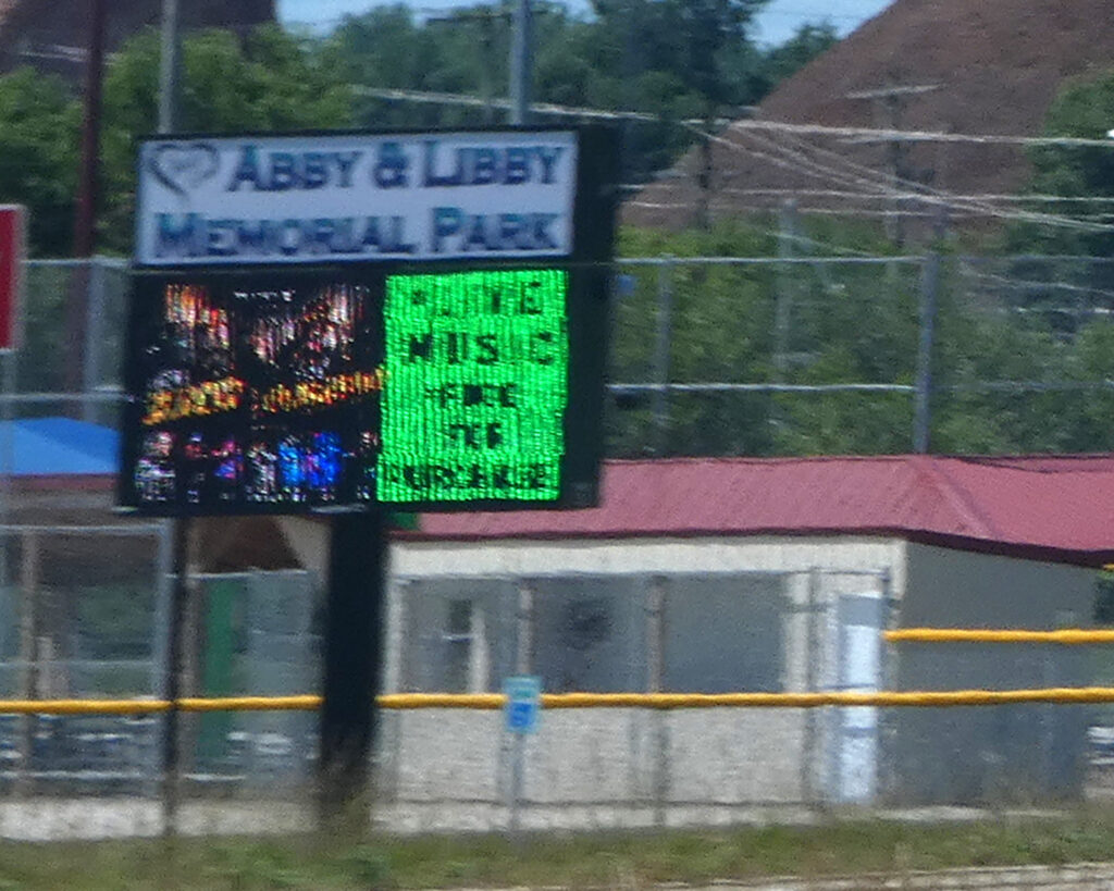
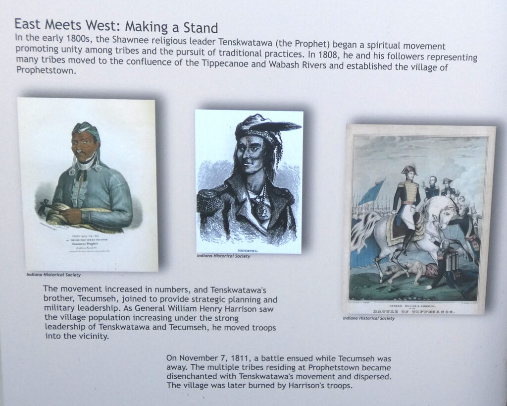
On Monday June 15th, we left Michigan and drove towards Lafayette, Indiana. Our route took us near Delphi, Indiana, and we passed by the Abby and Libby Memorial Park….
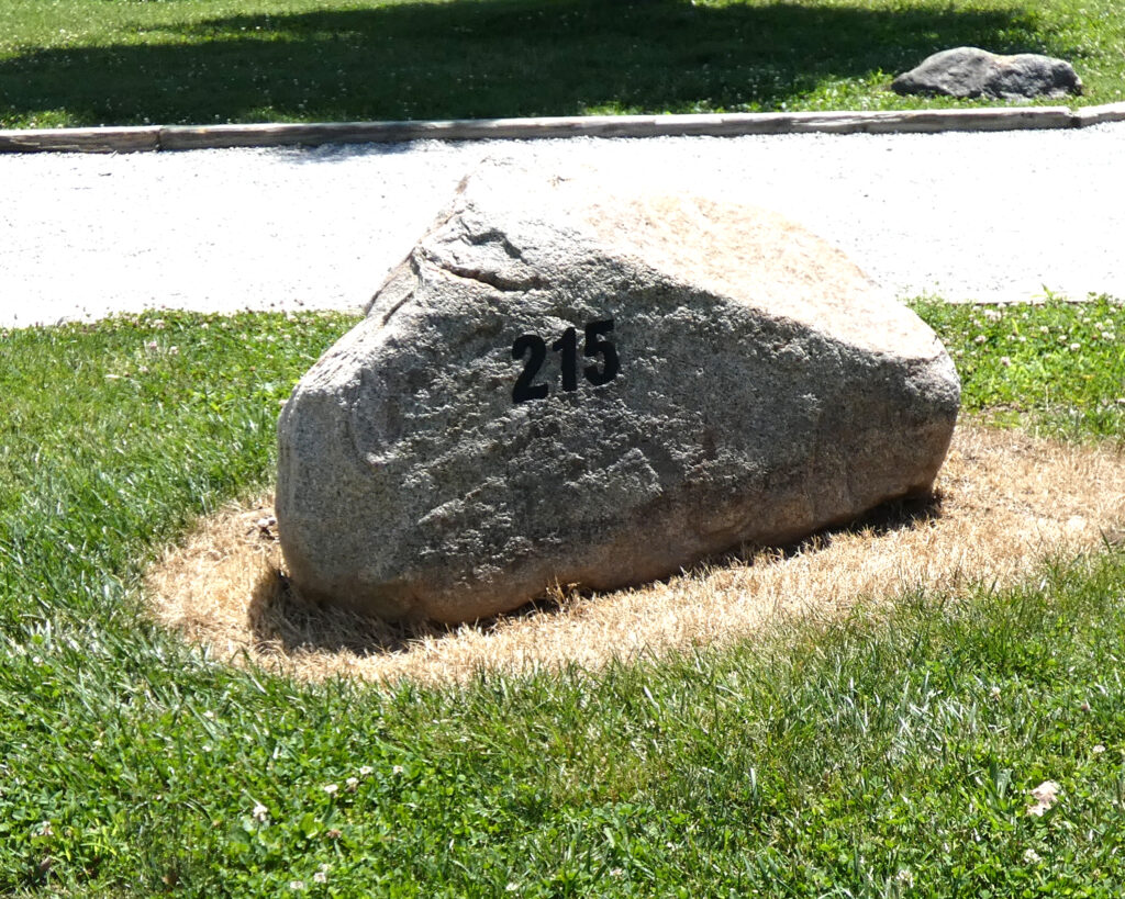
In 2021 and 2022 I camped at Prophetstown State Park near Battleground, Indiana, and I enjoyed revisiting the campground and seeing some of the exhibits again on this trip.
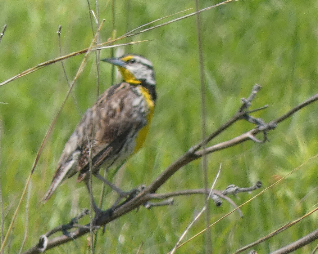
I saw–and heard–a beautiful Western Meadowlark at the park, but my camera had a hard time focusing on the bird.
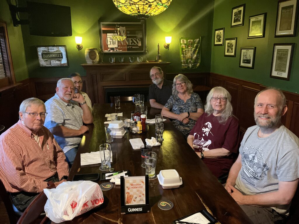
That evening we met up with several of my family members at one of our favorite restaurants in Lafayette. While it was a quick, one-evening visit, it was so good to see those who could make it, and we missed those who couldn’t be there. ❤️
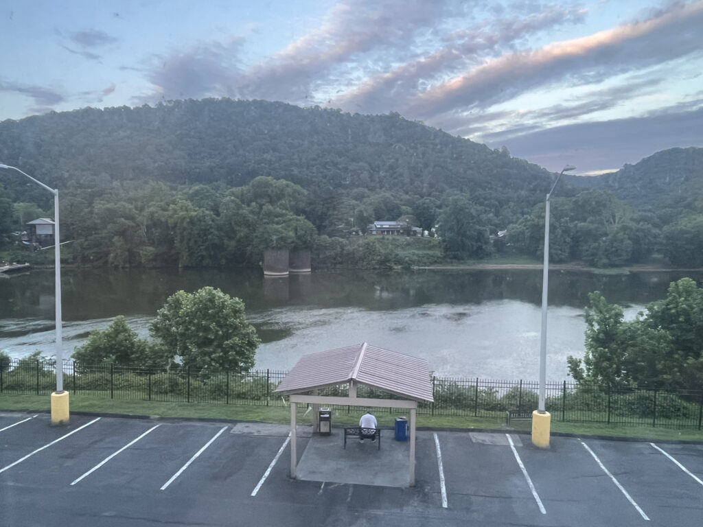
The next day, Tuesday, June 16th, we started for home, stopping for the night just east of Charleston, West Virginia.
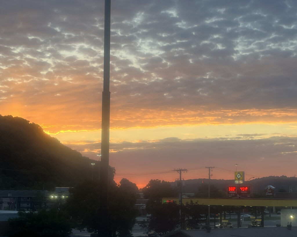
The Kanawha River was right behind our hotel…
…and a pretty sunset closed out the day.
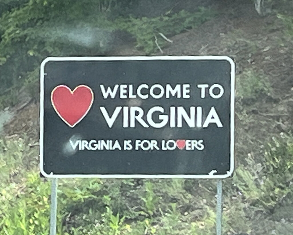
We made it back to Virginia–safe, but tired–early the next afternoon. No rest for the weary, however, as there were still some things that needed to be done….
If you read my last blog post, you might recall that I sold my Jeep to the guy who towed it–and my trailer–back to my house after an unexpectedly challenging camping trip. Right after selling the Jeep, I’d gotten a rental car ($$$$), but I turned it in the day before we left on this trip. As I still hadn’t found a car I wanted to buy, I’d reserved yet another rental ($$$$) and needed to pick it up that afternoon.
Before going to the rental company, however, we went back to a dealership where I’d TWICE looked at a used car that I liked–but didn’t really love. It was still available, and while I couldn’t make myself say that I loved it this time, either, I finally realized that I kind of needed it.
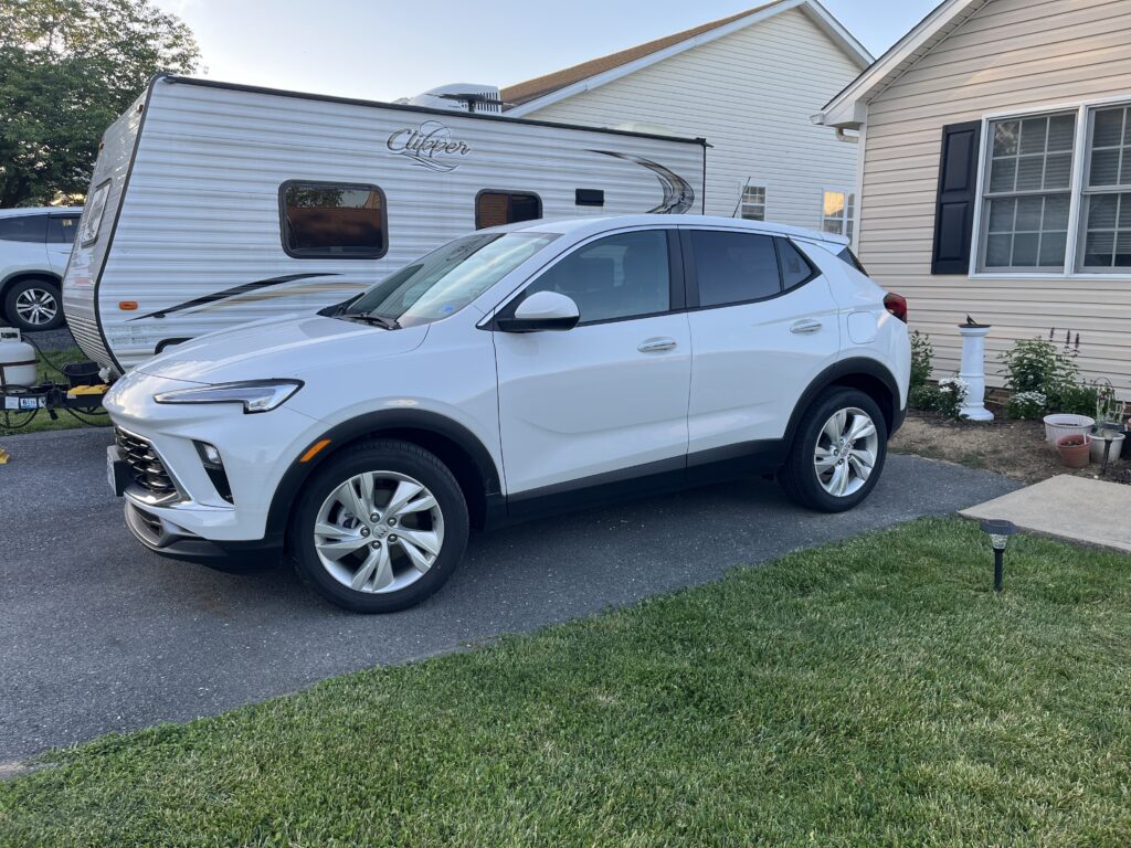
And thus, the trip to Michigan and Indiana ultimately ended with me driving home in a new-to-me vehicle, which was absolutely an end-of-vacation FIRST–and hopefully LAST!
By the way, the color of the car is called “Baja Storm,” but it sure looks a lot like “Seal Point Siamese” to me. What do YOU think?! 😉
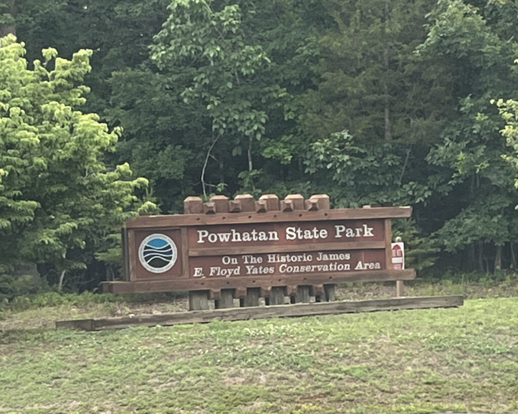
After an enjoyable camping trip to Sherando Lake in early May, we were looking forward to our second outing of the year. Based on good memories from a previous trip to Powhatan State Park, I made reservations for a midweek, 3-night stay there. While I had some concerns about the weather since rain was in the forecast, very early into this adventure much bigger issues quickly–and relentlessly–presented themselves!
On the drive to the campground, my 2015 Jeep Grand Cherokee started running rough, and the check engine light flashed on and off a few times. After several miles when it seemed obvious that this wasn’t going to resolve on its own, I stopped at an O’Reilly Auto Parts store not far off the interstate.
This chain offers free diagnostic testing–which is SUCH a nice service!-and the scan showed that the Jeep needed new spark plugs and an ignition coil. Additionally, it indicated that “cylinder 1” was misfiring.
Wow… I already knew of some unrelated repair work that the Jeep needed–sooner rather than later–so this news was not good at all!
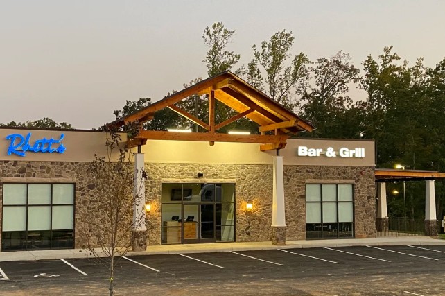
Less than 1/4 miles from O’Reilly’s, however, was Rhett’s Bar and Grill. We’d planned to stop there for lunch anyhow, and luckily that part of the day turned out to be really, really good! I would definitely recommend the crab cake sandwich, and probably everything else on the menu! Most excellent!
But back to the Jeep, it was obvious that these just-diagnosed problems needed to be addressed quickly; but where? We could turn around and go home, but I wasn’t sure that we’d be able to tow the trailer up and over the mountain….
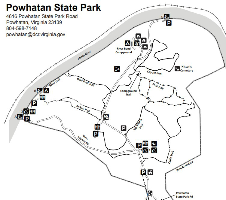
By “googling,” we learned that there was at least one repair shop (with good reviews) in the town near the state park, so after lunch we continued on to the campground, arriving a little after 3 p.m..
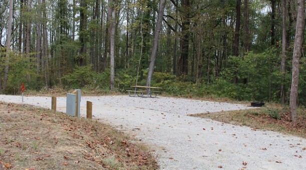
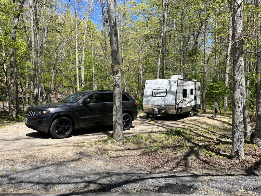
I’d reserved a “pull through” site (because I’m notoriously bad at backing up the trailer), and this one was exceptionally nice; large and level. (The picture below is from the state parks’ website.)
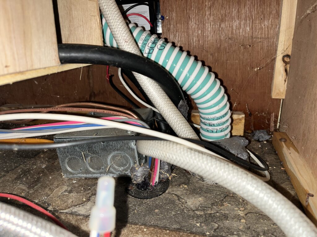
The campsites at Powhatan offer both electric and water connections, so after plugging the trailer into the 30-amp electrical service, we attached one end of our water hose to the outside faucet and the other end to the “city water” inlet on the camper. As we continued to set up and settle in, however, I noticed a small puddle of water on the floor of the trailer in the “kitchen.” What?! Where was that coming from?!
We turned off the water outside, and then I took the panel off the compartment where the water lines and the water pump are located. There was obviously a small leak somewhere in that far corner, but I couldn’t tell exactly where the problem was.
We disconnected the hose from the “city water” port, turned on the outdoor faucet again, and used it to fill our fresh water tank. By turning on the water pump inside the trailer, we’d still have running water for washing dishes, flushing the toilet, etc.. But even though this stopped the leak from the city water connection, it obviously didn’t fix whatever was leaking. Alrighty….
In the meantime, Lenny called to make an appointment for the Jeep at the auto service center. Nothing was available for the next day (Wednesday), so we were told to bring it in at 7:30 a.m. on Thursday. Early, but do-able….
We’d certainly started this camping trip with some stressful events, but on the positive side, we were in a beautiful state park and in a really nice campsite. We didn’t have the convenience of “city water,” but filling the fresh water tank and using the pump worked fine; that’s how we’d camped at Sherando Lake, too. And even though I really hadn’t anticipated (or budgeted for) these unexpected car problems, at least the Jeep would be fixed and ready to get us home on Friday. Therefore, it was time to relax and enjoy the evening!
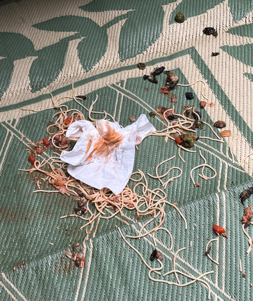
We set up a table outside the trailer under the awning, got out the camp stove, and started boiling water for spaghetti. I was really looking forward to Lenny’s homemade spaghetti sauce. Yum!
But you know how you sometimes figure things out just a few seconds too late…?
If I’d thought this through, I probably would have put the slippery pasta and spaghetti sauce in a bowl instead of on a plate because as soon as I sat down in my camp chair, most of it slid right off and landed on the rug! The rest landed on my shirt, shorts, and chair…. Well, phooey! (Okay, not what I really said in the moment…)
Can anyone read spilled spaghetti noodles? Kind of like reading tea leaves, maybe? (And would this be called “pastaography” instead of “tasseography”?) While predicting the future is not one of my strong suits, I was definitely getting some woo-woo vibes about how this was not going to be a relaxing and “normal” camping trip!
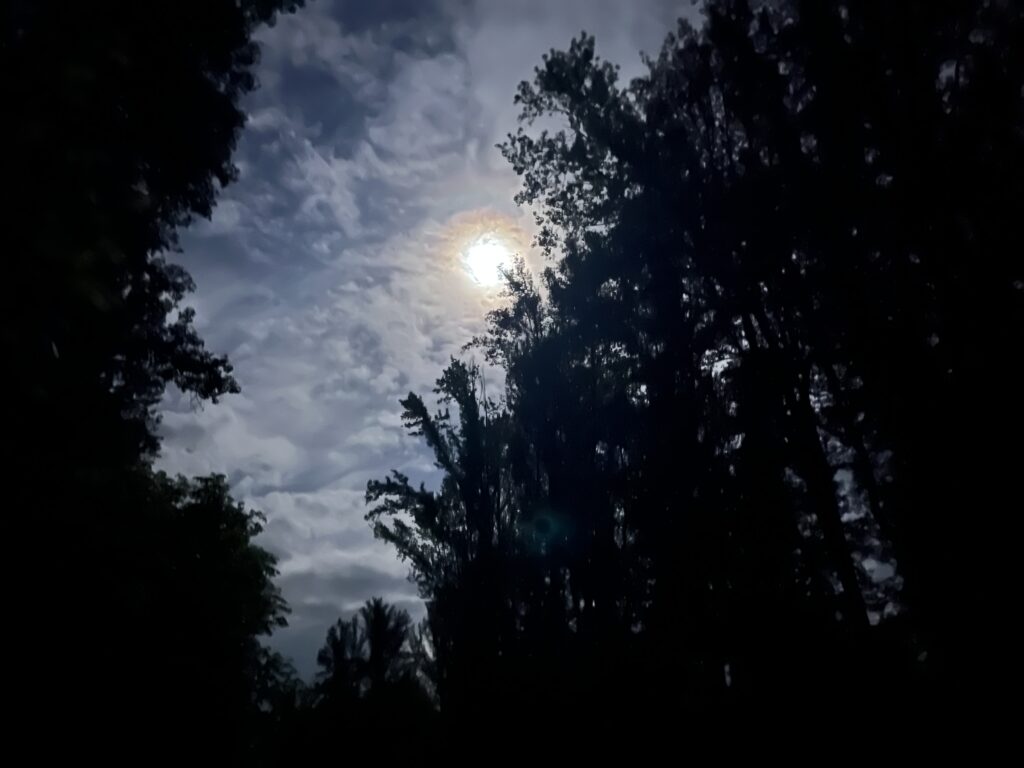
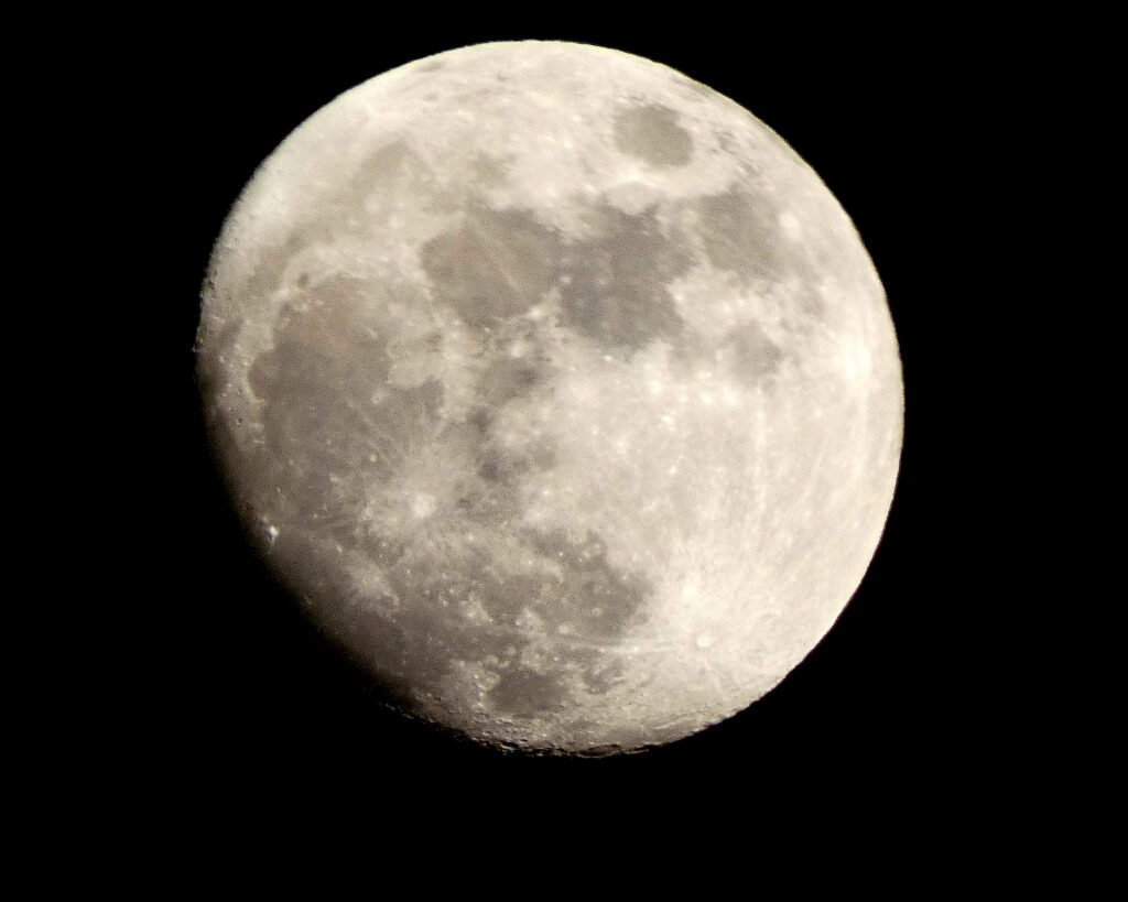
At least the moon rose that night–like normal!–and it was quite pretty as it climbed through the clouds….
The next morning it was warm and very humid; rain was likely before the end of the day. We tilted the awning so that the rain–if it did come–would run off easily. (When storms or high winds are predicted, I simply roll up the awning and don’t use it.)
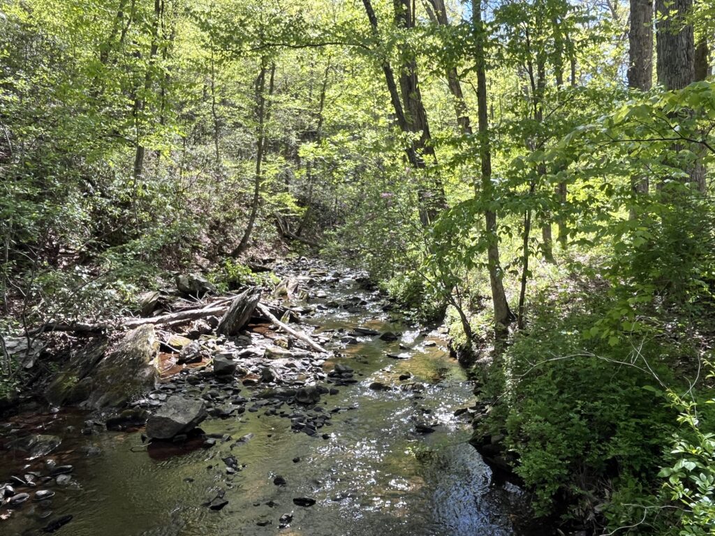
Always eager to see the James River, we drove to Canoe Launch C, which is pretty close to the campground.
I love this big ol’ river! Formed by the confluence of the Jackson and Cowpasture Rivers in the western part of Virginia, I’ve visited the James in many, many places along its eastward trek to the Chesapeake Bay.
The Jeep was still running very poorly, but–to its credit–it was still running, so we drove to another part of the state park to walk on the River Trail. It had gotten quite hot and sticky by early afternoon, but at least most of the trail was in the shade.
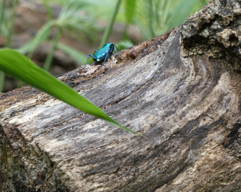
We saw a lot of these shiny blue-green bugs at our campsite and also on our walk. I haven’t been able to positively identify what they are, but I think these are Six-Spotted Tiger Beetles. When I zoomed in on this picture, I could see the spots.
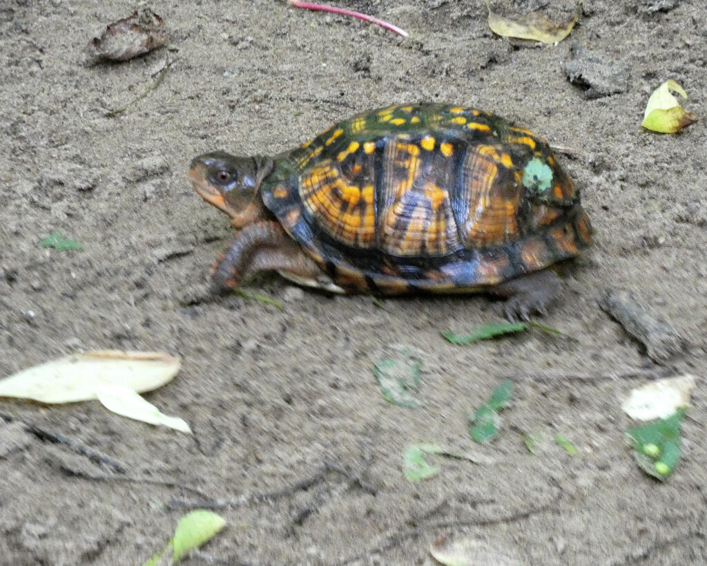
We also saw an Eastern Box Turtle. So cool to know that each turtle has a unique pattern on its shell.
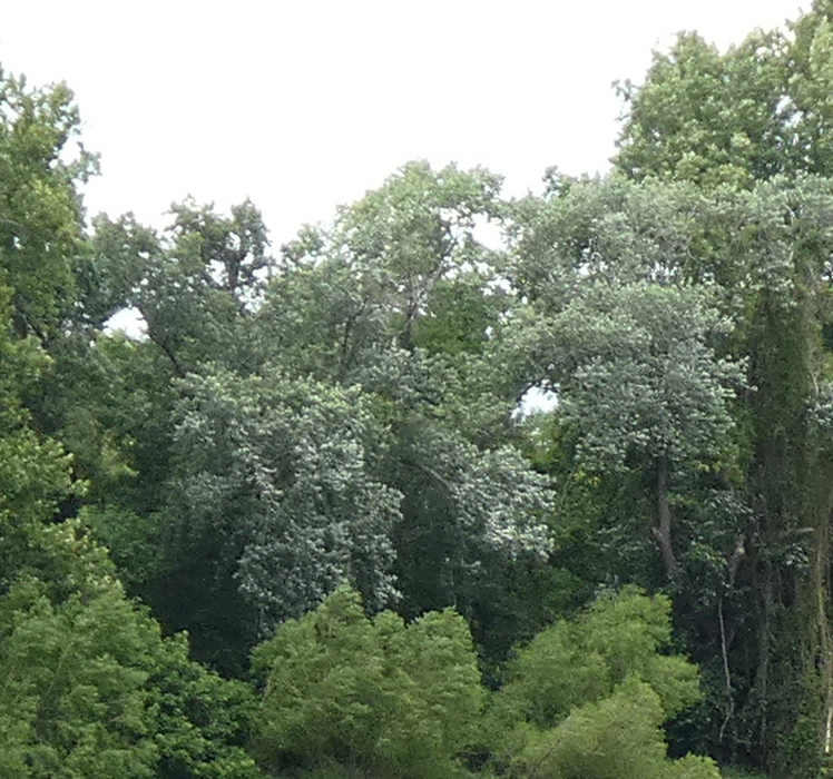
When I took this picture of the river, I immediately noticed something…
Have you ever heard that when leaves are turned up, rain is on the way? In the picture below I zoomed in on the trees across the river, and–yep–the undersides of the leaves were clearly visible…
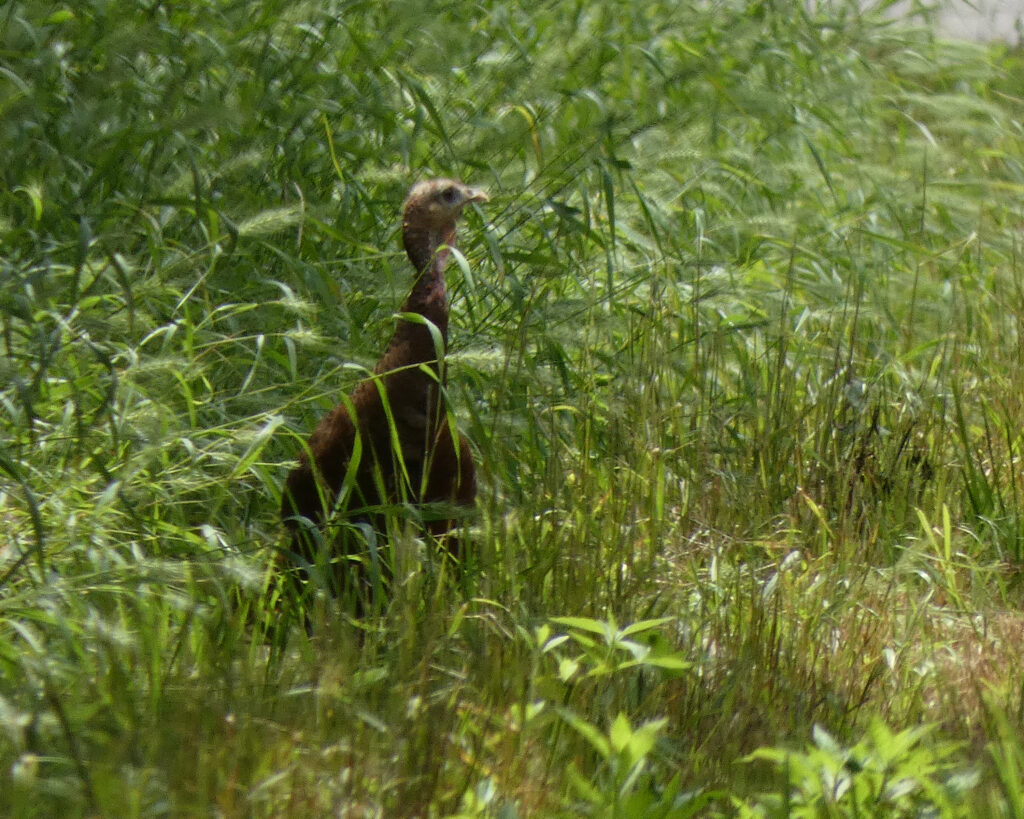
On our way back to the parking lot, we saw a wild turkey with a bunch of babies! I didn’t get my camera focused in time to get a picture of the babies, but I did get a picture of the mama.
The upturned-leaf-predicted rain finally came around 5:00 that evening. Most of the state is in drought conditions, so we were actually pretty happy to see it.
The next morning (Thursday, May 28th) we jerked and jolted our way to the auto service center to have the Jeep worked on. Once we’d gotten it into the lot, checked in with the mechanics, and dropped off the key, we went across the road to a Hardees for breakfast.
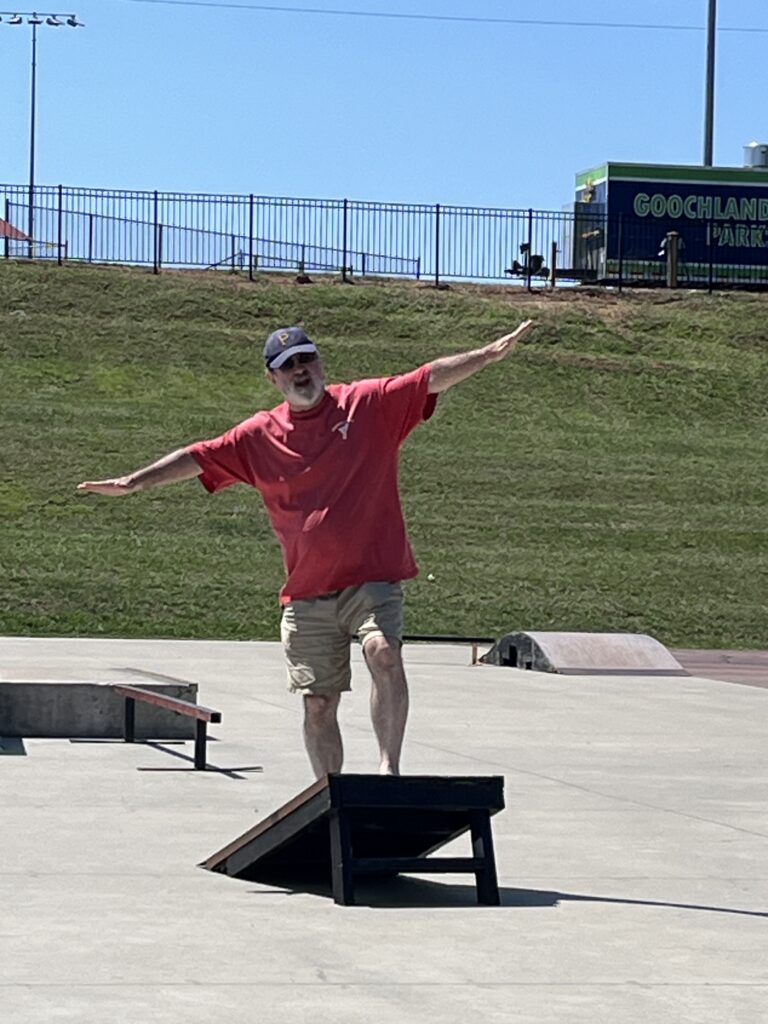
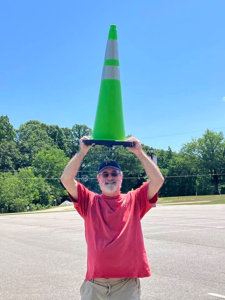
We hung out there for over an hour before walking back across the road and then down the road to a local skate park…. Yeah, it was shaping up to be a very long day, but hey, we can amuse ourselves! (The second picture references a rallying cry of the Pittsburgh Pirates; it’s a baseball thing….)
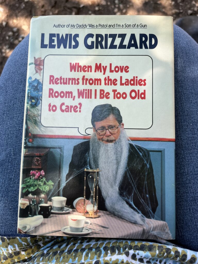
We discovered a little lending library at the skate park and got some laughs while reading aloud sections of this book:
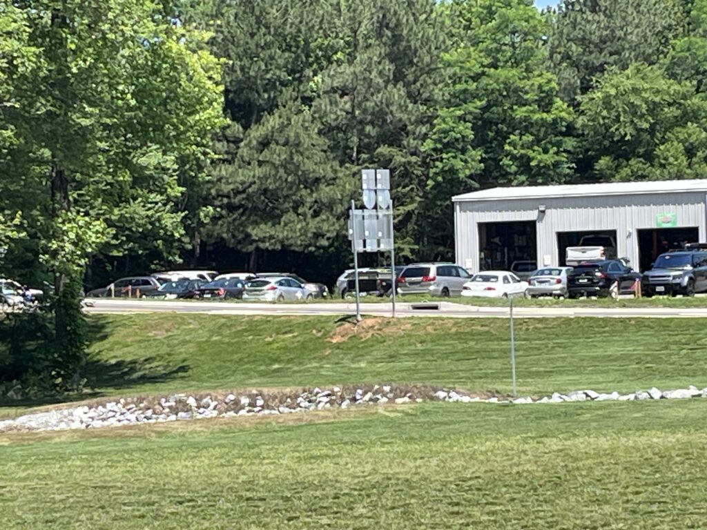
Across the field we could see the service center, but we couldn’t tell if the Jeep had been taken into one of the bays. And so we waited some more.
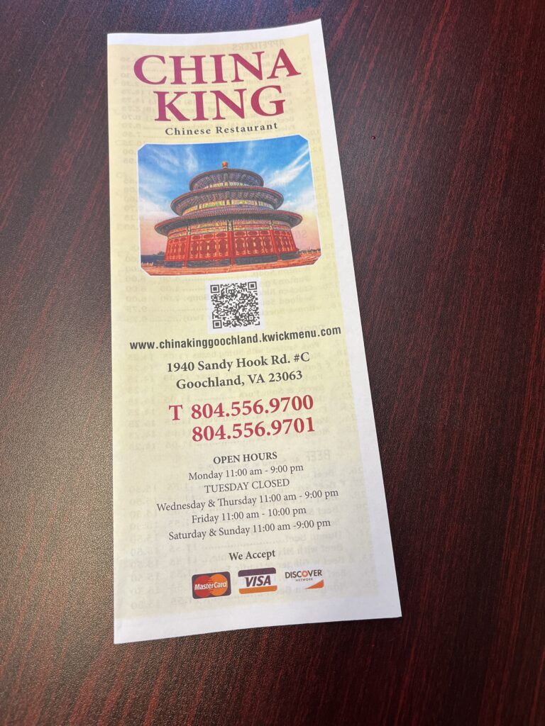
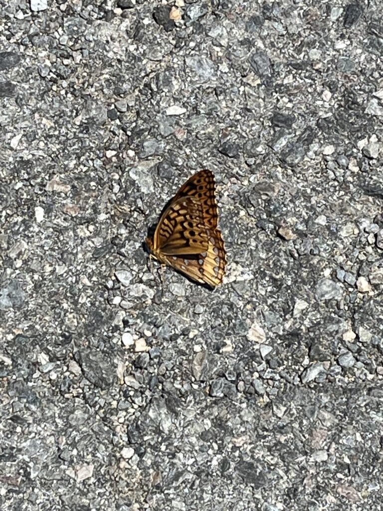
We walked to a Chinese restaurant for lunch, and everything was really good. On the way back across the parking lot, I saw a new-to-me butterfly, a Great Spangled Fritillary. Yep, trying to make the most of rather limited surroundings and stimuli!
After lunch, we went back to the service center and decided to finish waiting there. Maybe it wouldn’t take too much longer for the Jeep to be fixed?
Unfortunately, a short while later we were told that replacing the spark plugs and the ignition coil had not fixed the Jeep; not even close…. The mechanics weren’t exactly sure what was wrong with it, but they said the engine would likely have to be taken apart. They weren’t equipped to do major engine work in their small shop, and we were cautioned that it would probably cost thousands (yes, the man said thousands!) to have it towed, diagnosed, and repaired at a major shop. The cylinder was still misfiring and they’d also discovered that gasoline was leaking into the oil, and this can cause catastrophic engine damage. It was quite possible that the Jeep’s engine was already damaged beyond repair. Wow…
We asked if the Jeep would get us back to the campground, and they said it probably would, so on the drive back we started trying to brainstorm about how we were going to get the car, the trailer, and ourselves home the next day!!
Back at Powhatan, we stopped at the visitor center to ask if it would be possible to leave the trailer somewhere in the park for a day or two at most until we arranged to get it home. The ranger we spoke with checked with her manager who told her “No.” We were told we’d have to leave by checkout time on Friday! Yikes!
I called my insurance company to see what coverage I had for towing the car (some, but MINIMAL!), and Lenny and I both started making calls to various companies to see if we could rent an SUV or truck to tow the trailer. The camp hosts–who were wonderful!–said they could take us into Richmond Friday morning if we found a suitable tow vehicle to rent.
In the meantime–and to my surprise–I discovered that our campsite hadn’t been reserved for Friday night, so I made a reservation online just to give us another day to get everything worked out. This relieved a tiny bit of the pressure we were feeling, but there were still so many complications and uncertainties!
We were both totally exhausted, but after a quick dinner we walked on a short trail to try to see the sunset over the James River. We couldn’t really see too much through the leaves, but it felt good to move around some after spending so very much time sitting in our camp chairs while making phone calls and taking notes!
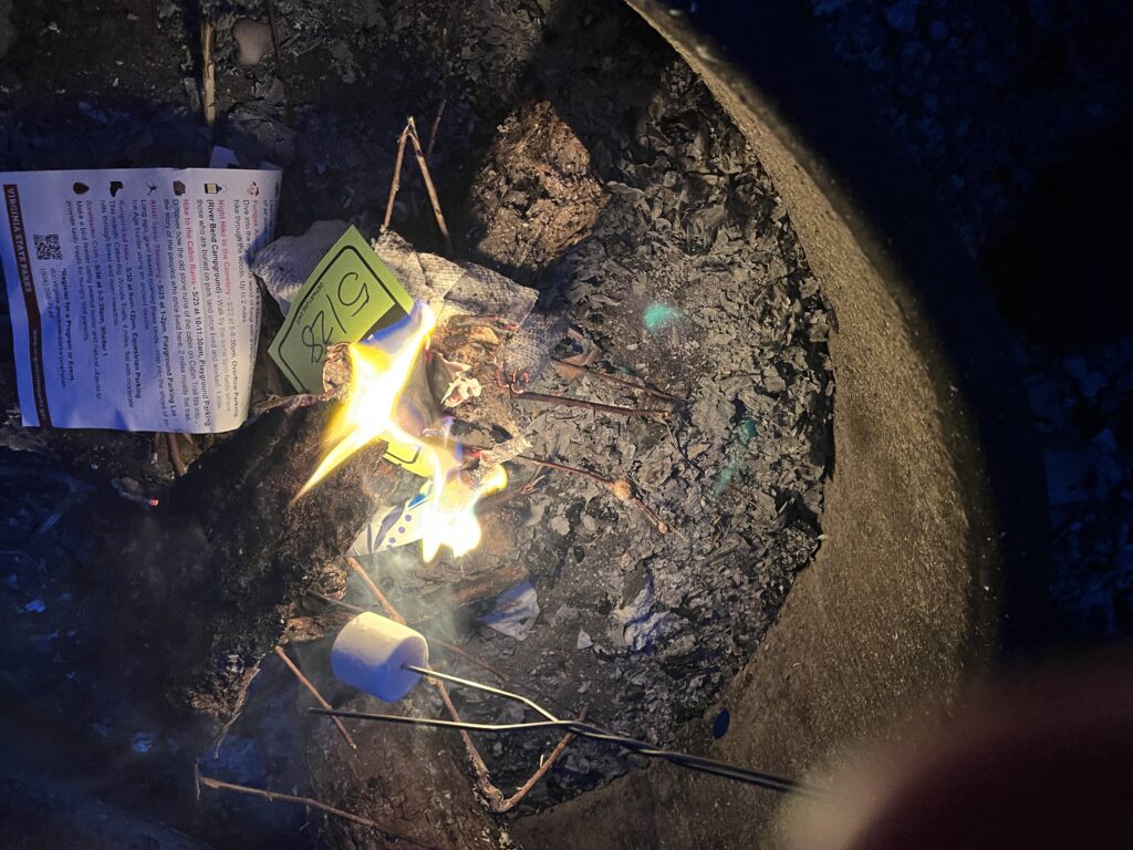
After it got dark, Lenny tried to get a campfire started, but everything was still damp from the previous day’s heavy rain. If we’d had some “good Norwegian wood” we absolutely would have tried to burn it (ha), but by torching some paper we were able to roast two–just two–marshmallows to make one “s’mores” each. (Did you know that this traditional camping dessert has been around for close to 100 years?! You can read about its history here.)
At least the skies were clear and the waxing gibbous moon was quite beautiful as it rose on Thursday night…
Friday morning we learned that we would be able to ride in the cab with the tow truck driver (yay!), but we also learned that there wasn’t a vehicle available to rent in Richmond that could tow the trailer! So after making even more phone calls, we made a reservation for a truck in Harrisonburg, about 110 miles away from the state park! At least by reserving the campsite for an extra night we’d have the option to wait until Saturday to pick up the rental in Harrisonburg, drive back to the park, and then tow the trailer (with an unfamiliar tow vehicle…) back over the mountain. This was obviously not a great option, but at least it WAS an option….
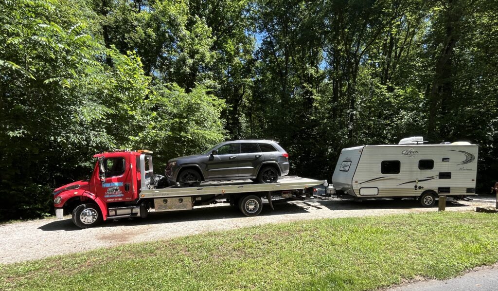
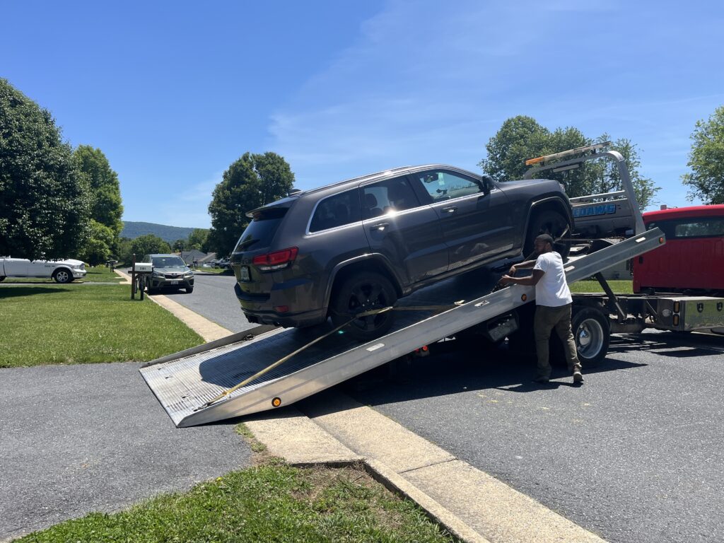
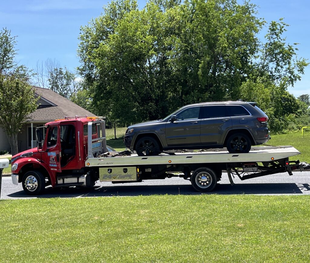
The rollback tow truck arrived on time, and the driver was quickly able to get the Jeep loaded. We were still trying to decide when we would come back to get the trailer, but to our surprise the driver said he could take the trailer, too–for an extra fee–by using the “stinger” extension on the back of his truck. We said yes.
Lenny called the rental place to cancel the vehicle in Harrisonburg while I called the park office to cancel our campsite reservation for that night. By canceling so late, however, I wasn’t able to have the reservation fee (already charged to my credit card, of course) refunded. Phooey.
So after stopping at the dump station on the way out (which kind of seemed like the highlight of the trip–or maybe its essential zeitgeist –all things considered…), we were on our way.
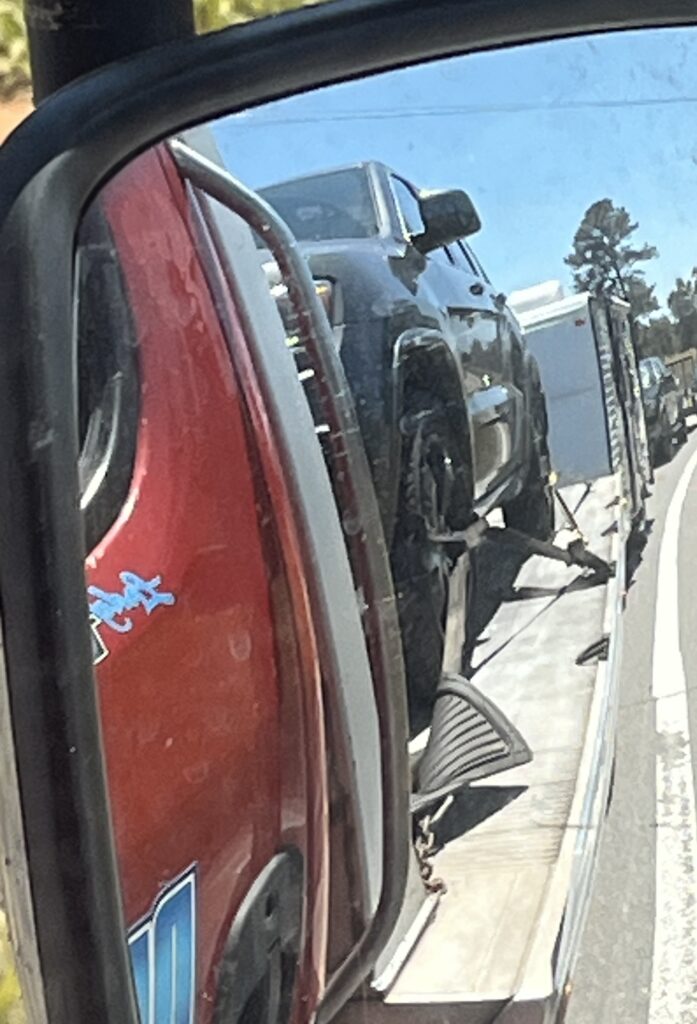
This was my view in the side mirror when we were stopped for a minute due to construction on the road. We were one very long, connected concoction as we headed west on the interstate…
It took a couple of hours to get from the campground back over the mountain to my house, and I was straight up amazed (astounded, astonished, and flabbergasted!) when the driver quickly and easily backed the trailer into my driveway!! WOW!!
Of course we had talked a lot on the drive back, and a lot of the talk had been about the Jeep. From the previously diagnosed issues that needed to be repaired, I already knew I was looking at a few thousand dollars to get it fixed. And with the just diagnosed problems–which would likely cost several more thousands–well, I wasn’t sure that I could justify investing that much in a vehicle that was 11 years old… And even if I fixed all of the known problems, what system would go next?!
My 2015 Jeep Grand Cherokee had been rock solid since I’d bought it in January 2021. It had safely towed the trailer to Michigan and Indiana twice, and as far as St. Louis one time, as well as to numerous campgrounds in Virginia over the years. It had also been a very comfortable and dependable daily drive vehicle. But once the extended warranty had run out in October 2025, literally one thing after another had gone wrong, and I’d made multiple–and pretty costly–trips to the shop for repairs.
Even knowing all of this, the tow truck driver expressed interest in buying it, and I agreed to sell it; right then, right there. Crazy maybe, but this seemed like the best decision under the circumstances. He lowered the car off the flatbed so we could get everything out of it, and we removed the license plates.
Then he put it back on his truck and towed it right out of my life….
So sad; this Jeep had really been one of my all-time favorites. 🙁
Now, a week + later, I’m (still) looking for my next “favorite” vehicle. Admittedly, it’s a complicated search. If I were ready to give up my travel trailer–which I’m not!–I would have far more options to consider. But by keeping my camper, I have to find something that is properly equipped and powerful enough to safely tow it. I don’t want a car or truck with a bazillion miles on it, or one that’s priced much, much more than I’m willing/able to spend. And given that the majority of the time it will be used for regular driving, I don’t need a monstrous beast that gets poor gas mileage or that is costly to maintain.
While I like my little rental car, a brand new Buick Encore GX, obviously I need to buy something soon as renting is crazy expensive!
I’ve tried to be as positive as possible about this whole unfortunate series of events, and I am sincerely and humbly very thankful that that I “lost” my Jeep due to its extensive mechanical issues, and not because we were involved in some kind of horrible accident or car crash.
Related to that, I am very thankful that we were never in any particular danger, and that we both made it through these challenging days safe and unharmed (as long as the numerous mosquito and other bug bites aren’t factored in).
And despite considerable (extensive, dogged, implacable) frustrations–which quite frequently led to considerable, creative, and rather original swearing and cursing–I am thankful that we often laughed together about this whole ridiculous assortment of absurdities. That is a blessing in itself!
As Greek philosopher Epictetus may (or may not) have said, “It’s not what happens to you but how you react that matters. “ And, at the moment, that’s kind of good enough for me.
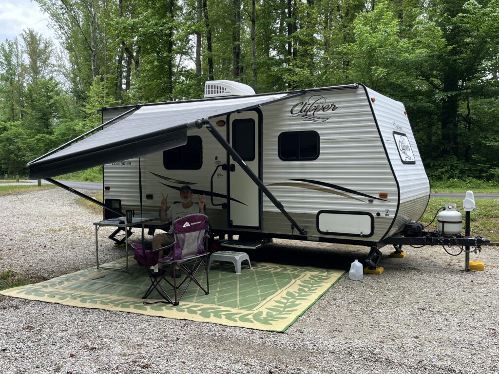
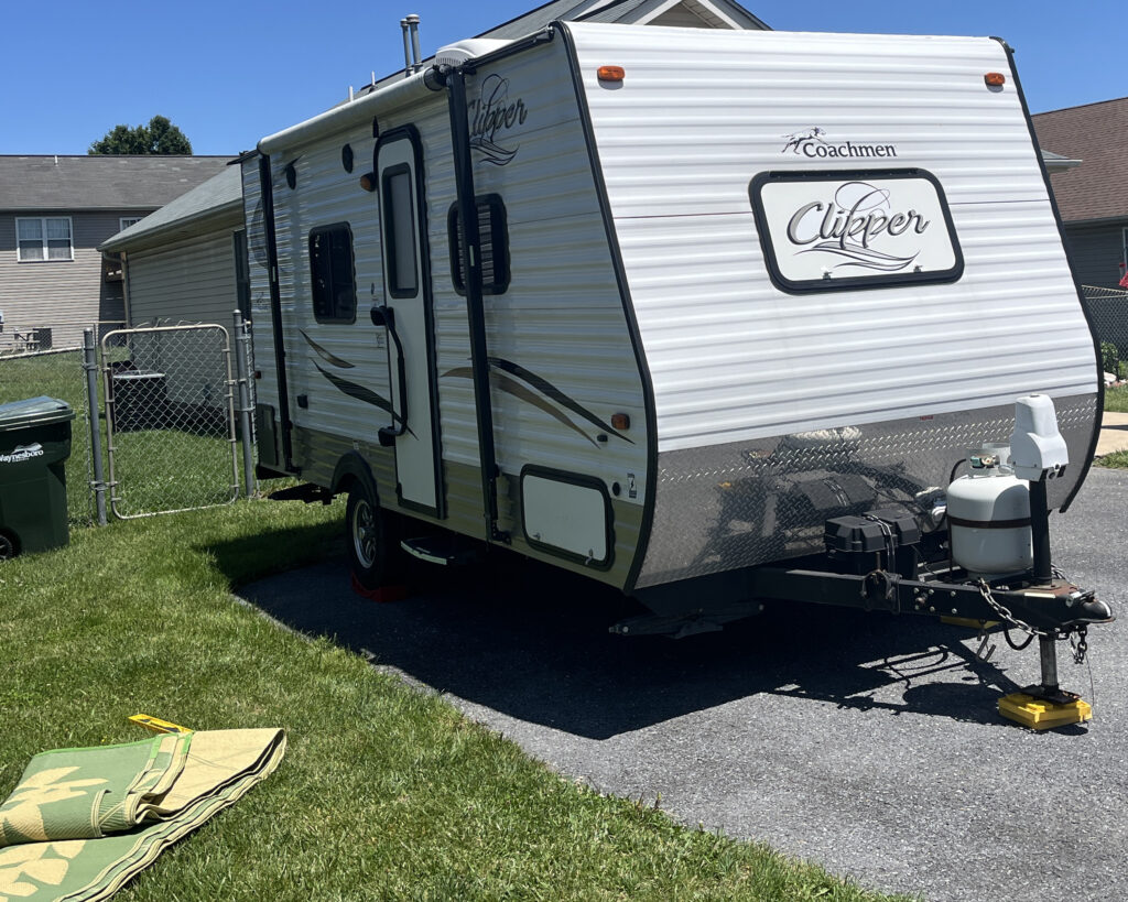
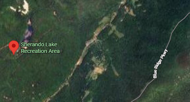
The first camping trip of 2026–and the first since August 2024 when I did a solo trip to Westmoreland State Park–was to Sherando Lake near Lyndhurst, Virginia. It felt great to hitch up the little Coachmen Clipper for a relatively local trip with unexpectedly nice weather.
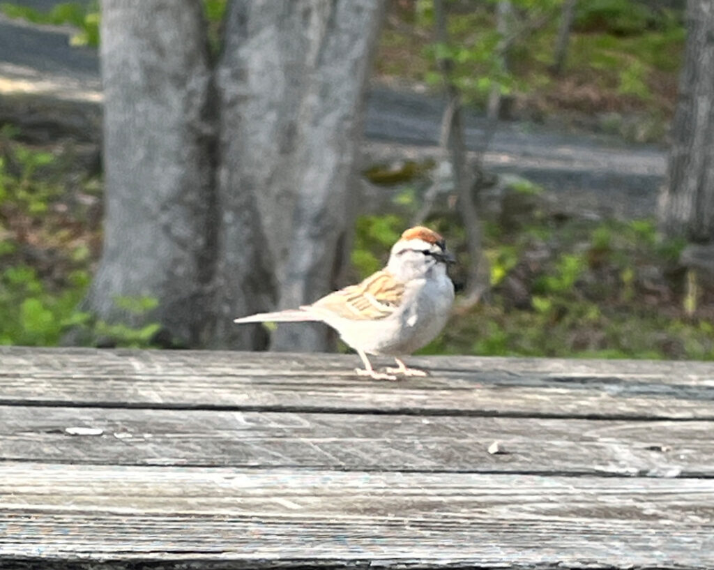
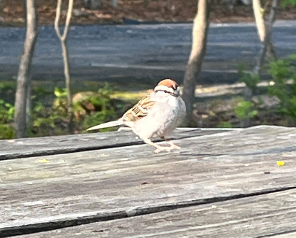
A bold little Chipping Sparrow was a frequent visitor at our campsite:
The Sherando Lake Recreation Area is very close to the Blue Ridge Mountains. And with it being very early in May, it got chilly as soon as the sun went down!
So after a delicious dinner of turkey chili and cornbread on Sunday evening, we enjoyed sitting by a small campfire. Inside the trailer, a ceramic heater kept it comfortably warm.
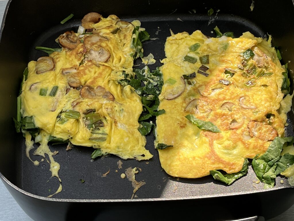
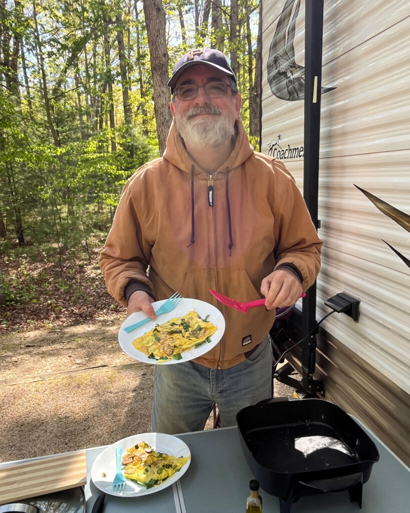
The next morning, omelets were cooked outside in an electric skillet.
Breakfast is served!
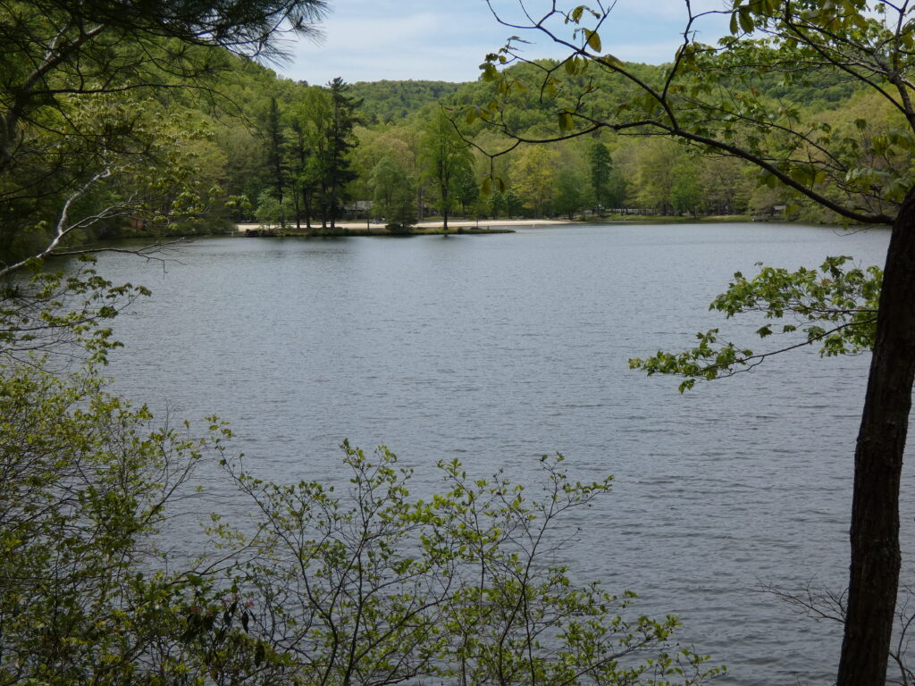
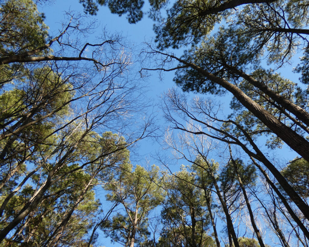
We washed dishes and cleaned up outside and in, then we went for a walk along the lake. Spring was putting on a wonderful show, and I took dozens of pictures:
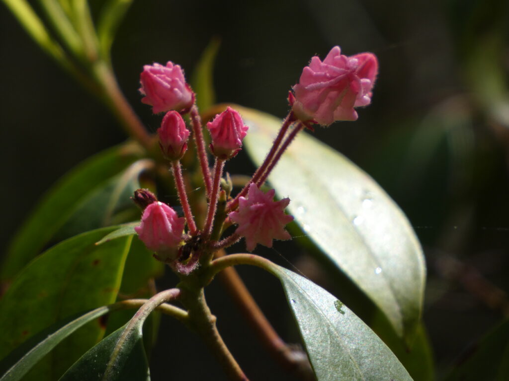
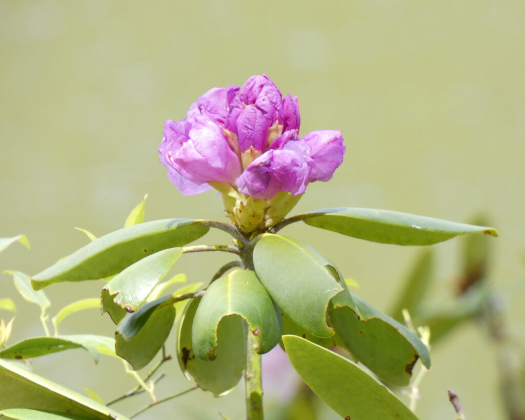
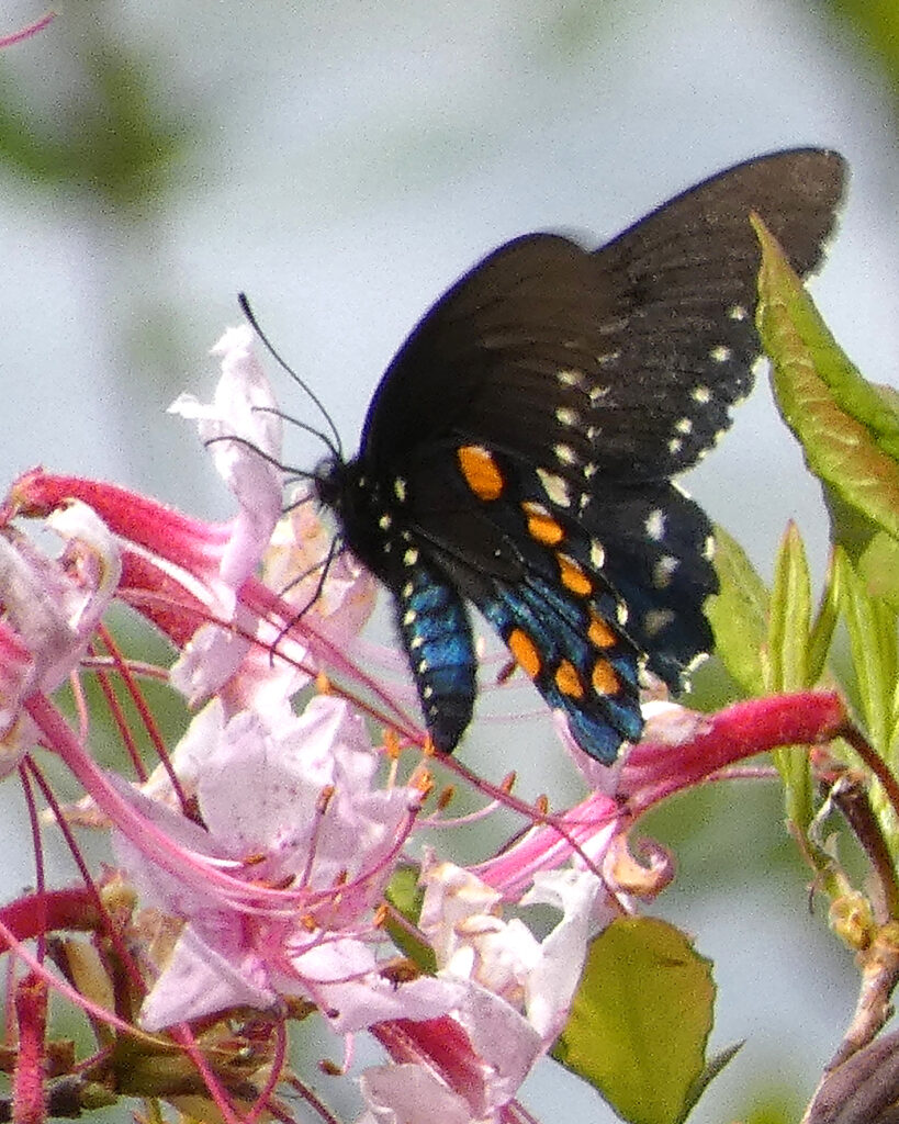
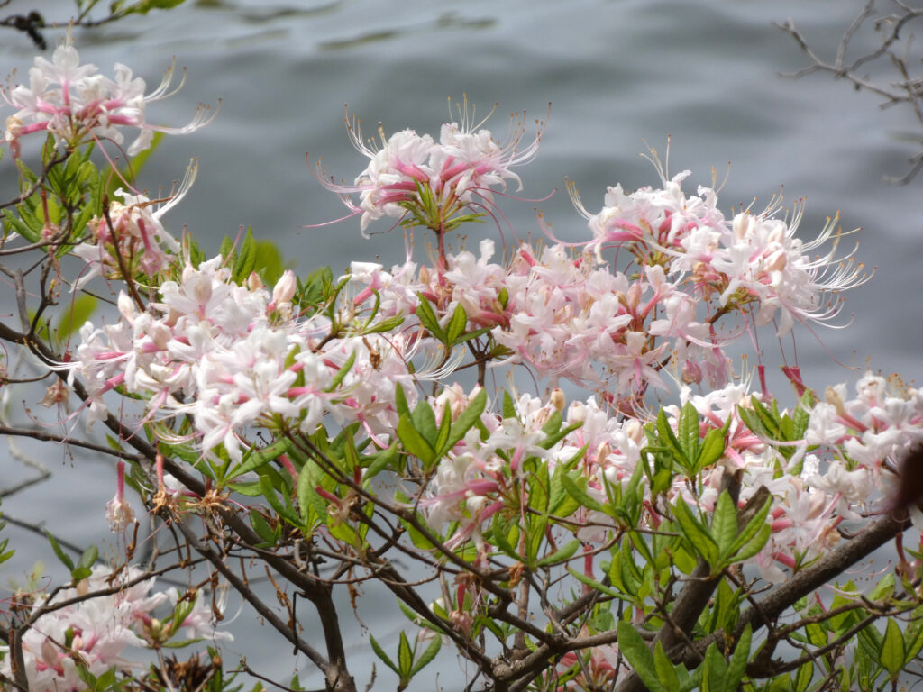
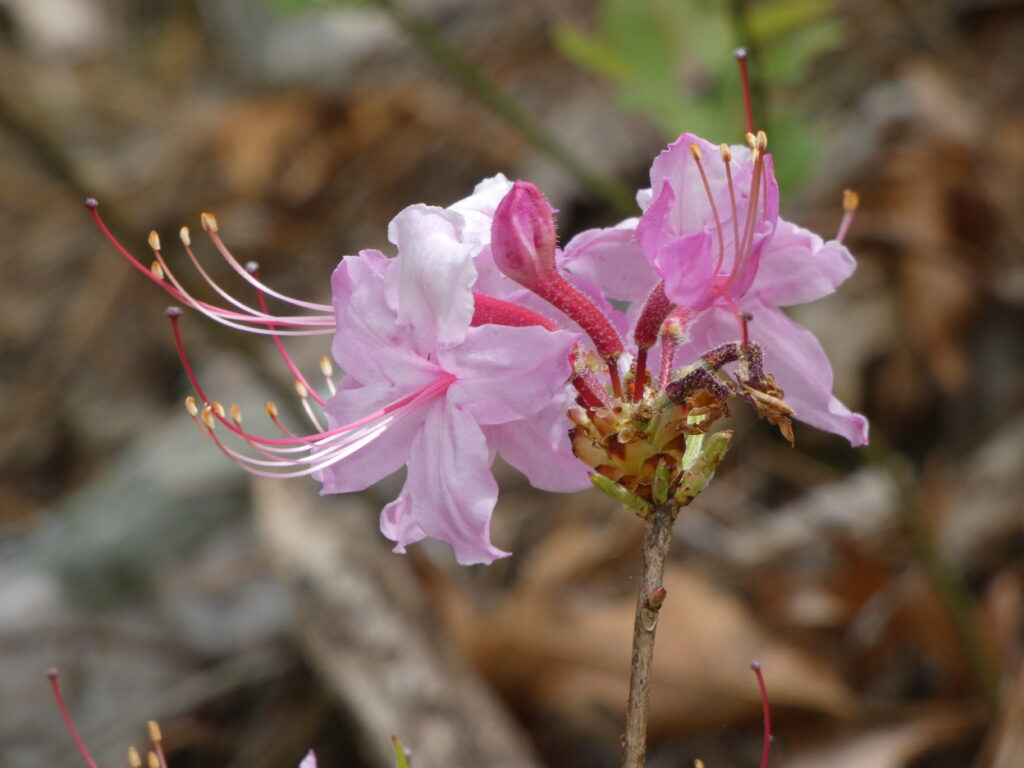
Delicate Mountain Laurel, just starting to openRhododendronPipevine Swallowtail Butterfly on AzaleasAzaleas by the lakeLooking back towards the Sherando Lake beach
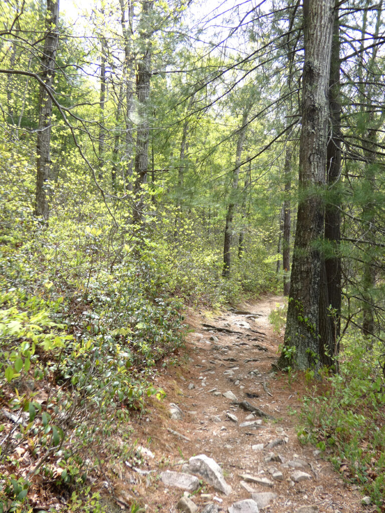
The trail along this side of the lake is generally more level than the trail on the opposite side of the lake, but with rocks and roots everywhere it’s still important to pay attention to where you’re stepping!
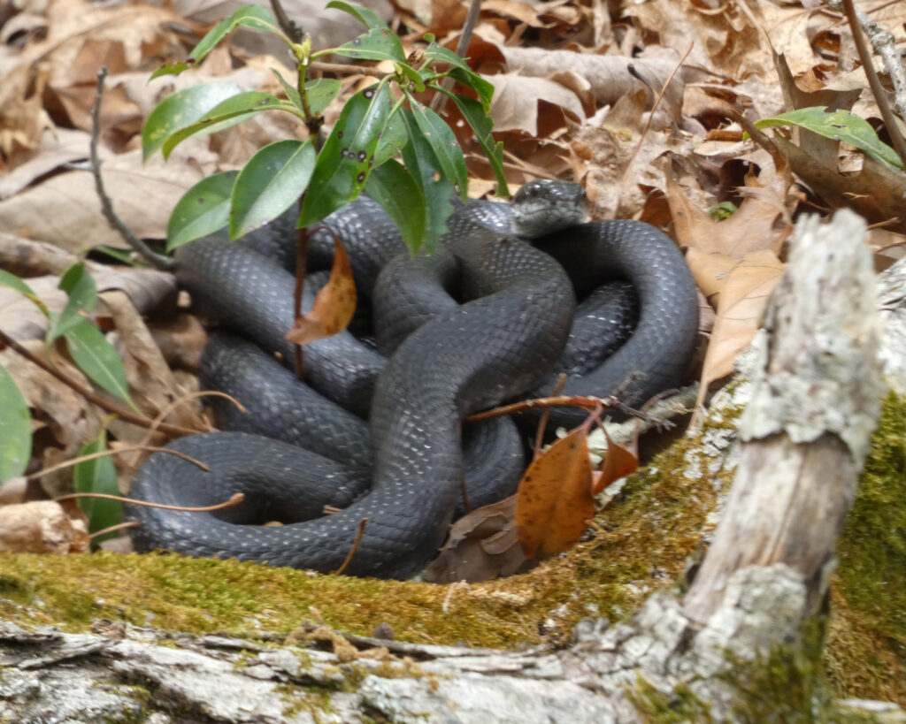
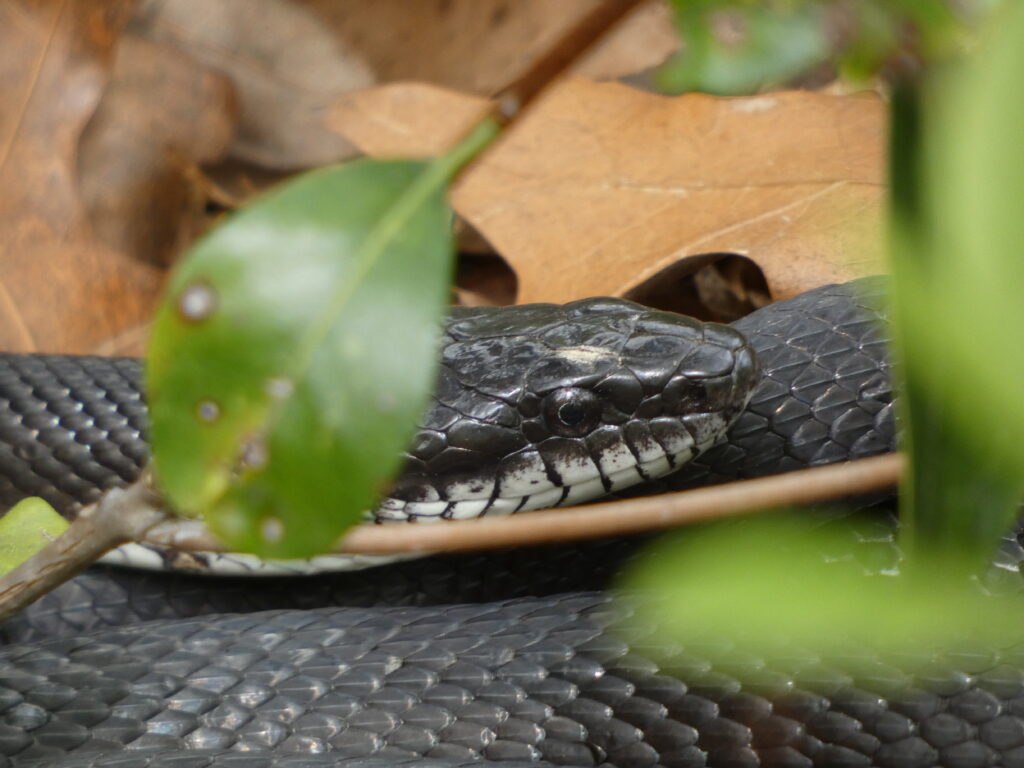
In addition to watching out for rocks and roots, there are other reasons to watch where you step when you’re out in nature! Fortunately, this very, very long Black Rat Snake was to the side of the trail–and yes, I used the telephoto lens on my camera for these pictures!
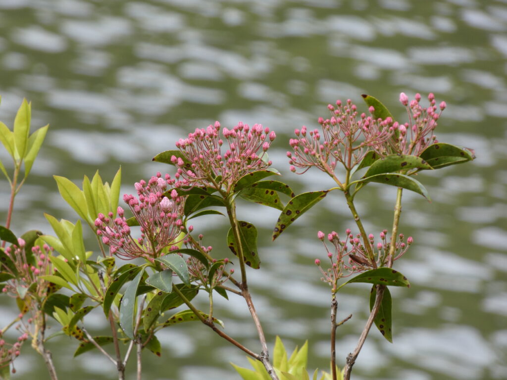
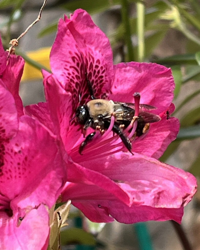
Carpenter Bee on a Rhododendron
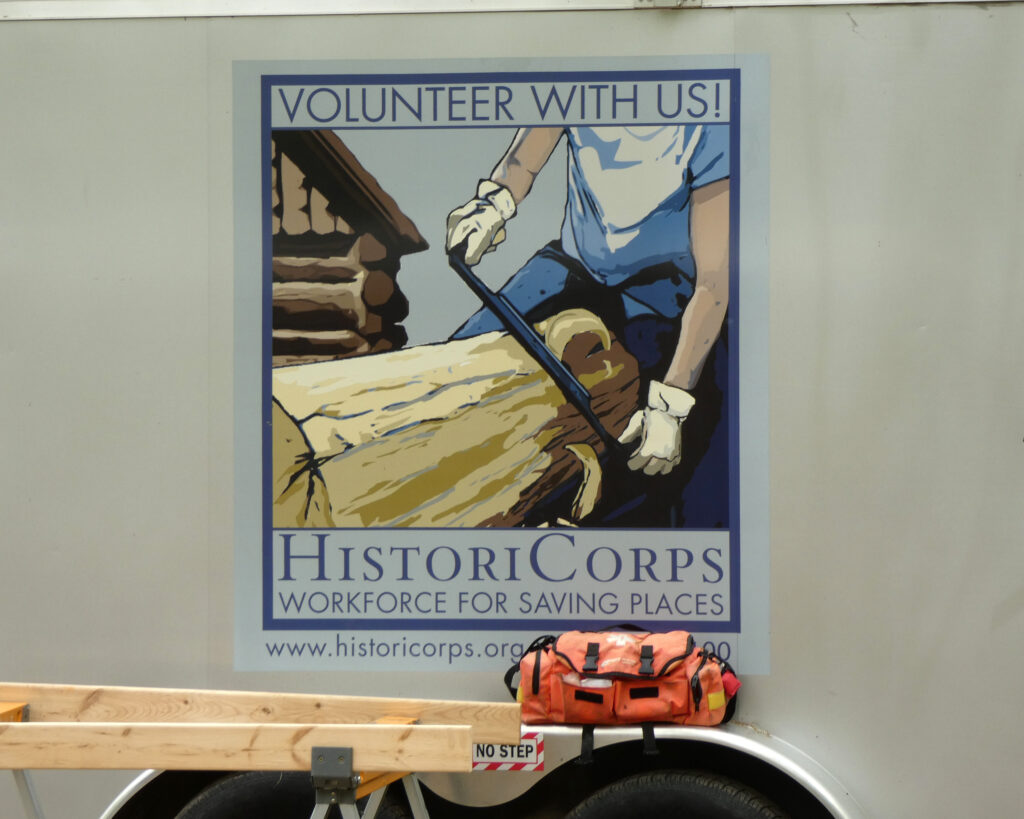
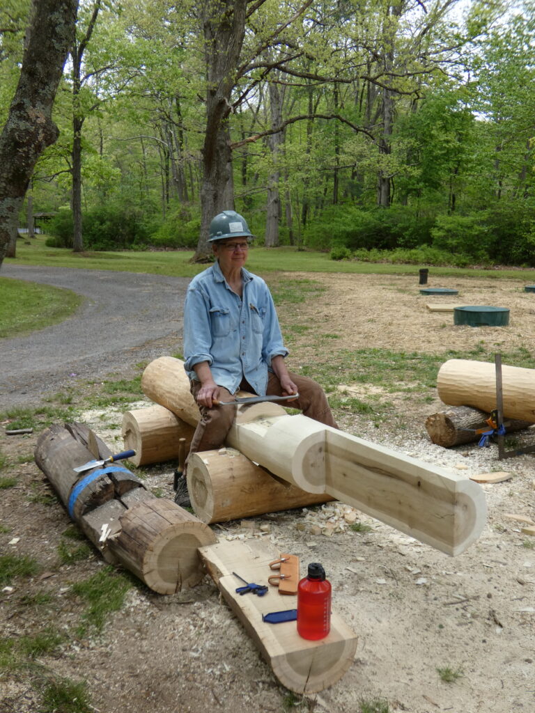
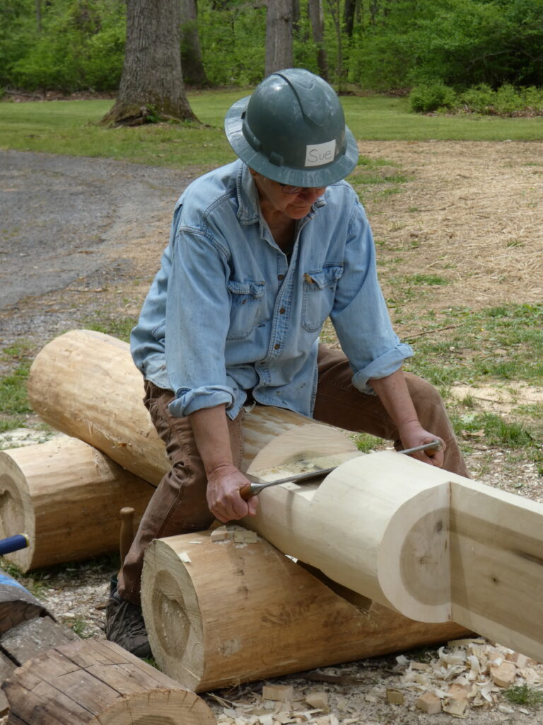
Back at the beach, there was a variety of work happening at the pavilion. This was the first time I’d heard of HistoriCorps and the type of services that volunteers provide in restoring historic places in public spaces. The Sherando Lake recreation area qualified for restoration work as it was created in the 1930s as a New Deal-era project by the Civilian Conservation Corps.
One volunteer was preparing Poplar logs which will be used to replace some of the worn out ceiling beams in the pavilion.
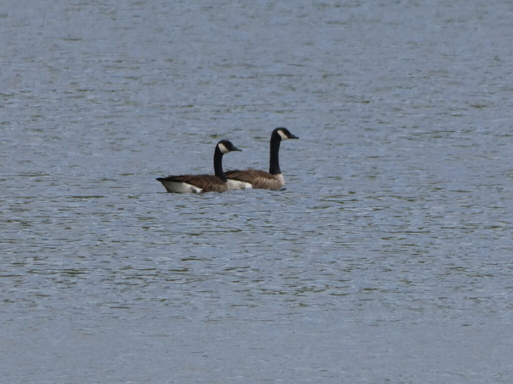
I always think of my parents whenever I see Canada Geese….Beautiful Sherando Lake in early May
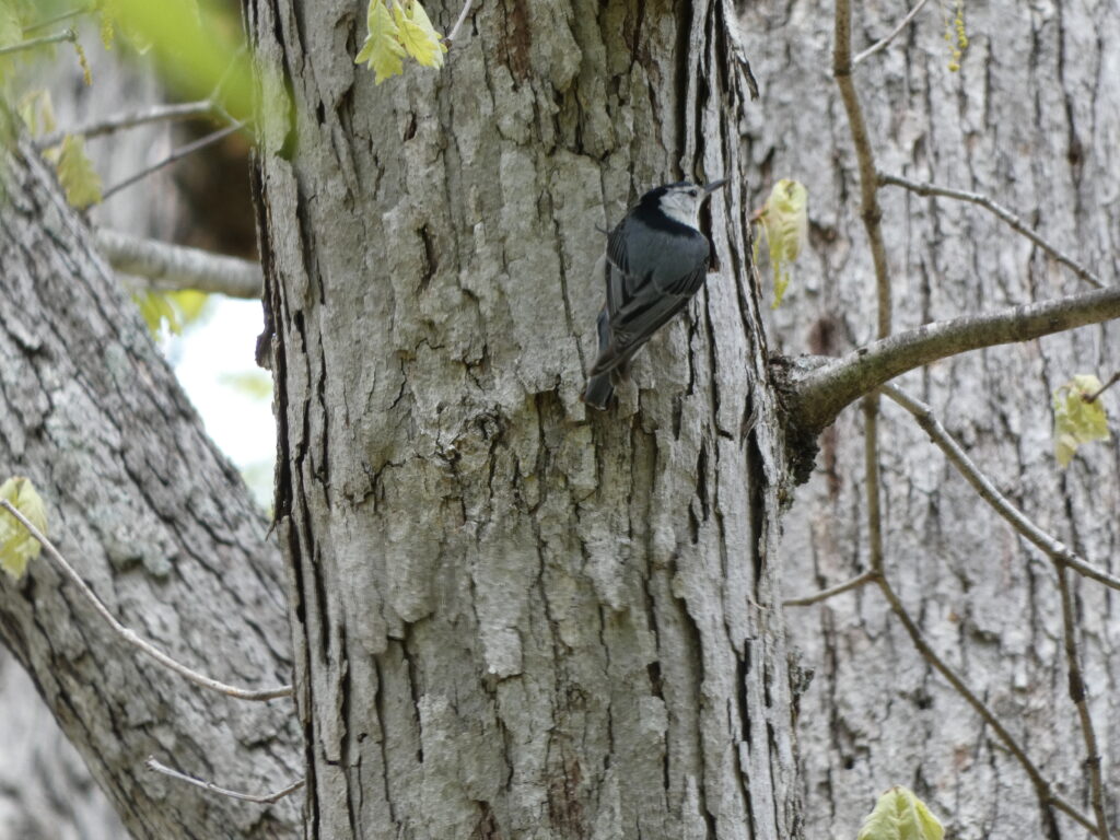
Some of the birds we heard frequently during our stay were Blue-Gray Gnatcatchers and Red-Eyed Vireos. Both nights that we were there we heard an Eastern Whippoorwill, and that was a special treat! We heard many more birds than we actually saw or that I was able to photograph, but a little White-Breasted Nuthatch was very busy looking for insects in this tree.
Young boy fishing at Sherando Lake
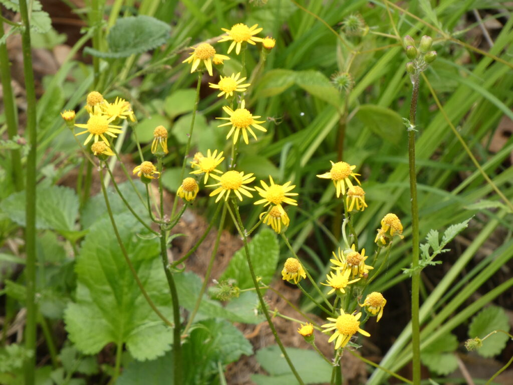
There were so many wildflowers near the lake! I think I’ve identified them correctly…
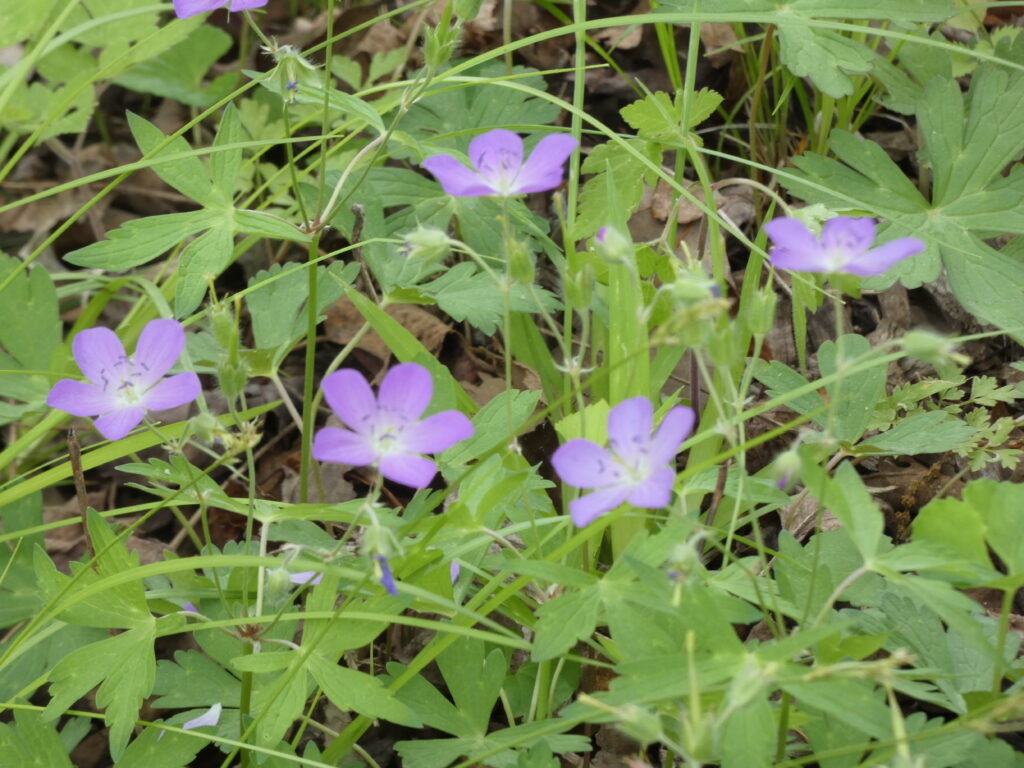
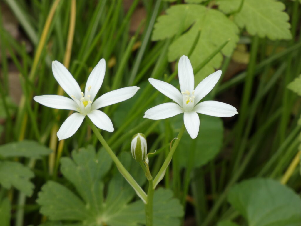
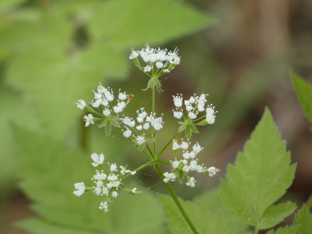
Golden RagwortWild GeraniumsSpring StarflowersSweet Anise
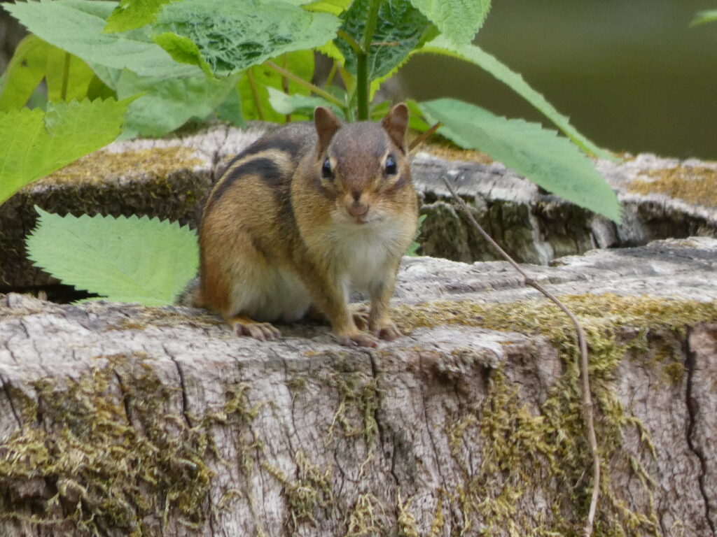
We saw a few fast-moving Chipmunks at our campsite, but this little guy or girl near the lake sat still long enough for me to take a couple of pictures!
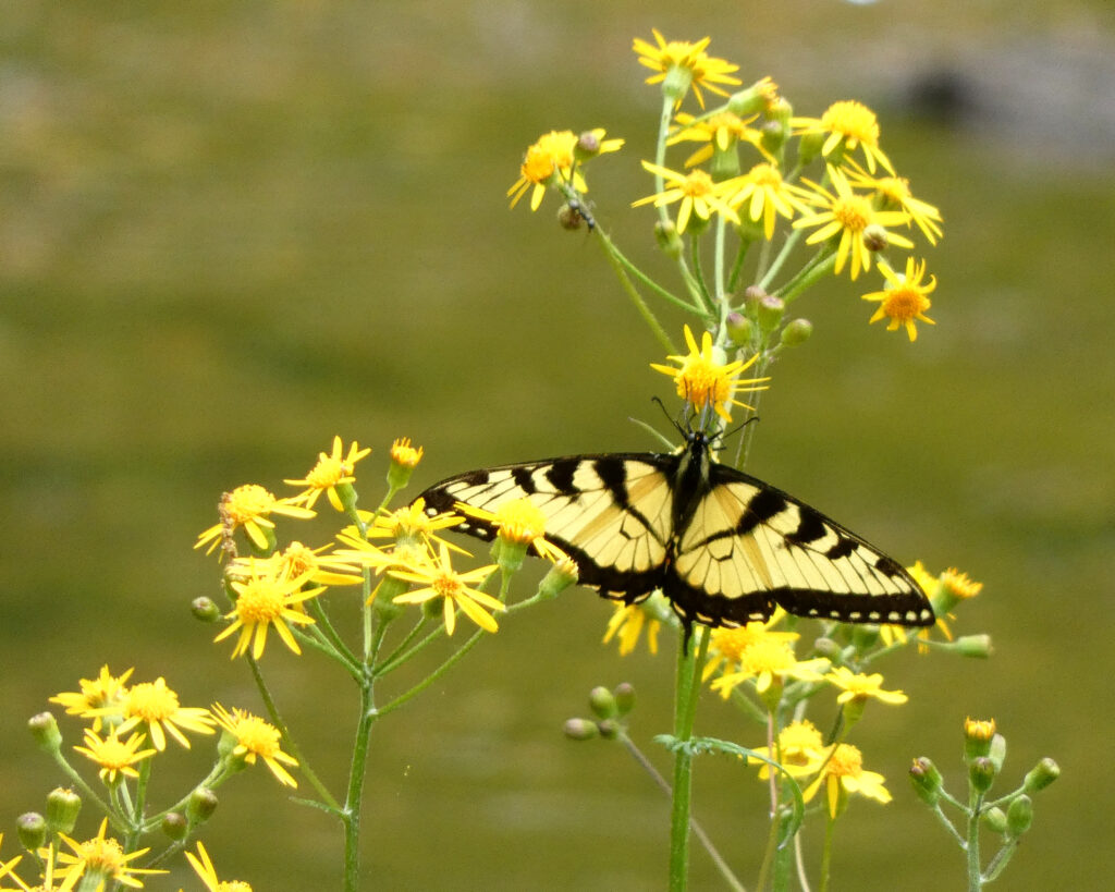
Eastern Tiger Swallowtail on Golden Ragwort
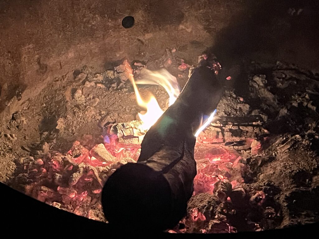
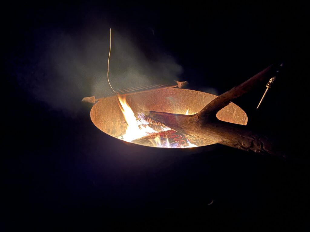
One of the simple joys associated with camping is to sit near a campfire on a cool evening. We were fortunate to be able to do that both nights. There is such a sense of timelessness and ageless continuity when one feels the warmth of the fire and watches the dancing flames and glowing embers….
I could have easily spent another couple of days at Sherando Lake, but it was a picture-perfect mini-vacation and a great way to start the 2026 camping season!
“Of all the paths you take in life, make sure a few are dirt.” ~ John Muir
Vacations don’t always require a lot of travel time to be enjoyable! A recent trip to Rockbridge County in the Shenandoah Valley of Virginia was only about 40 miles from where I live, but it proved to be a wonderful mid-week getaway.
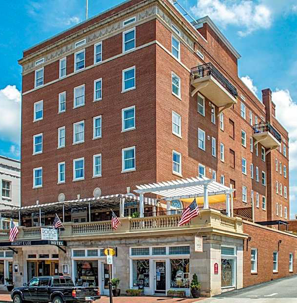
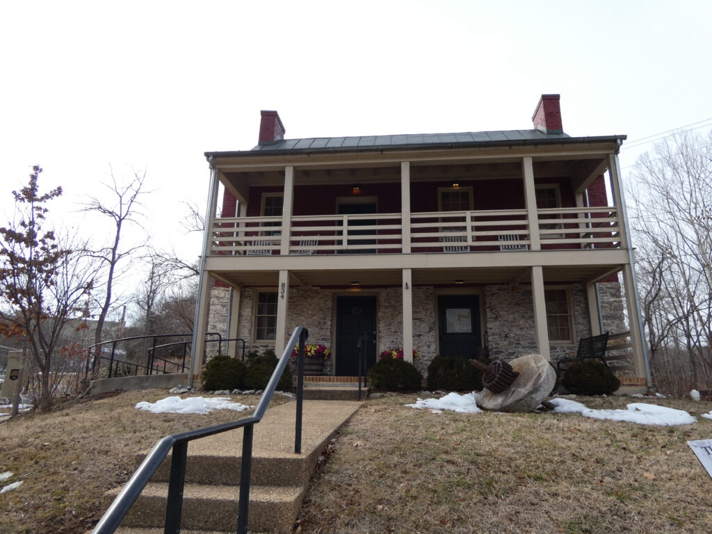
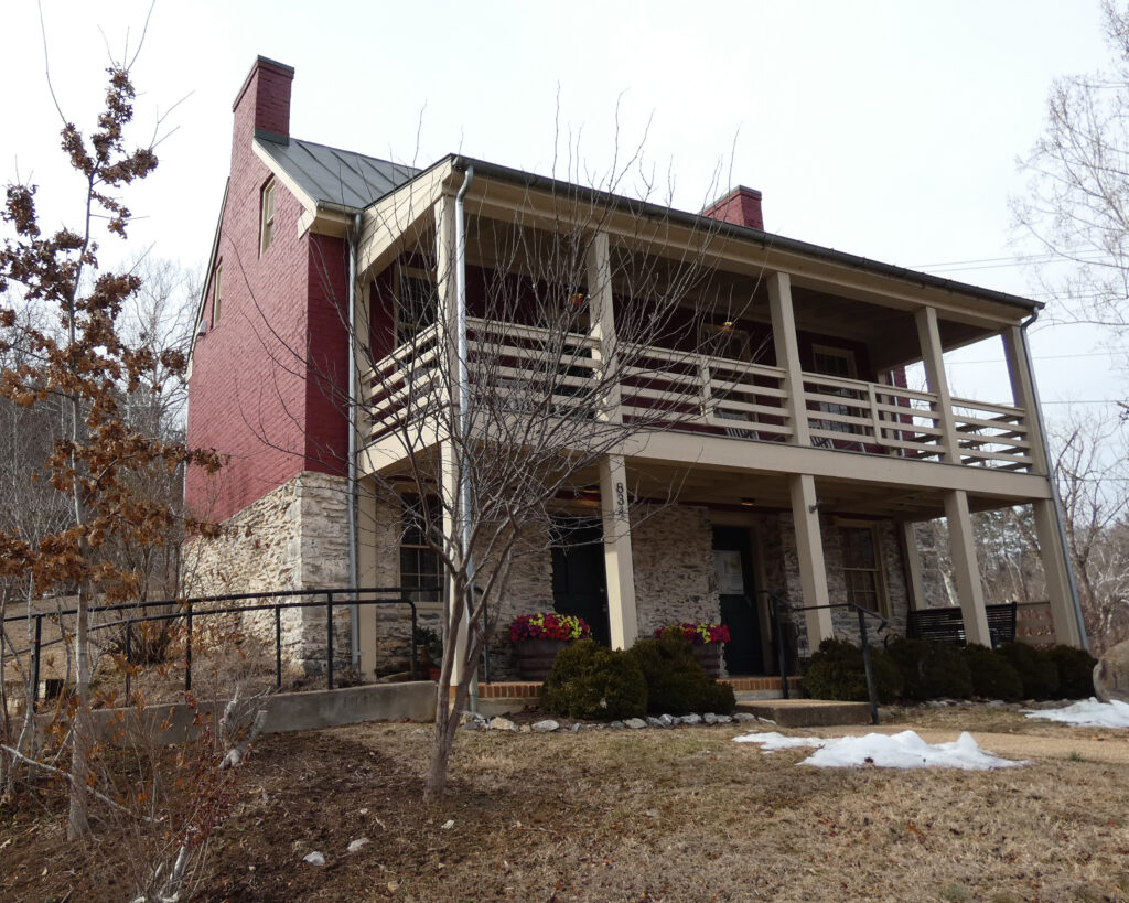
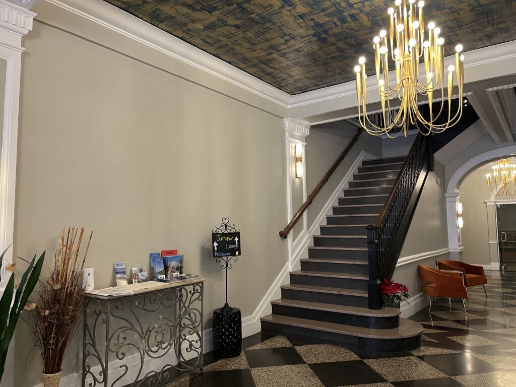
Over the years I’d been “to and through” Lexington, Virginia, but I’d never really explored the town, and I’d never stayed there. For this mini-vacation we stayed at The Gin Hotel, right on Main Street. Built in the 1920s, this historic hotel was restored and renovated by new owners in 2014. With present-day amenities–combined with its original Art Deco design elements–it was both a comfortable and an “artsy” experience!
Picture from the Hotel’s Website
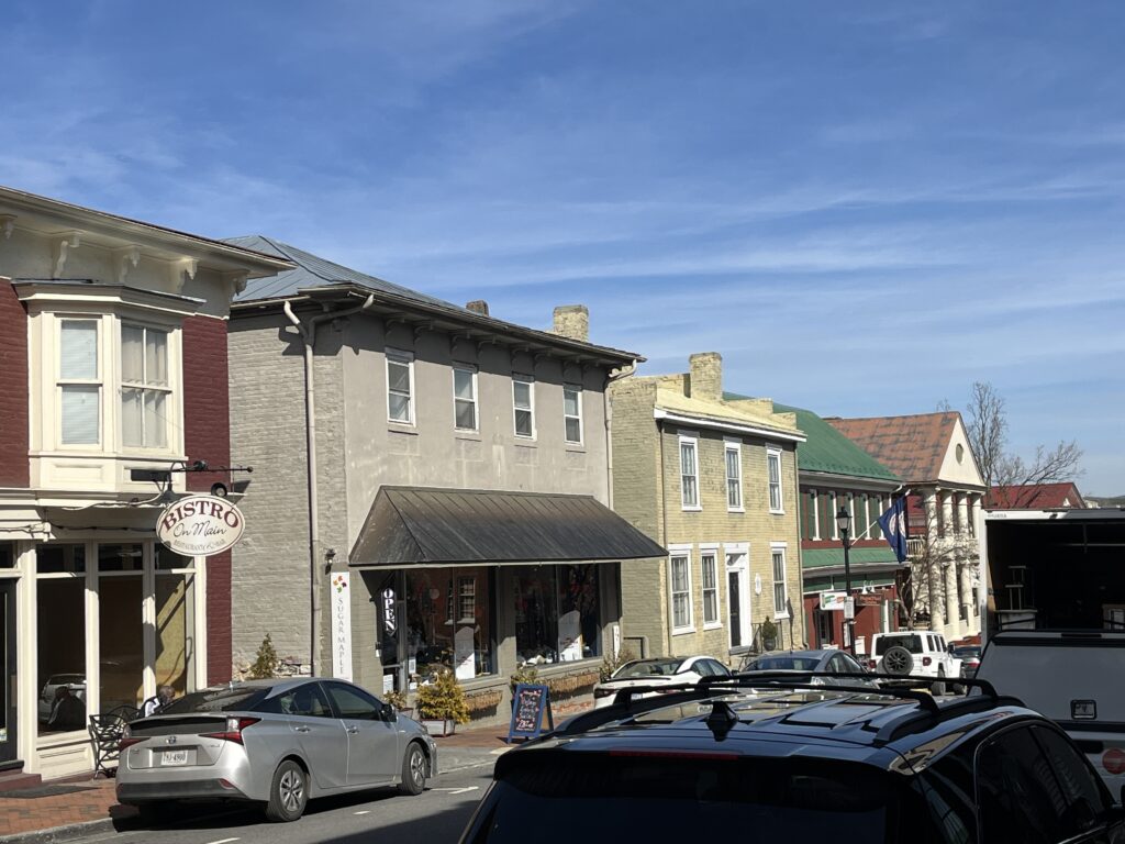
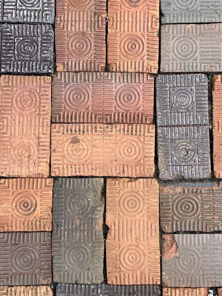
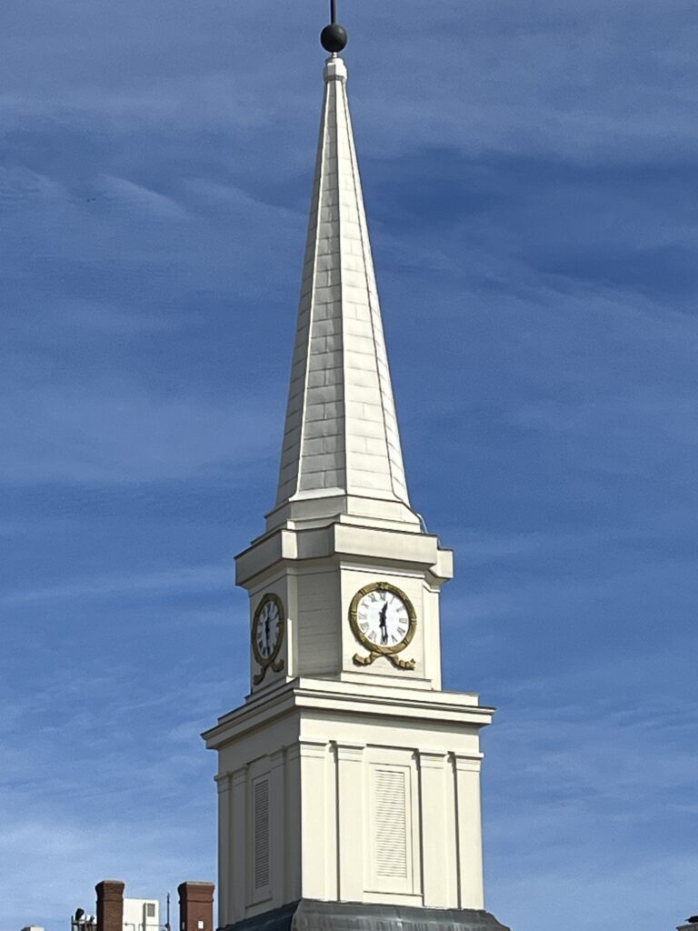
We arrived well before the check-in time, so we took advantage of the very walkable downtown area to do a bit of exploring.
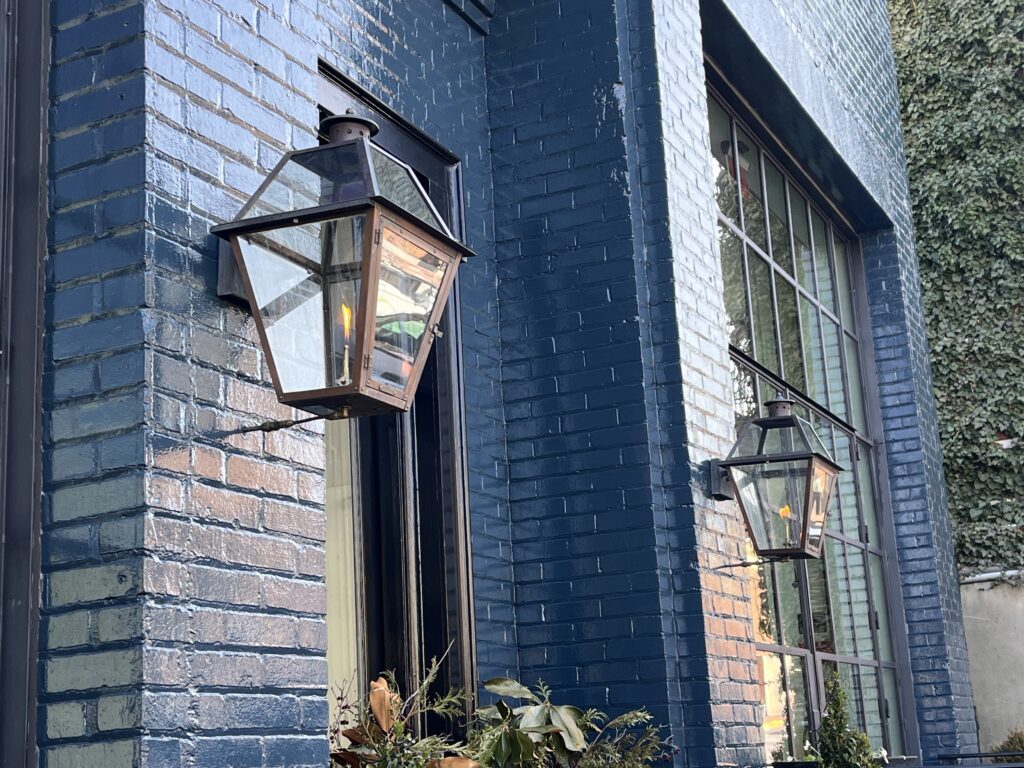
The downtown area in this historic town is alive and well, with a variety of shops & restaurants.Patterned bricks on the sidewalkStately clock towerSeveral buildings on Main Street had exterior gas lamps!
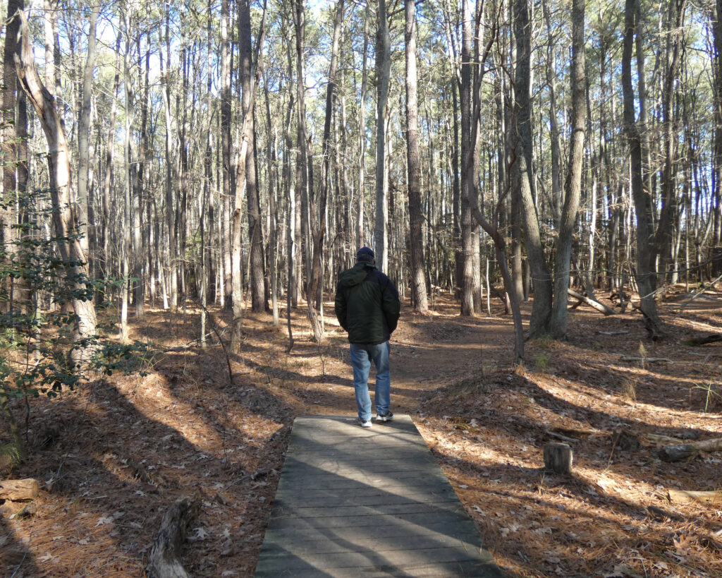
I’ve always enjoyed walking on the Chessie Nature Trail that follows the Maury River, so after leaving the downtown area we drove to one of its access points on the east side of Lexington. The following video shows a bit of what makes this trail a special place to visit:
Unfortunately, there was a lot of mud and some very slick areas on the trail given all the snow and ice we had in late January. Off-trail paths along the edge of the river weren’t a good option either, so we didn’t go too far….
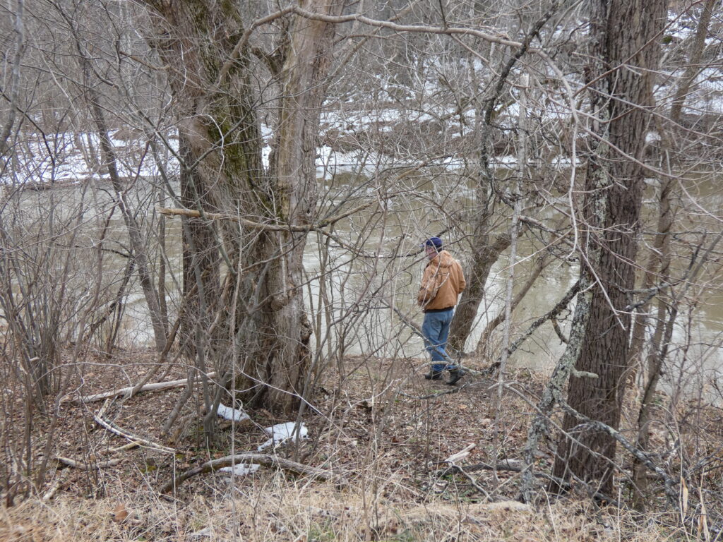
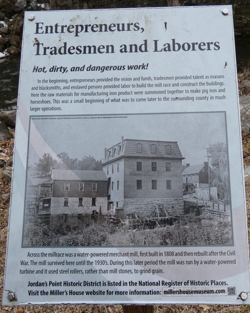
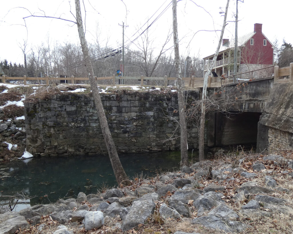
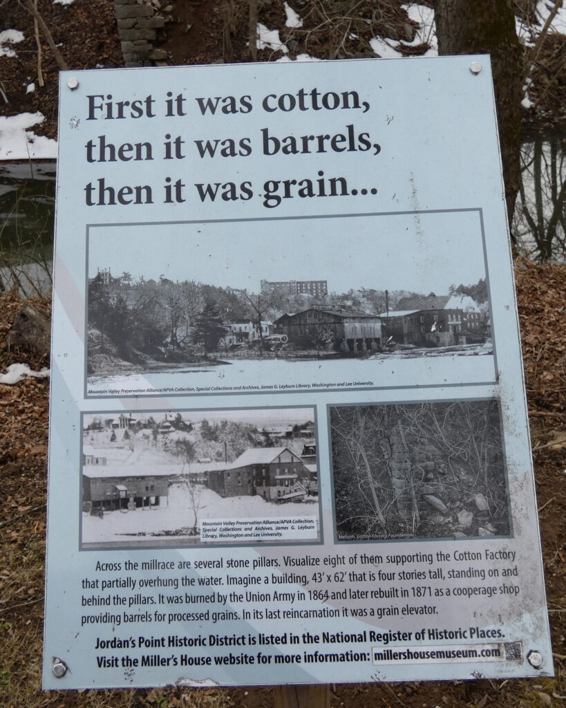
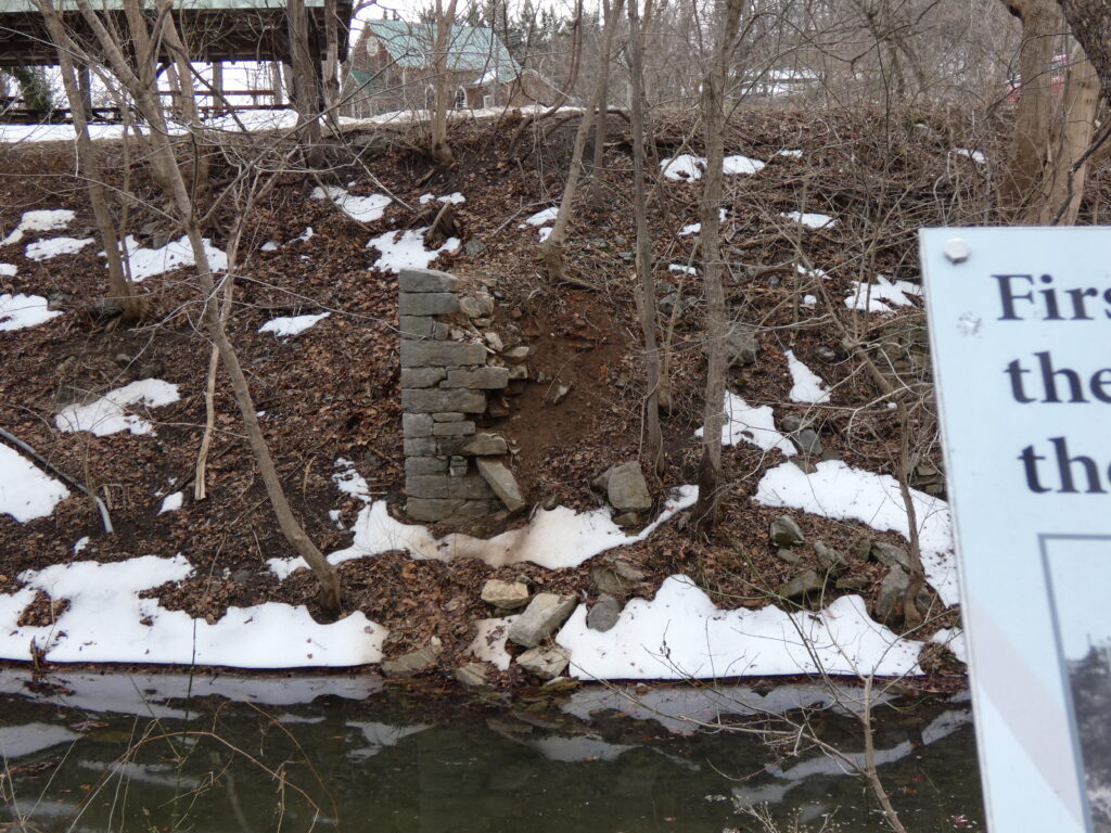
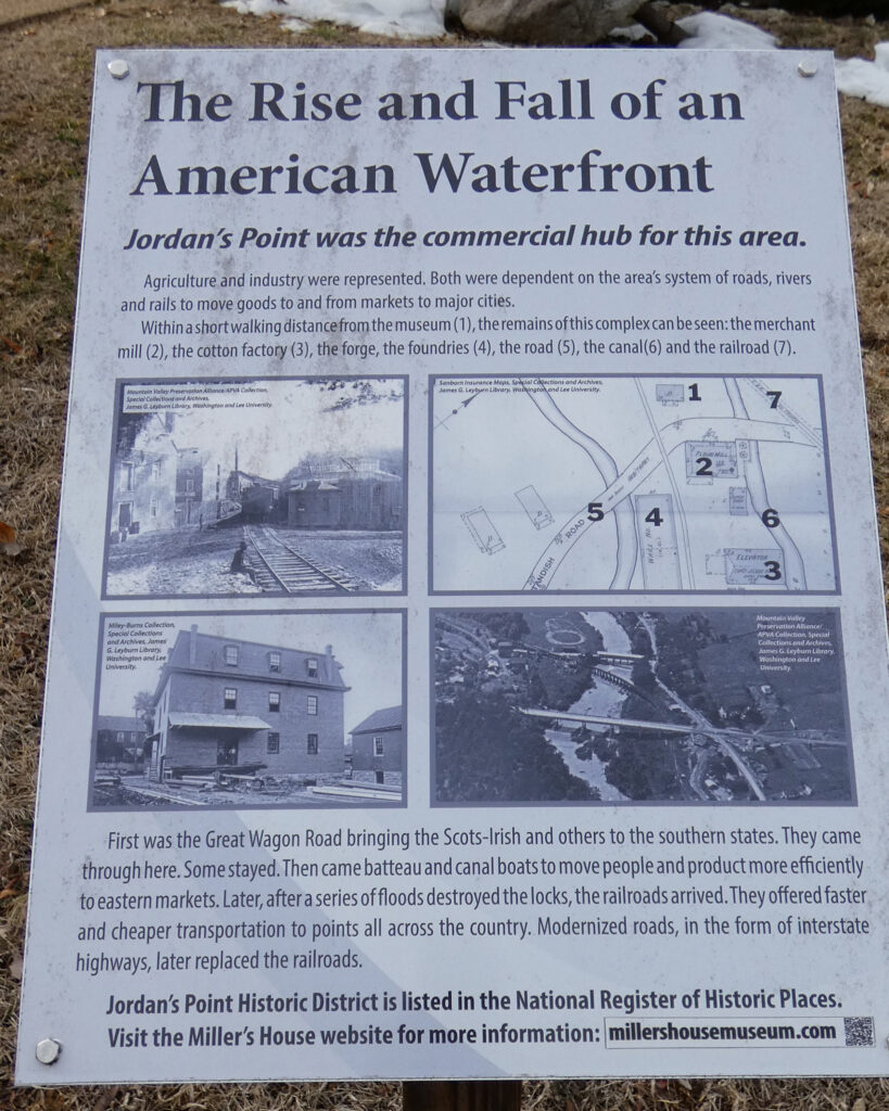
Instead, we drove “up river” just a bit to Jordan’s Point Park, which was once the industrial and transportation center in Lexington:
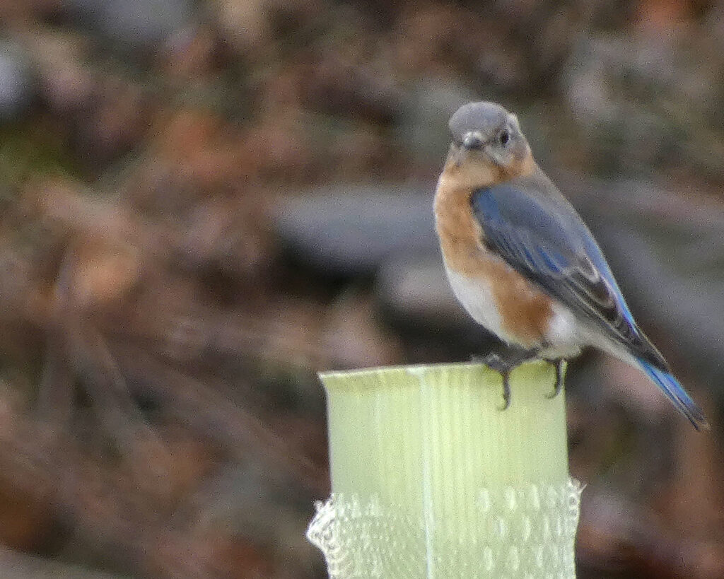
I zoomed way in to get this picture of an Eastern Bluebird at Jordan’s Point Park
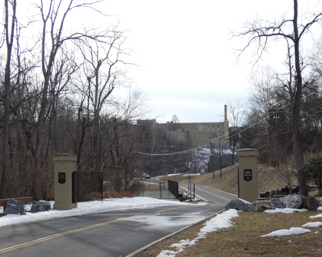
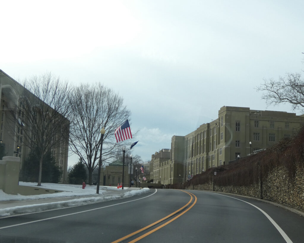
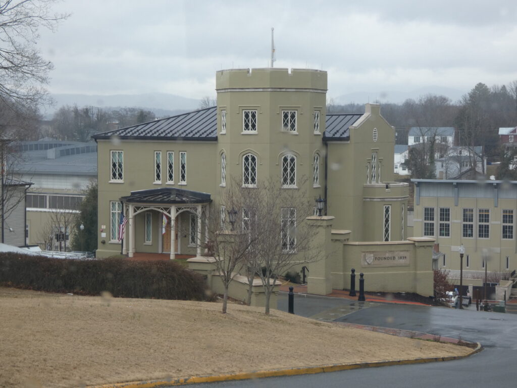
Just beyond Jordan’s Point is the Virginia Military Institute. Usually referred to as VMI, the school was founded in Lexington, VA in 1839.
Back at the hotel, I enjoyed seeing the mix of Art Deco and modern influences in the lobby…
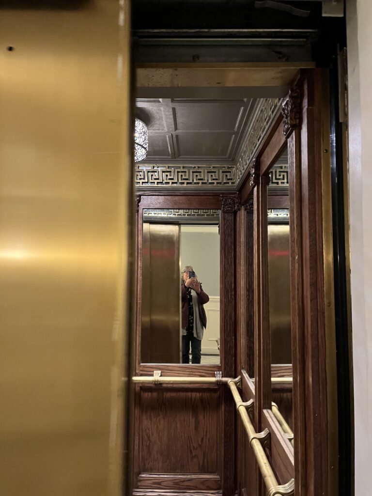
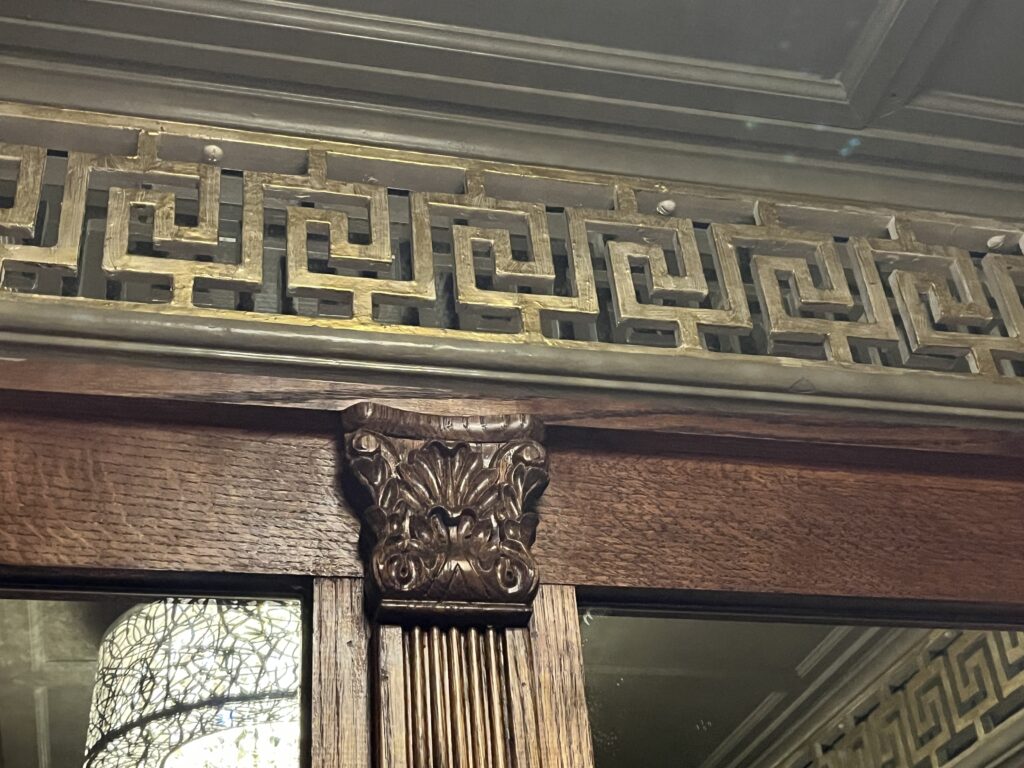
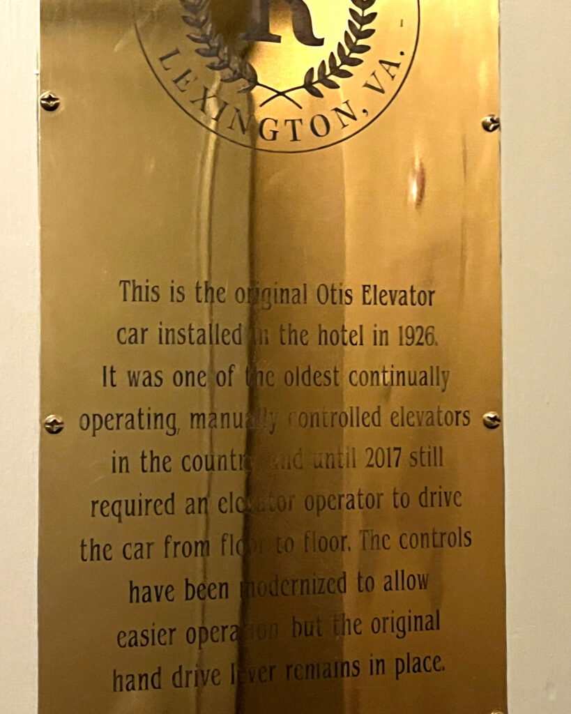
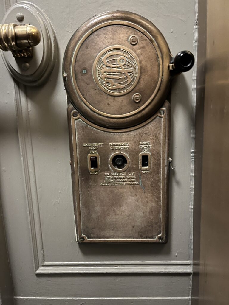
…but the elevators were really cool!
Wow, 100 years old!
These controls were used by an elevator operator until 2017 when the system was modernized!
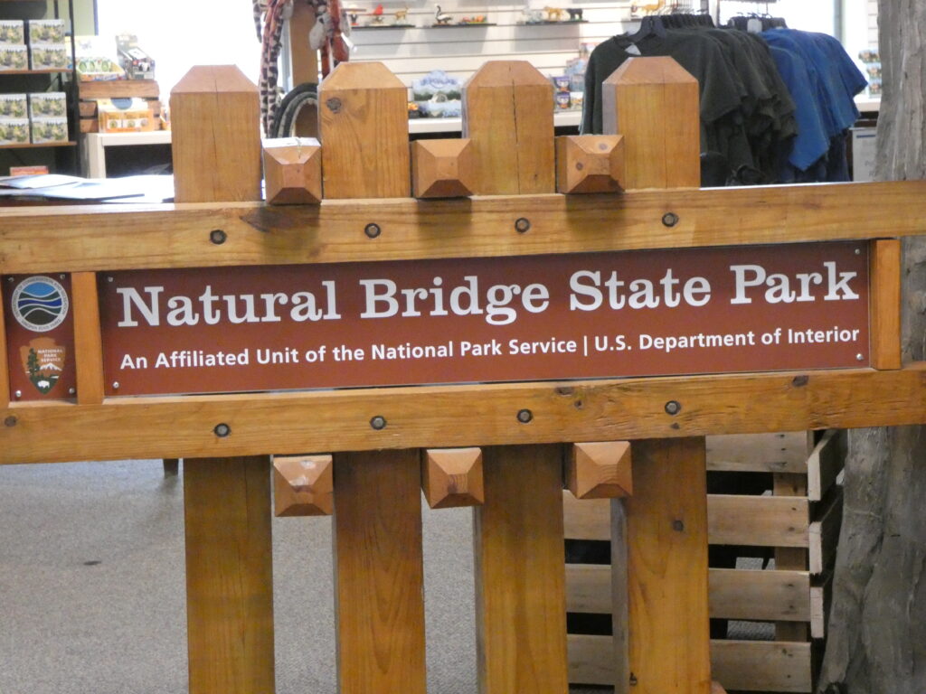
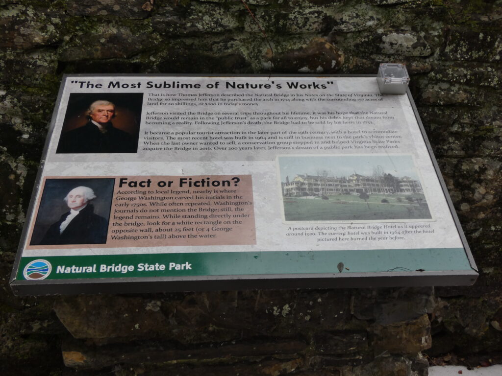
That evening we walked to Niko’s Grille on Main Street for dinner (I had Chicken Piccata–very good!), and the next day we visited Natural Bridge State Park, which is about 15 miles south of Lexington. While I’ve visited Natural Bridge several times over the years, this was the first time I’d been there since it became Virginia’s 37th state park in 2016.
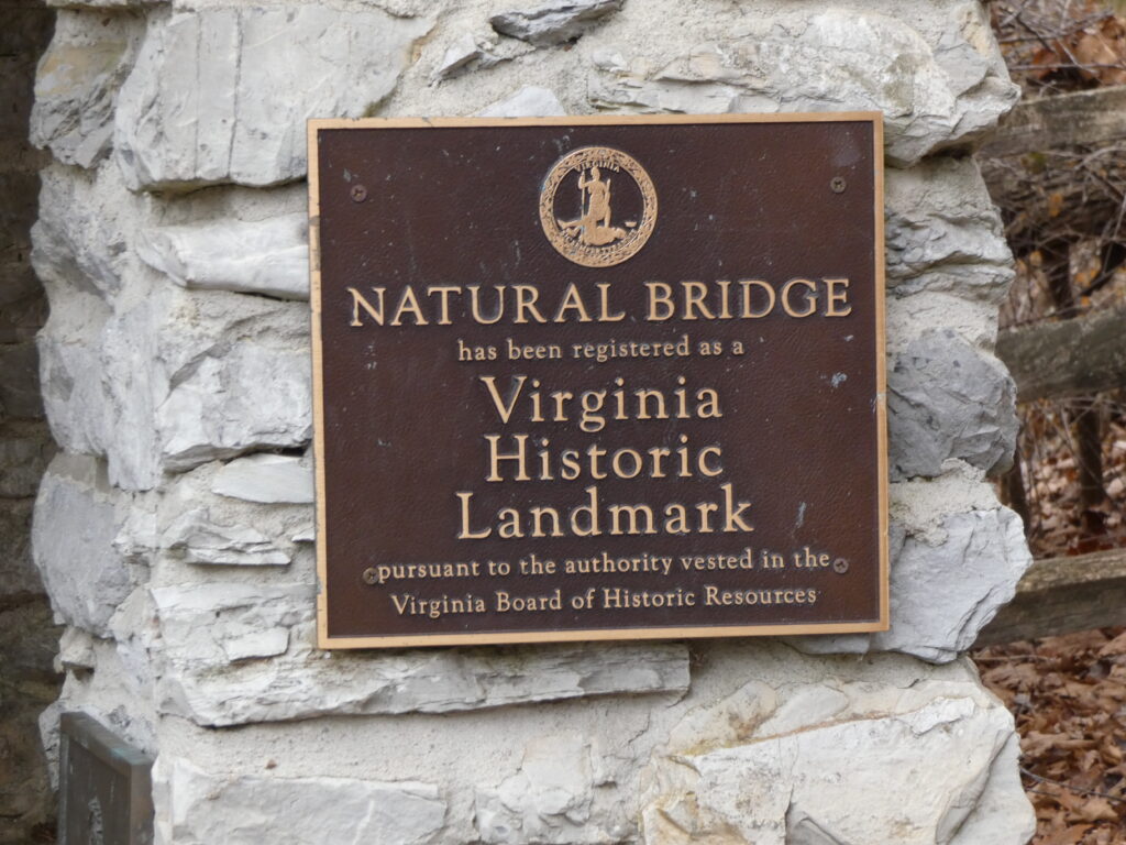
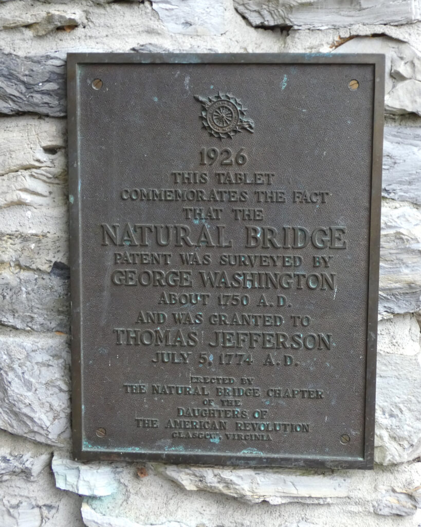
In addition to being a state park, this is a National Historic Landmark, as it was surveyed by George Washington in about 1750 and granted to Thomas Jefferson in 1774.
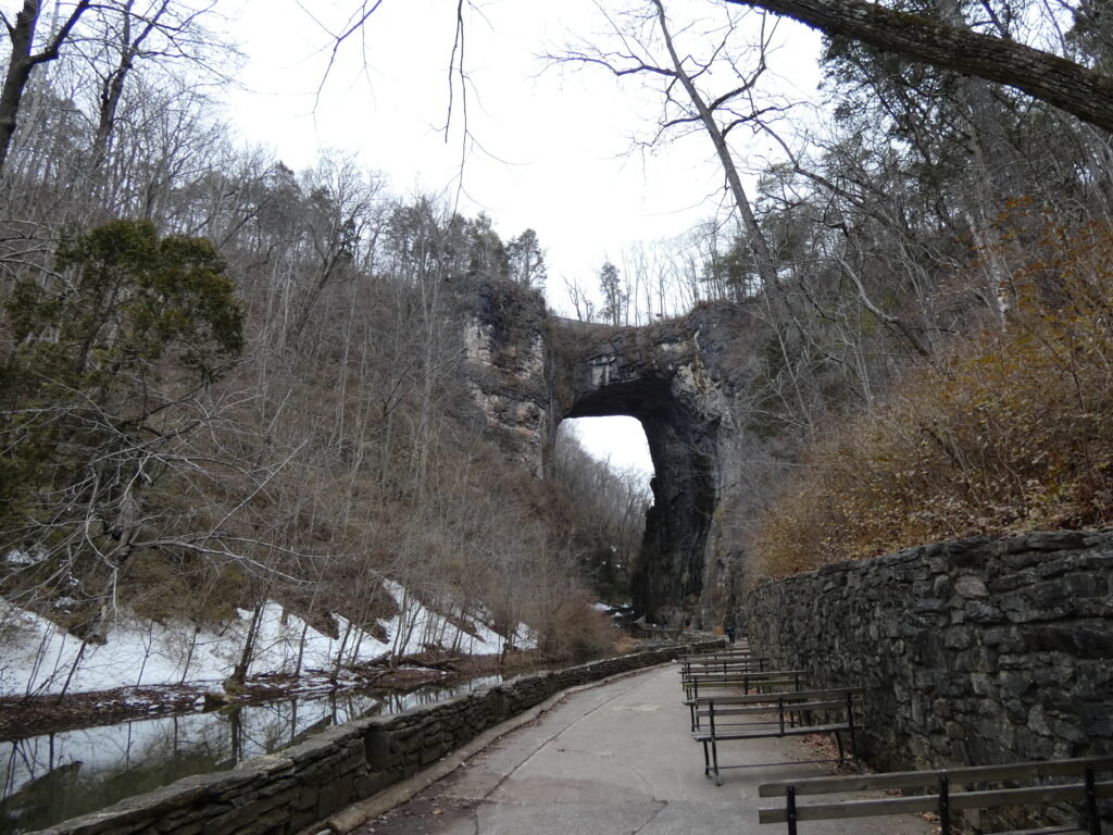
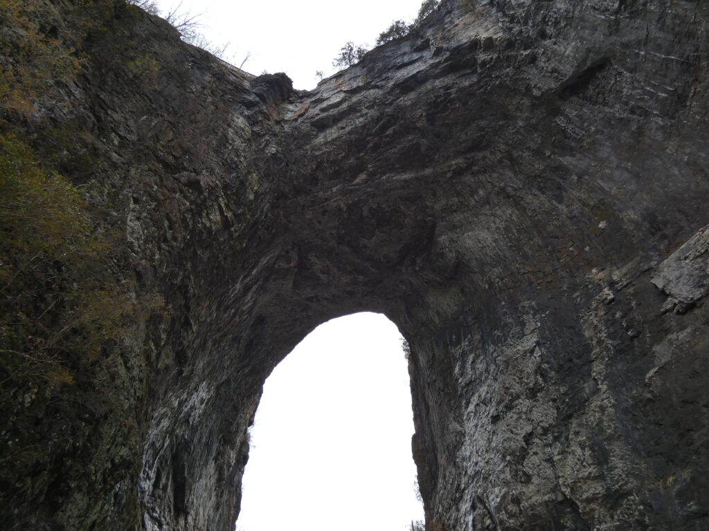
Getting to the bridge involves walking down stairs. LOTS of stairs (137). Fortunately there are interesting things to read along the way….
It’s hard to grasp just how tall the Bridge is, especially from this perspective.
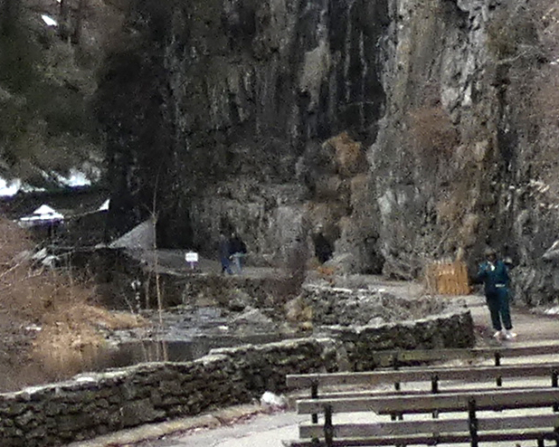
This is the same picture as above, just zoomed in and cropped to show the size of the people in relation to the height of the bridge. So yes, Natural Bridge is massive, rising 215 feet above Cedar Creek, which flows through its opening.
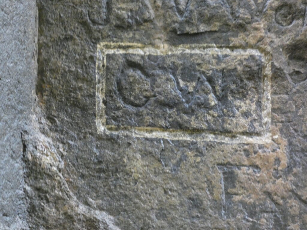
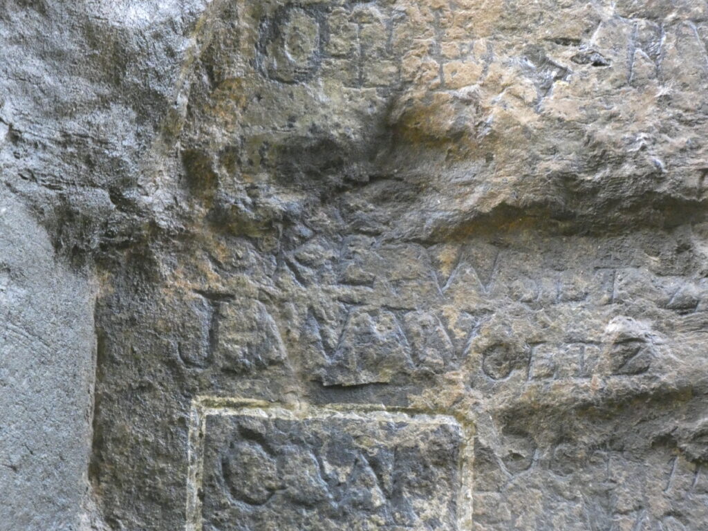
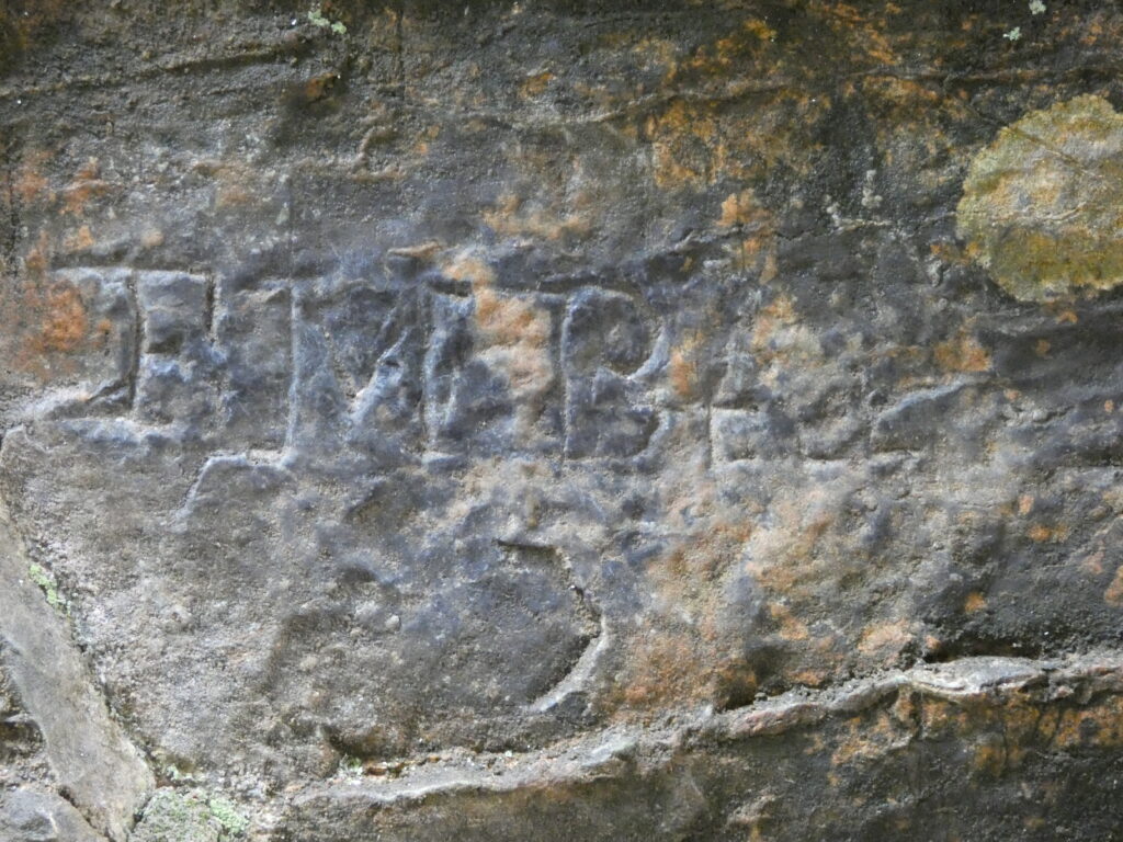
Legend says that George Washington carved his initials on the side of the Bridge, but there is no firm proof that the “G.W.” about 25 feet up was carved by him. There are several other names and initials carved into the limestone Bridge on either side of the creek.
Funny to think that Rt. 11–a busy N/S highway in the Shenandoah Valley–goes right over the top of Natural Bridge!
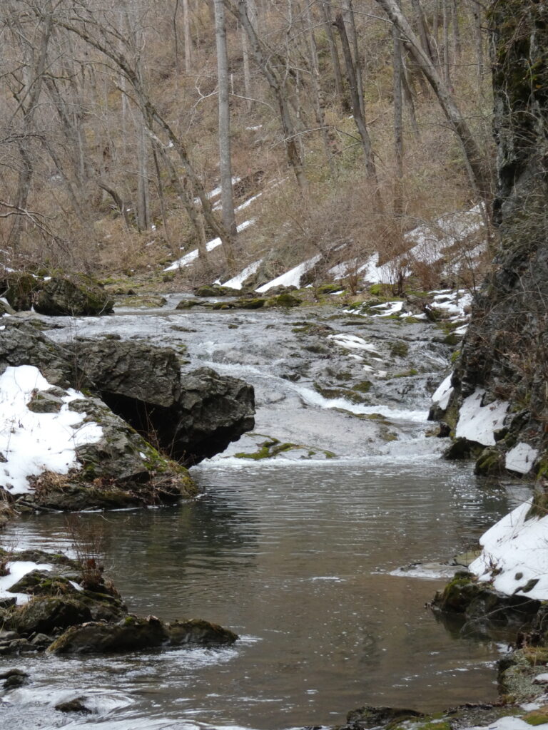
It was overcast and chilly when we were there, and Cedar Creek still had quite a bit of snow along its banks!
Almost 2 miles up the trail from the Bridge is Lace Falls, but knowing I’d ultimately have to hoof it back to the Bridge and then walk up 137 stairs to get to the car made the thought of going to the falls a hard pass!
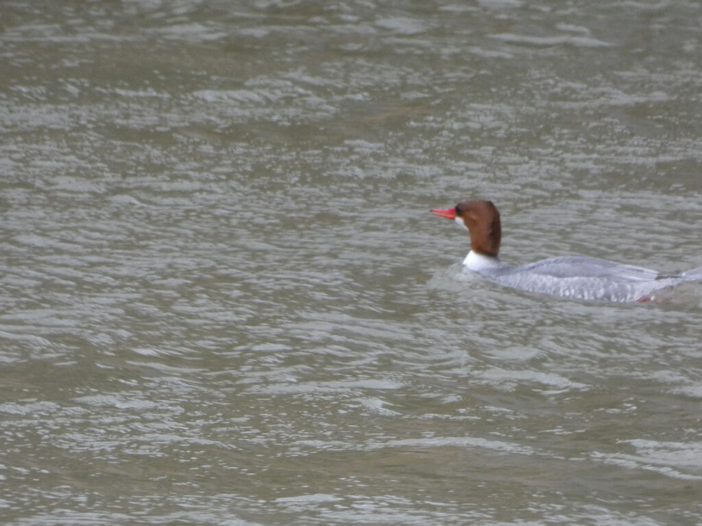
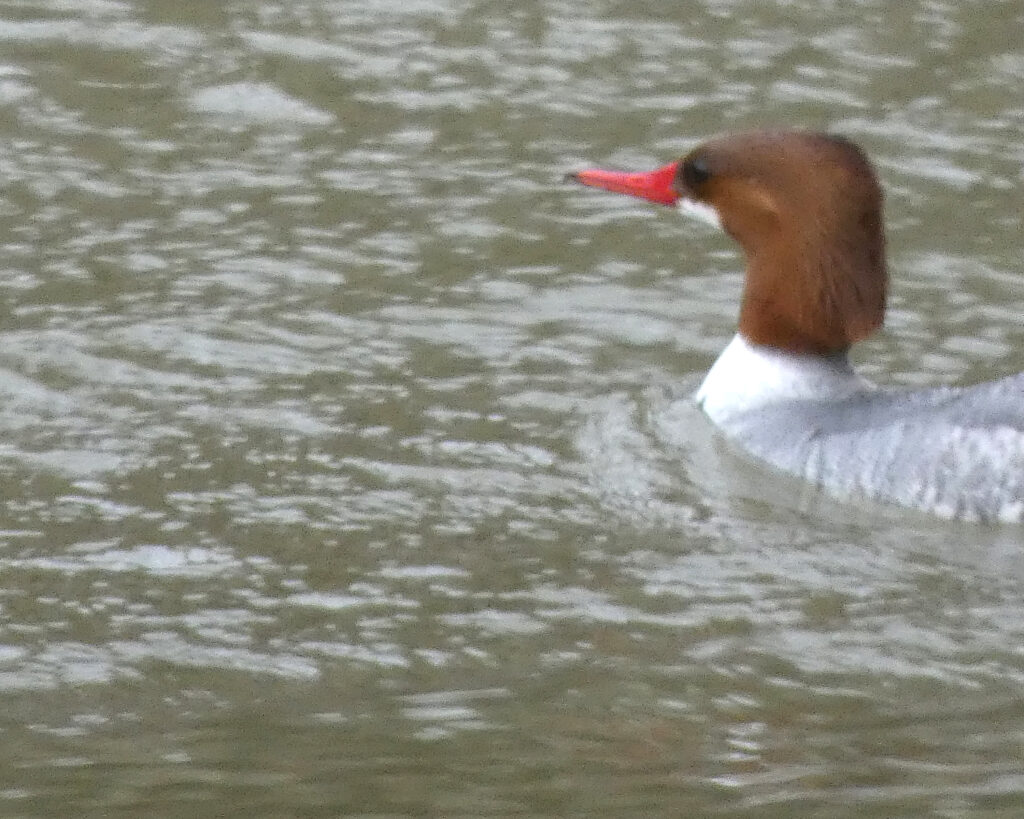
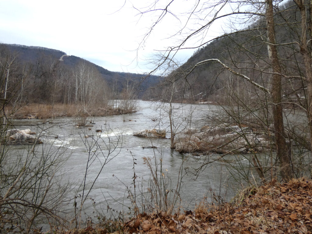
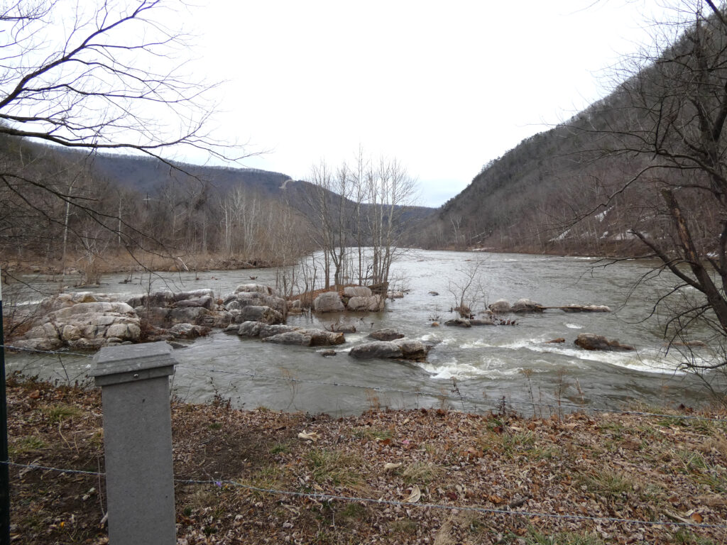
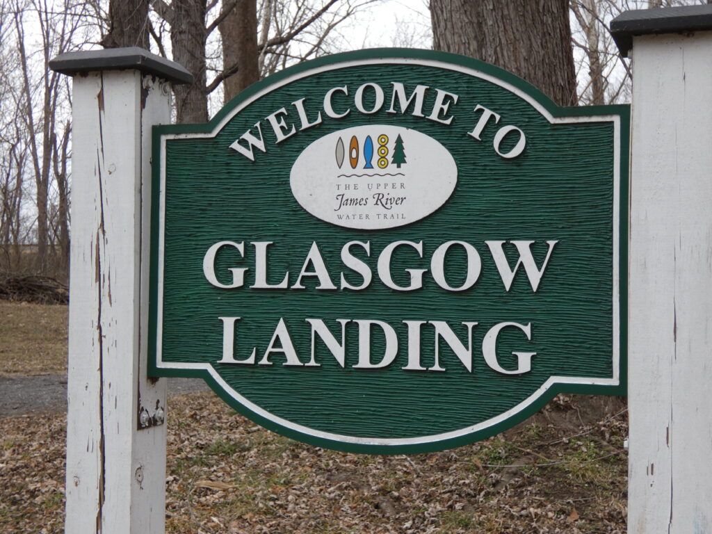
After lunch at Blue Ridge Deli in Natural Bridge Station, our next stop was in Glasgow, VA. A large duck, likely a female Common Merganser, was surfing the waves of the Maury as it flowed into the James River at the confluence.
I’ve always been drawn to confluences–where one river joins another river–and this has always been one of my favorite ones. Usually the fast-moving Maury has a greenish color and enters the slower-moving and brownish James River, but on this afternoon, both rivers were moving quickly and looked almost the same, likely from the ongoing snow melt.
The Maury River (in the foreground) entering the larger James River
The wind started blowing really hard as we walked out to the confluence, and you can hear it in this short video:
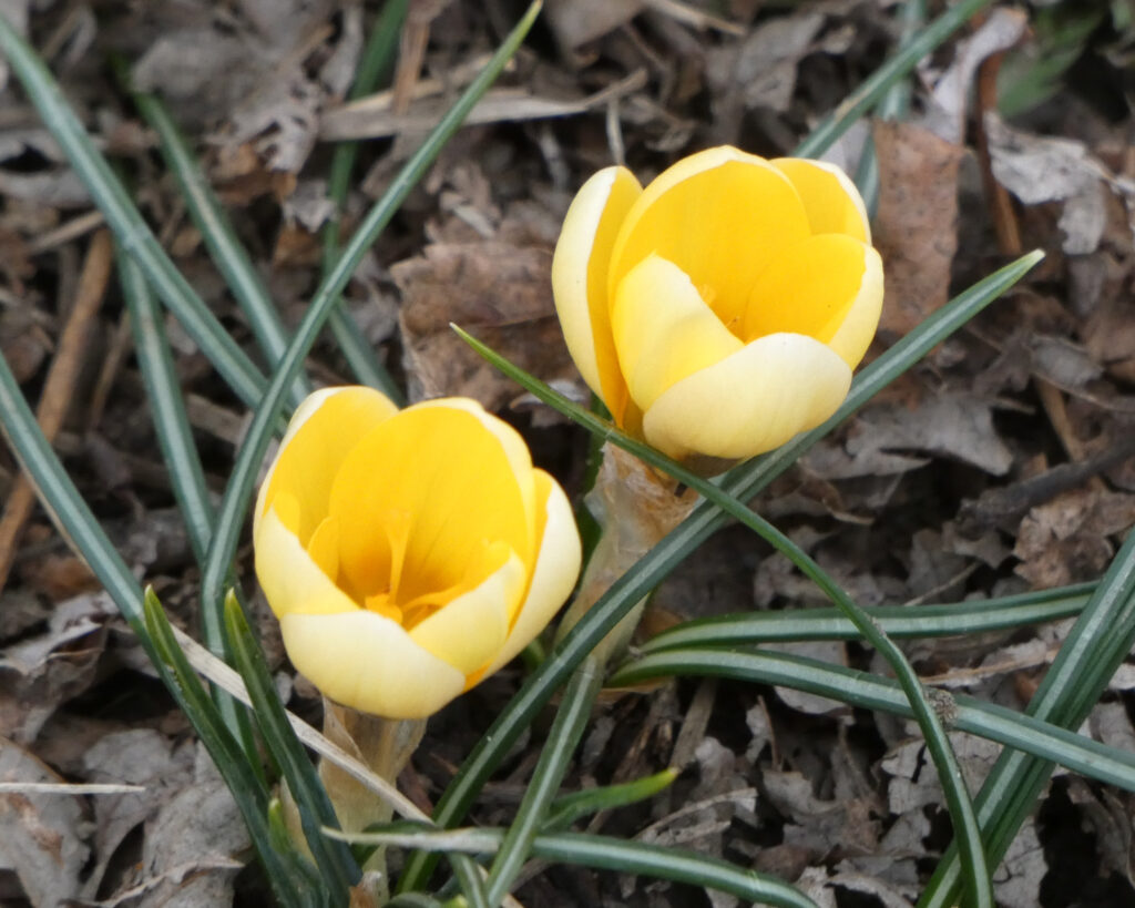
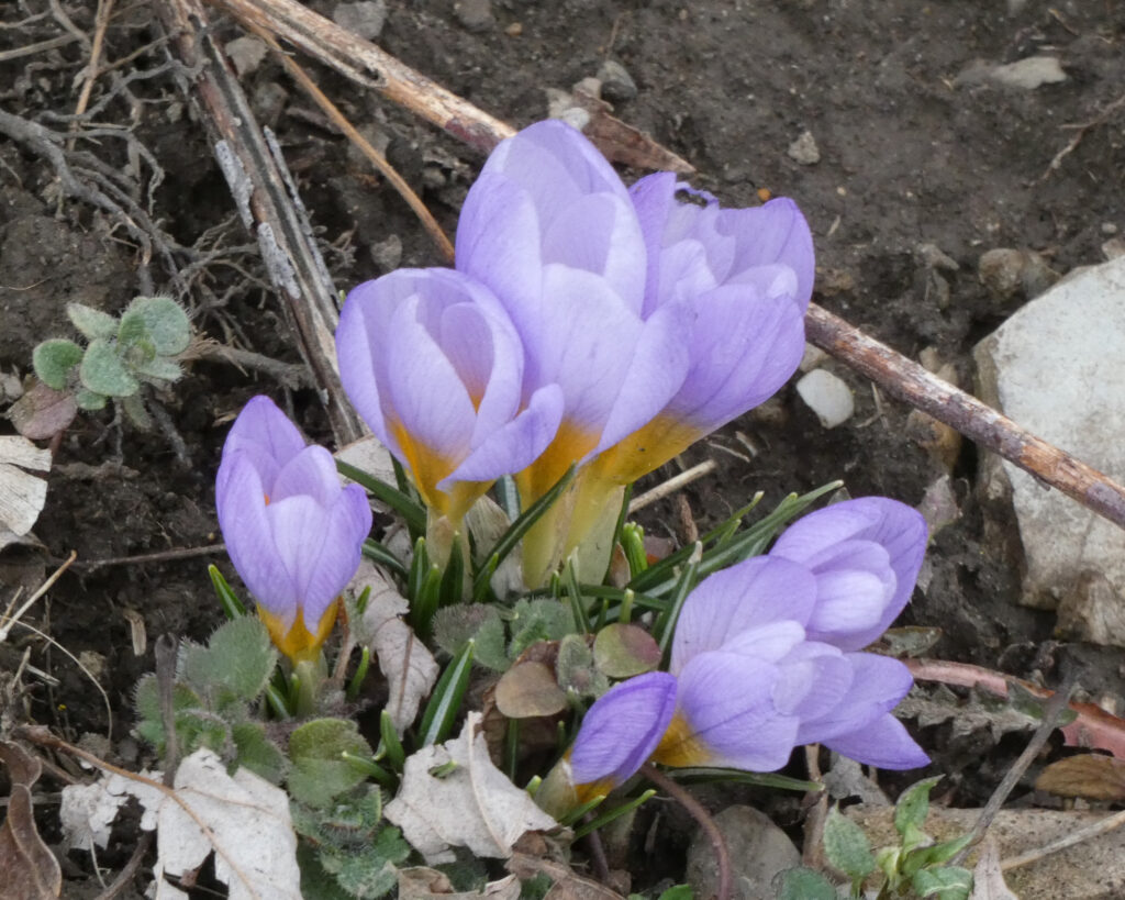
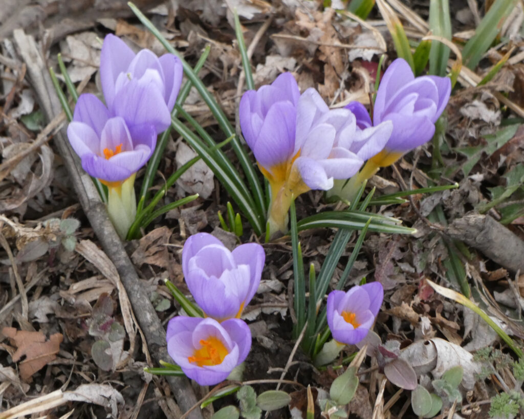
I guess it IS time for crocuses to start coming up, but I was surprised to see these delicate little beauties near the rivers!
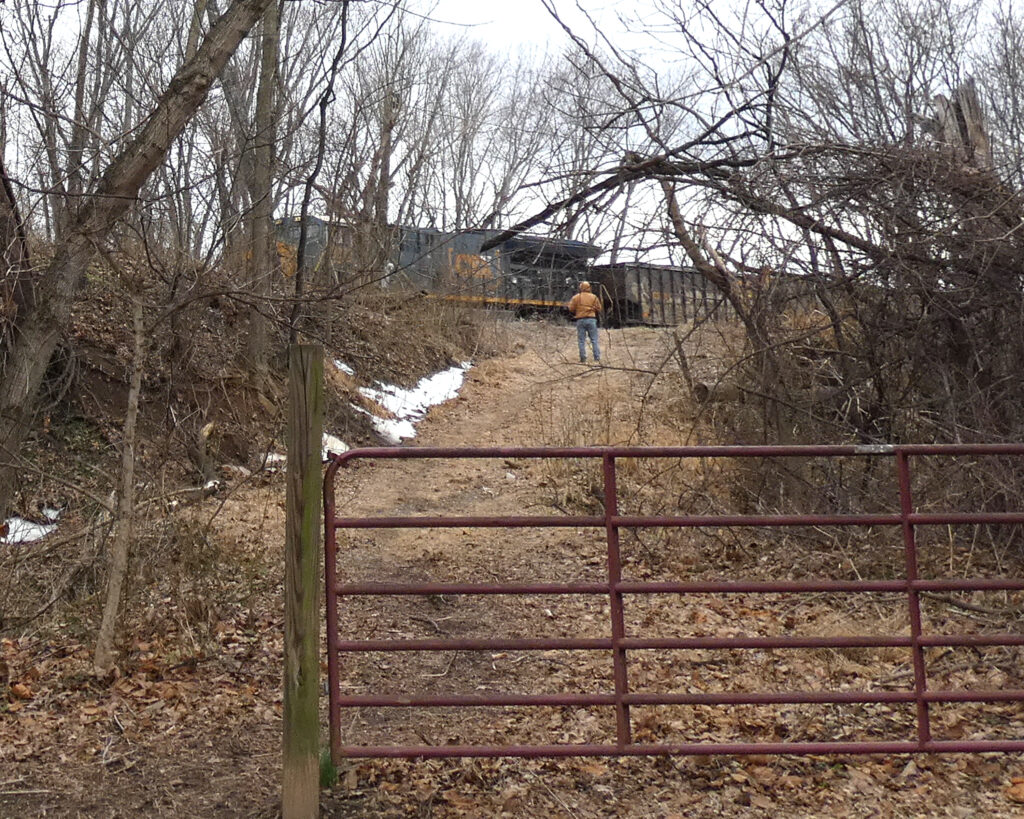
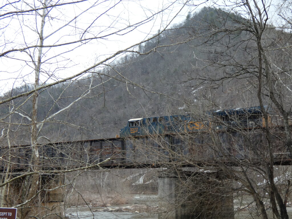
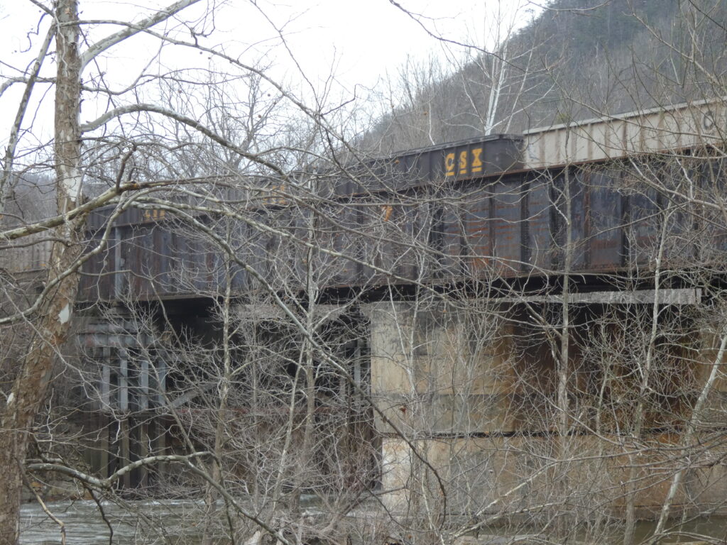
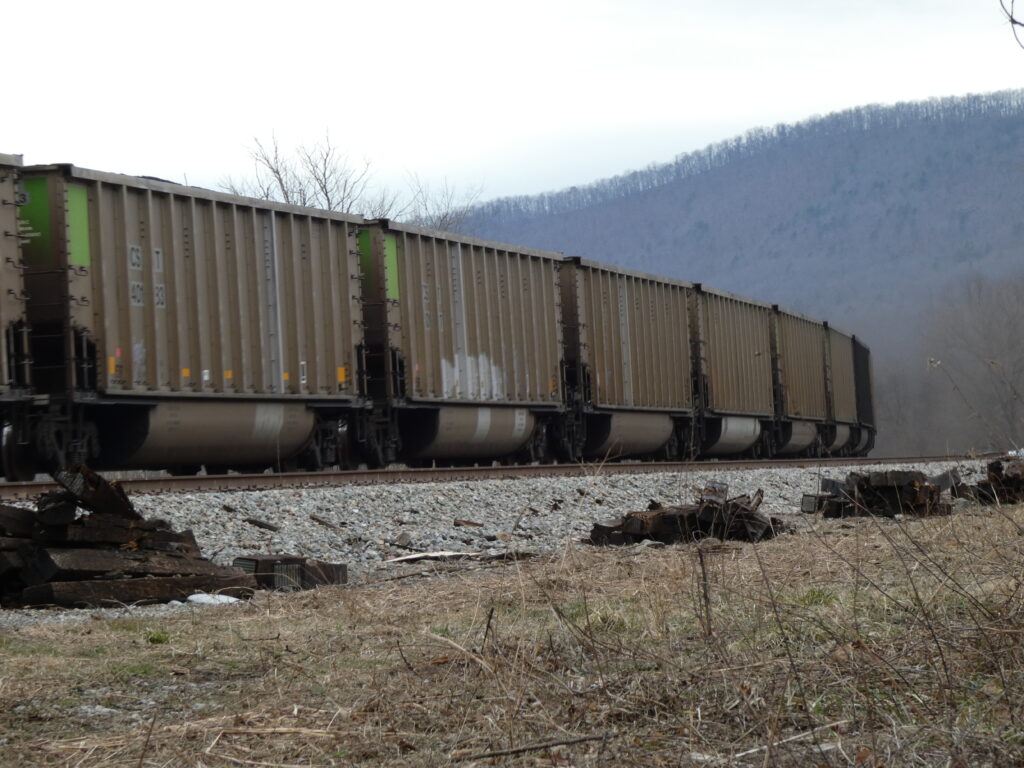
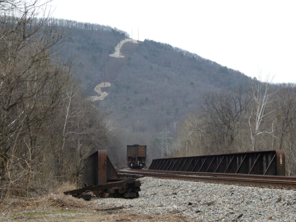
As we were walking back to the car, we heard a distant train whistle and decided to wait to see the train. It was hauling so many coal cars, likely coming from the mines in West Virginia and heading to deep-water terminals in Hampton Roads and Norfolk on the eastern edge of the state.
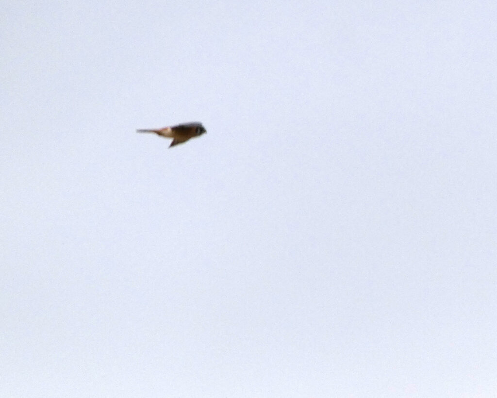
As we started driving away from the confluence, I spotted a bird hovering over the fields. While it was too far away to get a good picture, I’m almost positive that this was an American Kestrel, as I was able to get better photographs of one doing the same thing in October 2016! Kestrels, the smallest falcons in North America, are known for their “windhovering” ability which allows them to remain almost stationary while searching the ground below for prey.
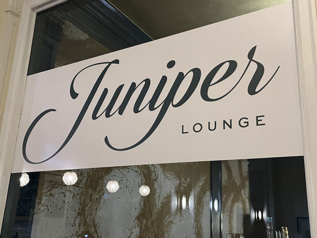
That evening back at the hotel, we ate dinner in the Juniper Lounge, and the food was absolutely amazing….
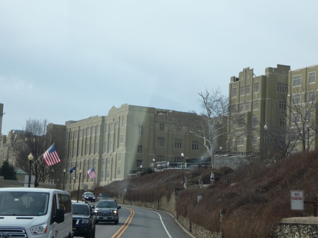
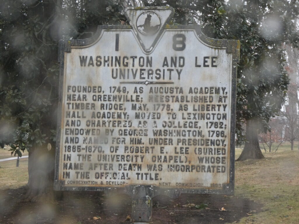
It was raining the next morning as we left Lexington, but we took a few minutes to drive through the VMI and Washington and Lee University campuses. I was surprised by how close W&L is to VMI–they’re literally nextdoor neighbors!
We’d talked about touring the W&L campus to see the museum and the art and ceramic galleries, but between the rain and a sign that the museum was temporarily closed, we decided to start the drive towards home.
Originally founded almost 100 years before VMI
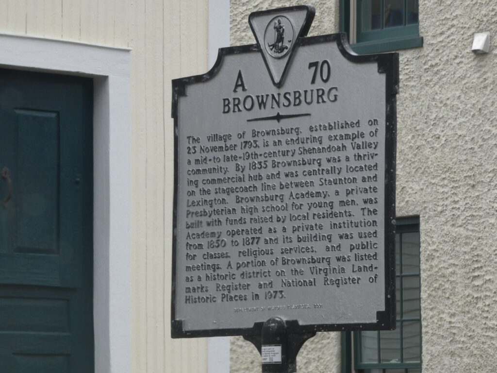
Preferring roads less traveled to interstates, we made most of the drive northeast on rural Rt. 252 which took us through the village of Brownsburg, VA. While it may be too small to read the sign in the photograph, it says that the community was established in 1793, and by 1835 it was a “thriving commercial hub” that was centrally located between Staunton, VA and Lexington on the stagecoach line. There is so much history in the Shenandoah Valley!
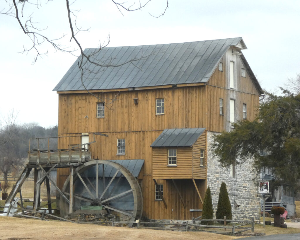
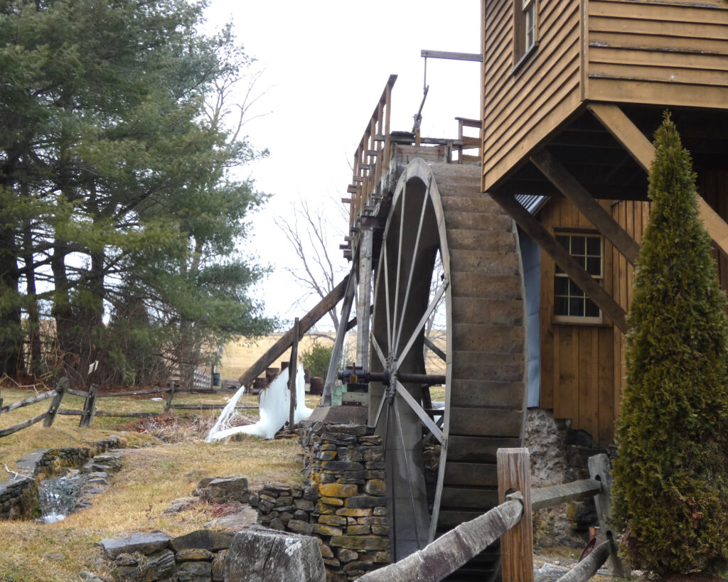
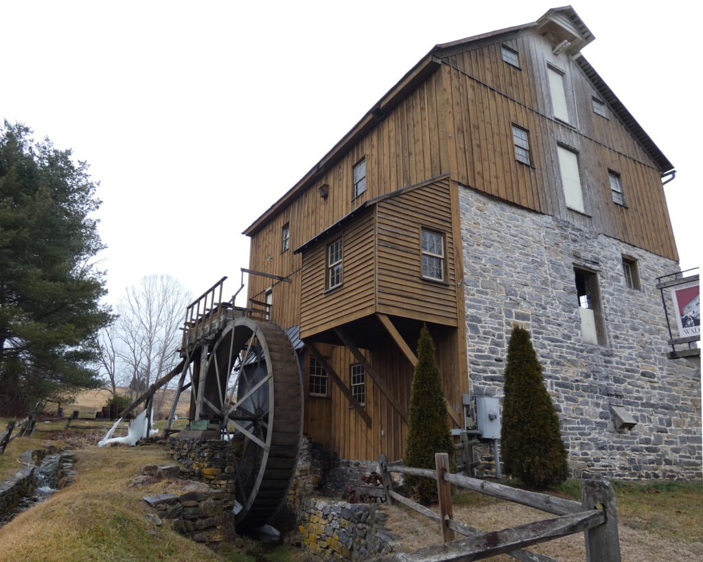
Our final stop was at historic Wade’s Mill near Raphine, VA. According to the website, this mill was founded in 1750, and it is the “oldest continuously operating commercial grist mill” in Virginia. A sign was posted saying it would be closed from December through April, but I’d love to visit in the spring to see it in operation!
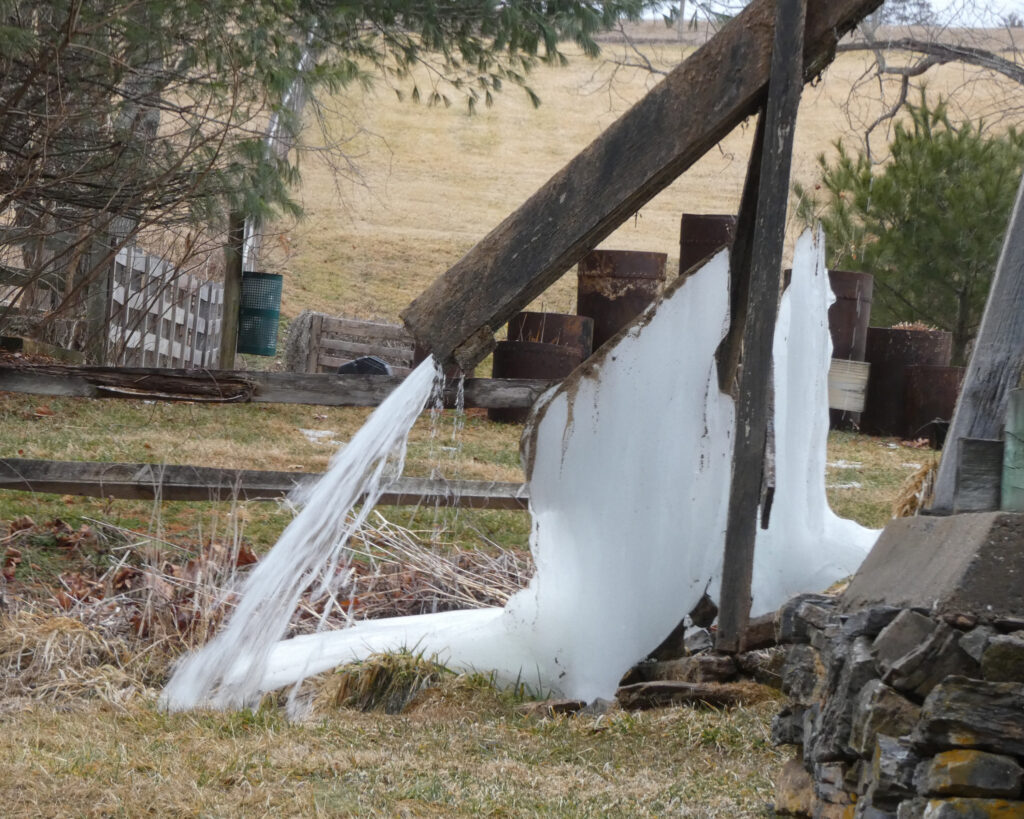
I believe I’ve mentioned it’s been cold in Virginia?! Look at that ice!
There is so much to see and so much to do in Virginia, and I’m always, always thankful for opportunities to get out and explore!
“The most beautiful things in life are not things. They are people, places, memories, and pictures. They are feelings and moments, smiles and laughter.” ~ mysuitcasejourneys.com
In January 2026 I had the opportunity to go to Middlesex County, Virginia to do genealogy research. I’d originally planned to go during the summer, but as my cats were separated then due to redirected aggression (as I wrote about here), that wasn’t possible. As it turned out, though, this was the perfect time for the trip!
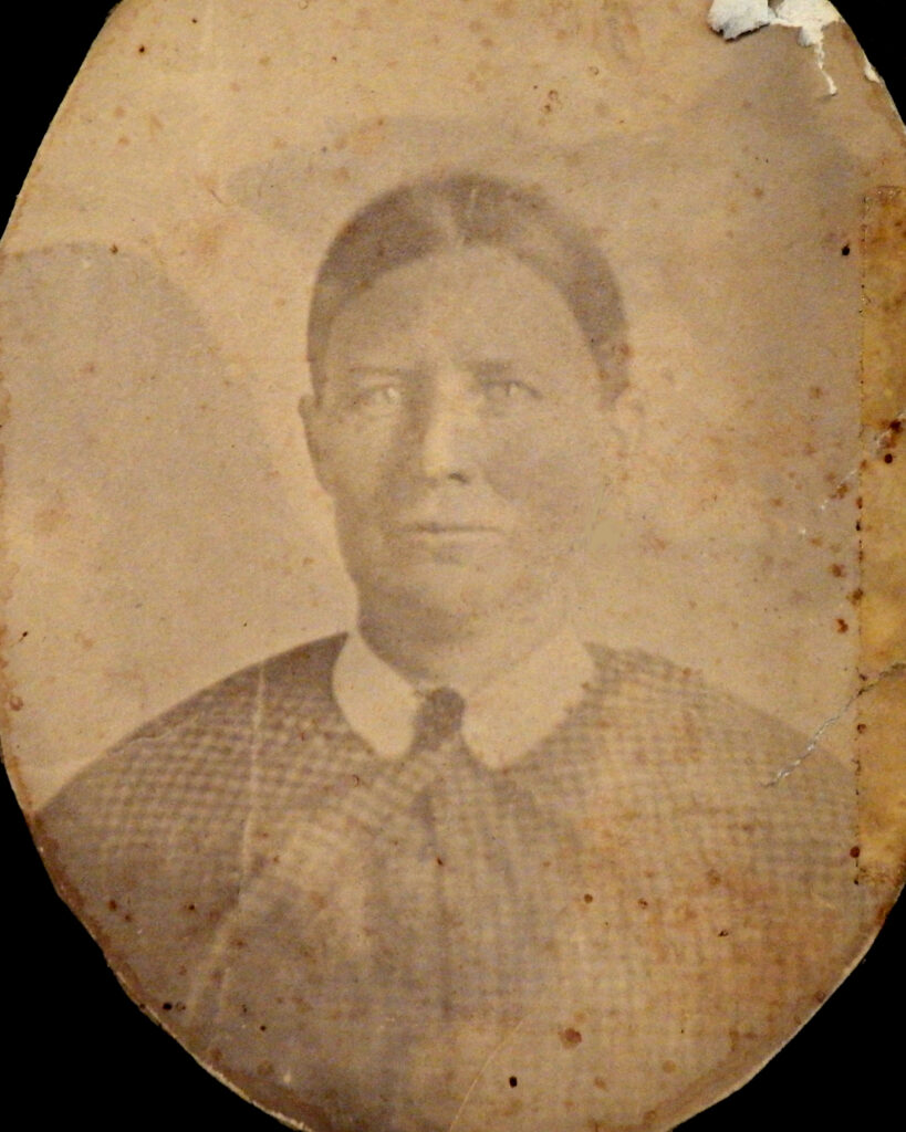
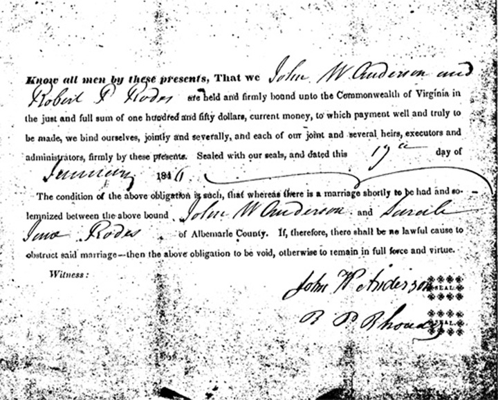
As to the backstory, one of my maternal great-great grandmothers was Sarah Jane (Sally) Rhodes.
Born in 1826 in Albemarle County, Virginia, she married my great-great grandfather, John William Anderson, in January 1846. From their marriage license and census records I knew that Sarah’s father was Robert P. Rhodes, but for 30+ years I was not able to confirm the identity of his parents.
In January 2020 (as documented here) everything opened up on this family after finding valuable information in chancery suits. From there–through wills, deeds, and the incredible resource of church records–I was able to move the Rhodes history all the way back to the mid-1600s!
My earliest known Rhodes ancestor was Hezekiah (Ezechias) Rhodes. He was born about 1662 on the island of Guernsey in the English Channel. When he came to this country, he settled in Middlesex County, Virginia. His place of birth was confirmed in a Middlesex County Court court record from 1689 (source: Wikitree):
“Middlesex County Court 1st of April 1689. Ezekiah Roades humbly petitions this Court to prove himselfe a free borne Subject & produceing the evidence of Zachery Mullens for ye same, he is accordingly sworne & his deposition ordered to be recorded. The Deposition of Zachery Mullens examined & sworne saith that Ezekiah Roades was borne in ye Iseland Gernsey within ye Kings Dominion & further yor: Depont. saith that he ye sd. Ezekiah Roades & yor: Depont. we ware play boyes together & I knew him there severall yeares & further saith not. Zachery Mullelns, his marke. Sworne this first day of Aprill in Court. Test J. Vause 89 Cl Cur“
While I don’t know the exact year that Hezekiah/Ezechias arrived in Middlesex County, he married Elizabeth Ann Nichols in Christ Church Parish in 1684.
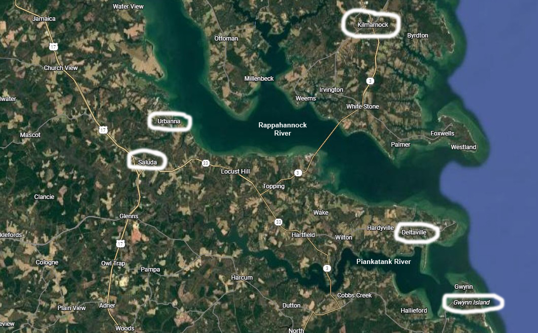
I wasn’t sure what I could find, in person, that hadn’t already been shared online, but I was ready for a fact-finding adventure and the opportunity to better explore this part of Virginia. So after an almost 3-hour drive, we arrived at the courthouse in Saluda, Virginia, (the county seat of Middlesex County), and the hunt was on!
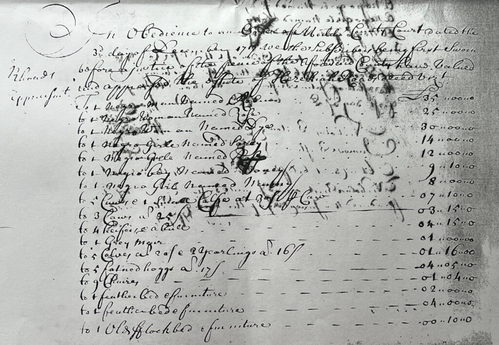
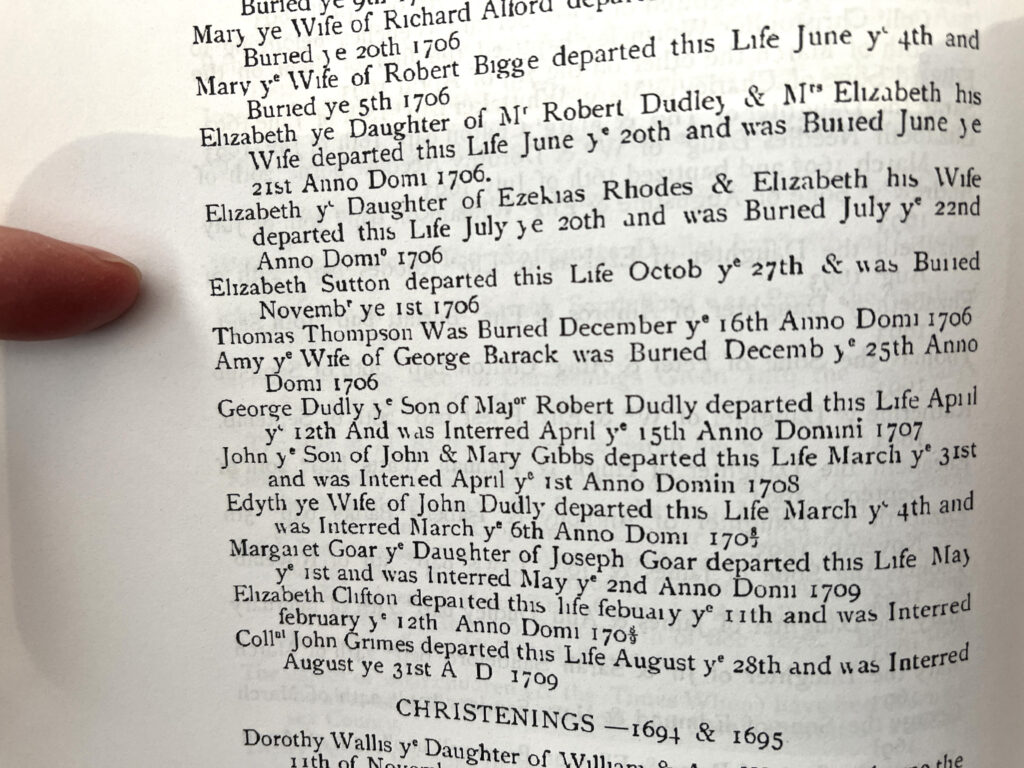
Church records showed that Hezekiah (Ezechias) Rhodes died in 1717, and I hoped to find a will at the courthouse. Instead, we found an inventory and appraisement of his estate, with his oldest son, John, as the administrator. This was in Will Book B, page 86, though the actual page number was somewhat deceiving (and frustrating) given the way the book was assembled.
While some courthouses allow documents in will and deed books to be photographed, Middlesex County requires that researchers make hard copies of their pages of interest, for a nominal fee. The pages in the books are copies of the original documents–which is understandable, given their age. Unfortunately, however, they are very difficult to read, largely due to “bleed through,” as both sides of the originals were written on. The Rhodes appraisement spans three pages, and ultimately I’ll carefully photograph each page and try to make them clear enough in Photoshop to decipher and transcribe.
It was late afternoon by the time we left the courthouse. We crossed the beautiful Rappahannock River into Lancaster County on our way to Kilmarnock where we’d be staying. The Rappahannock travels a distance of approximately 195 miles from its origin in the Blue Ridge Mountains to the Chesapeake Bay, and it separates the Northern and Middle peninsulas in the Tidewater region of the state.
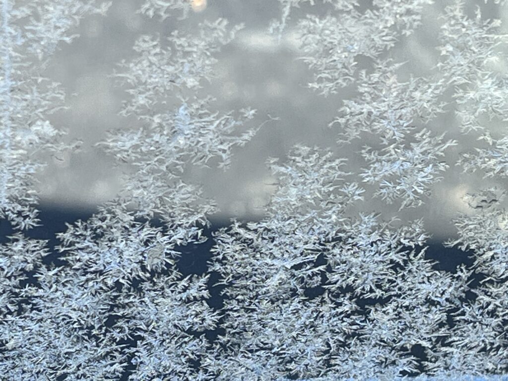
Frost had made a pretty pattern on the driver’s side window of my Jeep the next morning as we were heading out. It was a cold start to the day, but at least we had blue skies and bright sunshine!
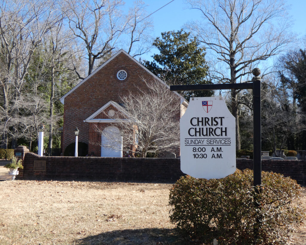
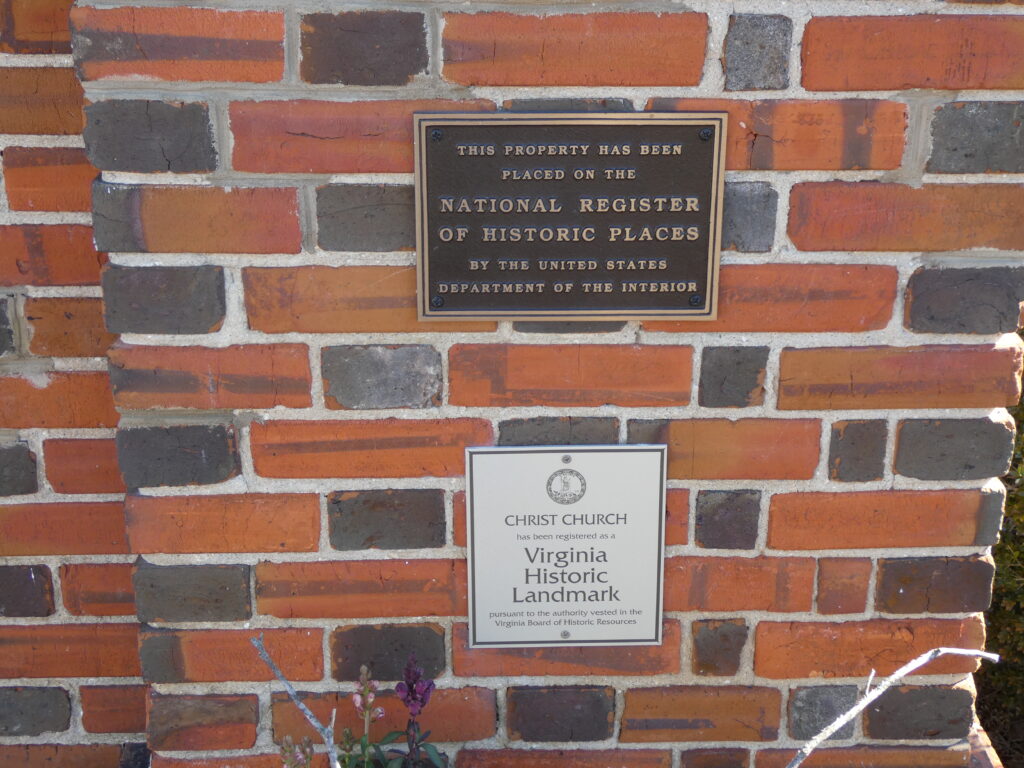
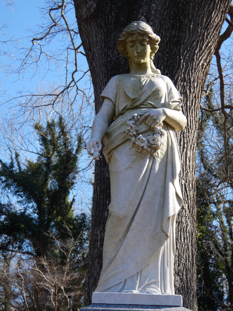
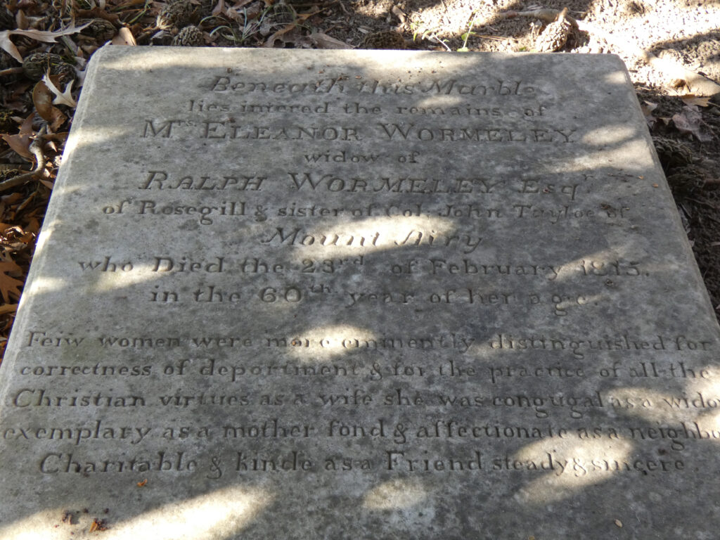
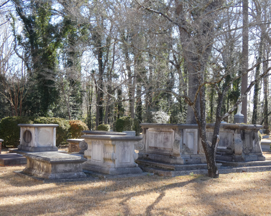
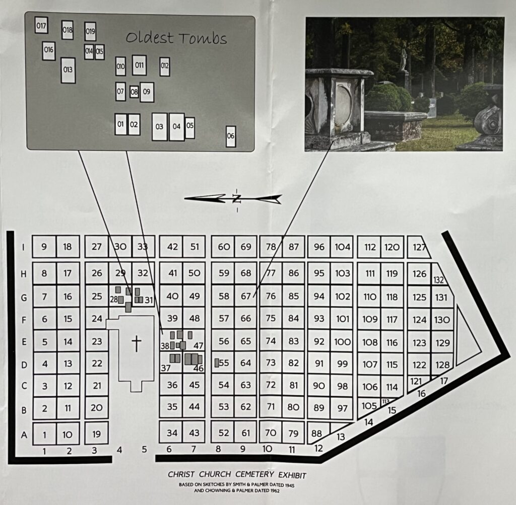
After driving south across the Rappahannock back into Middlesex County, our first stop was at Christ Church, just east of Saluda. Most of the records I’d found for this early Rhodes ancestor came from Christ Church Parish, so I was interested in seeing the church and cemetery.
I knew there was no marked grave for Hezekiah in the cemetery, but I still assumed he was buried there, based on information on Findagrave. I was confused, then, when we looked at a directory that listed everyone who was buried in the cemetery and there were no Rhodes mentioned at all!
As we were leaving the cemetery, we were greeted by a woman who was walking out of the Parish Hall building. In the course of our conversation, we learned that Christ Church Parishencompassed the whole of Middlesex County, not just the grounds of this particular church! That meant that that Hezekiah Rhodes had likely been buried in a family cemetery somewhere in Middlesex County, but not in this church cemetery!
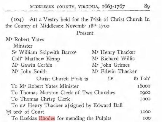
I also learned that there were three churches in Christ Church Parish, so the record I’d found in an online Vestry book regarding Hezekiah being paid for “mending the pulpits” didn’t necessarily mean he’d made the repairs at this particular church:
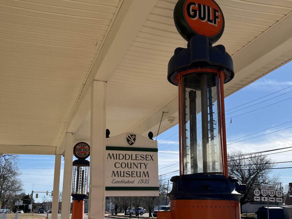
We left the church knowing less than we thought we knew (which is kind of how genealogy research works for me!) and our next stop was the Middlesex County Museum and Historical Society in Saluda.
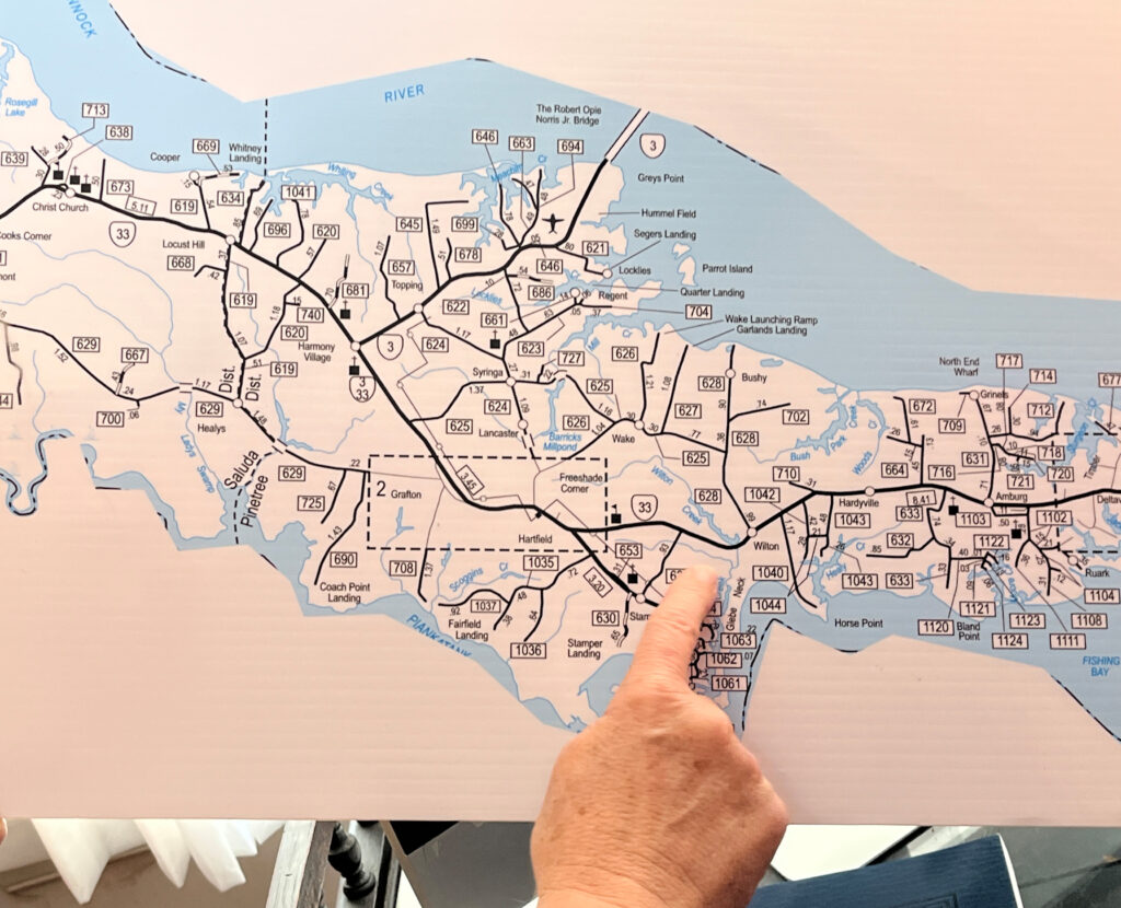
We were fortunate to be there on a day that Holly, the museum’s director, was working, and she was eager to help us make the most of our visit. Based on some deeds we’d looked at in the courthouse regarding the sale of Hezekiah’s land after his death, she helped us figure out possible areas where the Rhodes land might have been located. Nothing was conclusive, however, because “Barbecue Creek,” which was referenced in the deeds, was nowhere to be found on a map of the county…
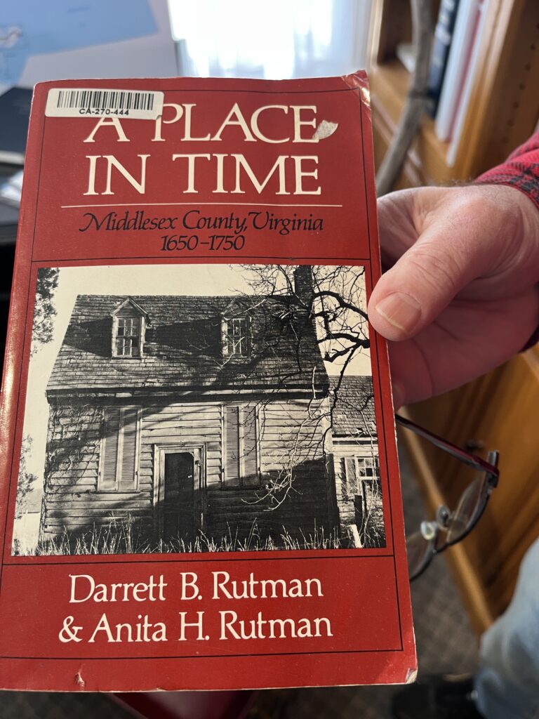
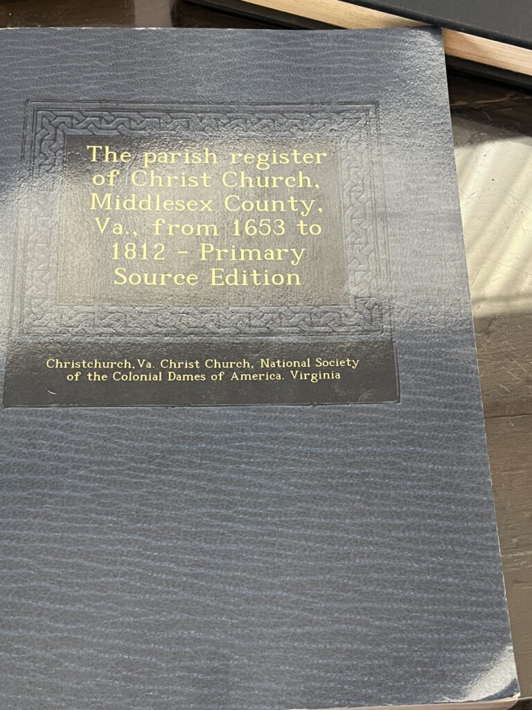
She suggested a couple of books that might be helpful with my research, and I ordered the parish register (the one shown on the right) before leaving the museum. This not only contains information about Hezekiah, but also lists the birth, baptism, marriage, and death dates of his wife and several of his children.
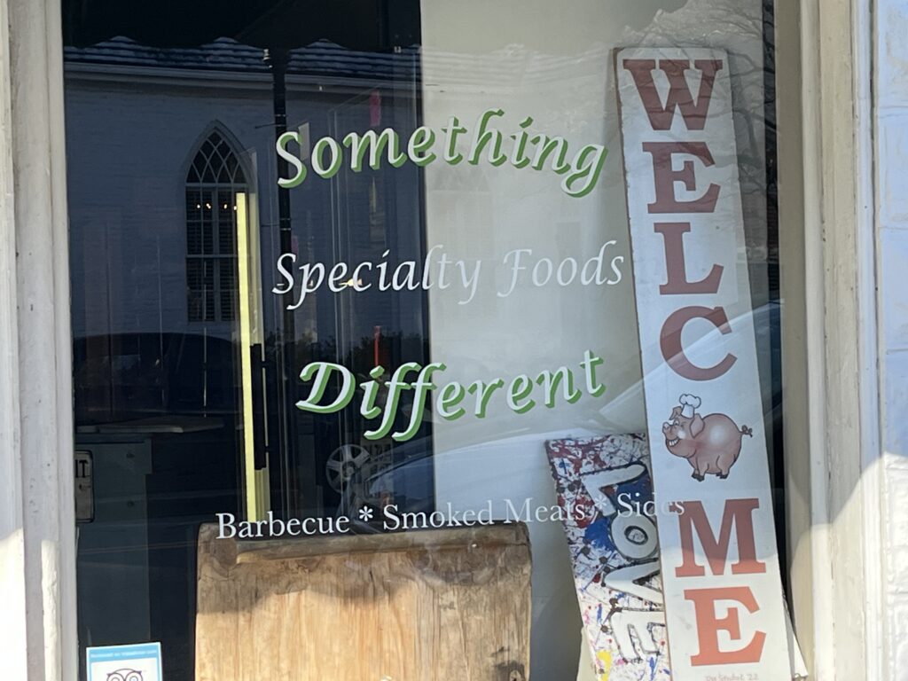
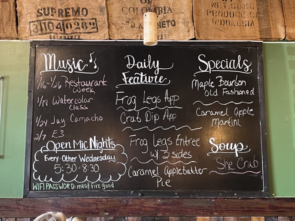
As a bit of a coincidence and “small world-ism,” we were surprised to learn that Holly had grown up in the town where I now live! (Seriously, what are the odds?) But as it was getting close to lunch time–and based on her recommendation–we drove to a restaurant called “Something Different” in the town of Urbanna. It did not disappoint; best She-Crab soup I’ve ever had!
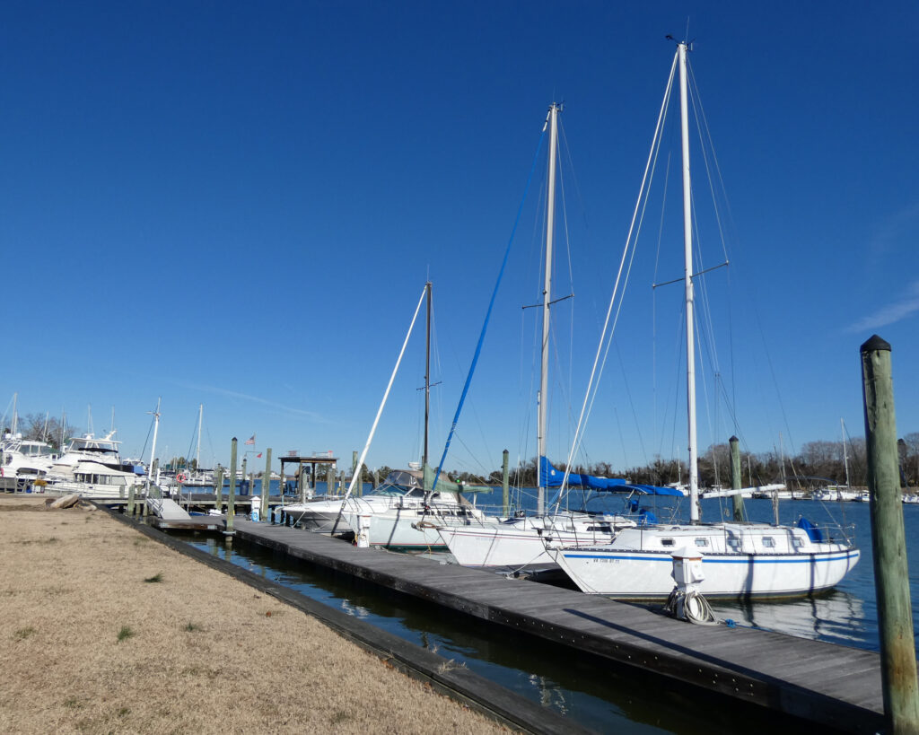
I’d never been to Urbanna before (famous for its Oyster Festival each November), and we stopped by one of the town’s marinas on our way to the restaurant:
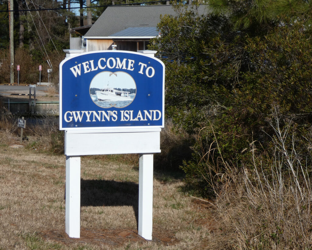
After lunch, with most of my genealogy research options exhausted, we shifted into tourist mode. Since it was only about 25-30 miles away, I wanted to visit the campground on Gwynn’s Island where Wayne and I had stayed in August 2020.
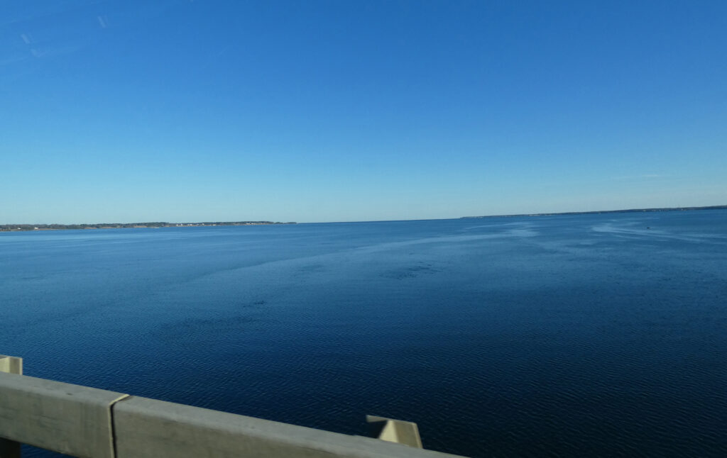
I probably should have checked before we made the drive, but the campground was closed for the season, and all access to it was blocked. Darn! We only got a small glimpse of the Chesapeake Bay–wow, look at that big, blue water!–but it was a pretty drive and a gorgeous day. No regrets!
After leaving Gwynn’s, we did some wandering. We found a peaceful little park on the Piankatank River….
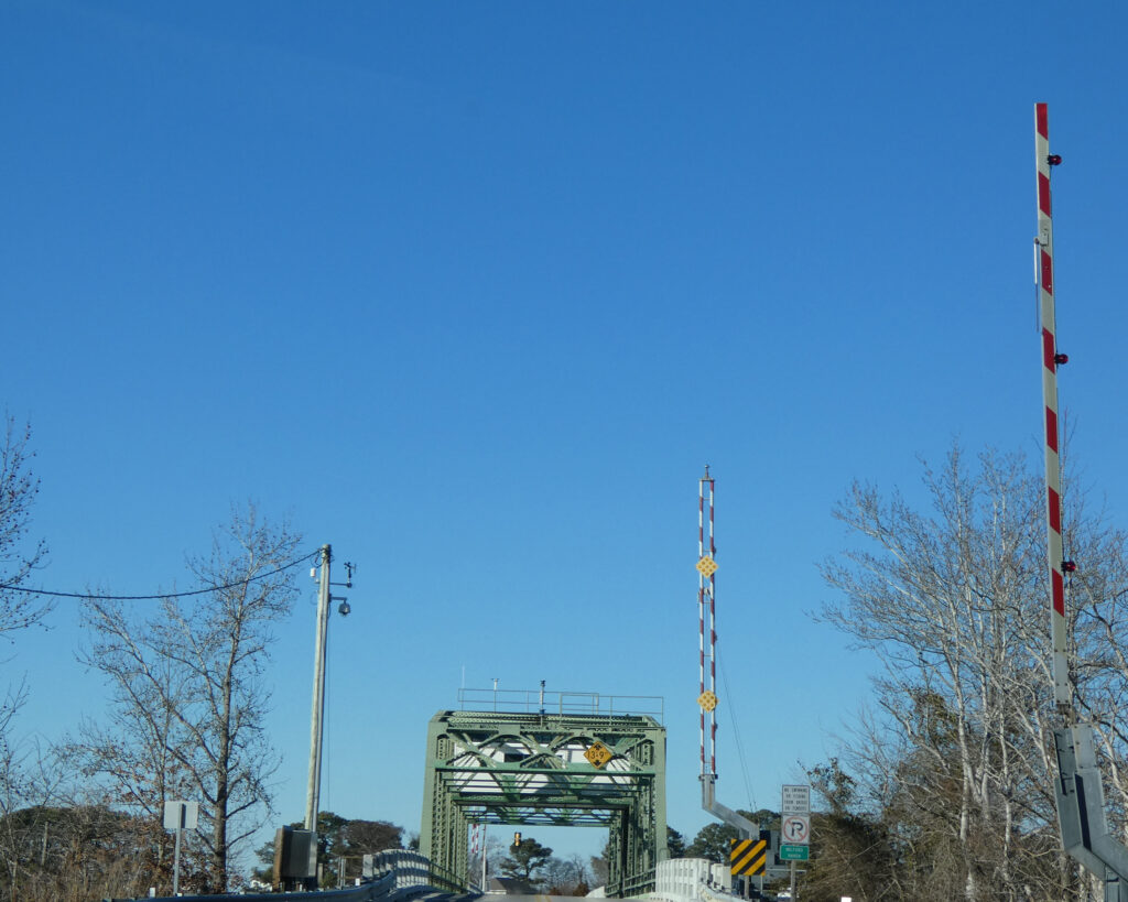
…. and after leaving Piankatank River Landing, we did a quick drive through Deltaville and out to Stingray Point before crossing the Rappahannock, yet again, on our return to Kilmarnock.
The name “Rappahannock” comes from an Algonquian (Native American) word meaning “river of quick, rising water” or “where the tide ebbs and flows.” Likes many rivers that empty into the Chesapeake Bay, the last 50 miles or so of the Rappahannock are tidal.
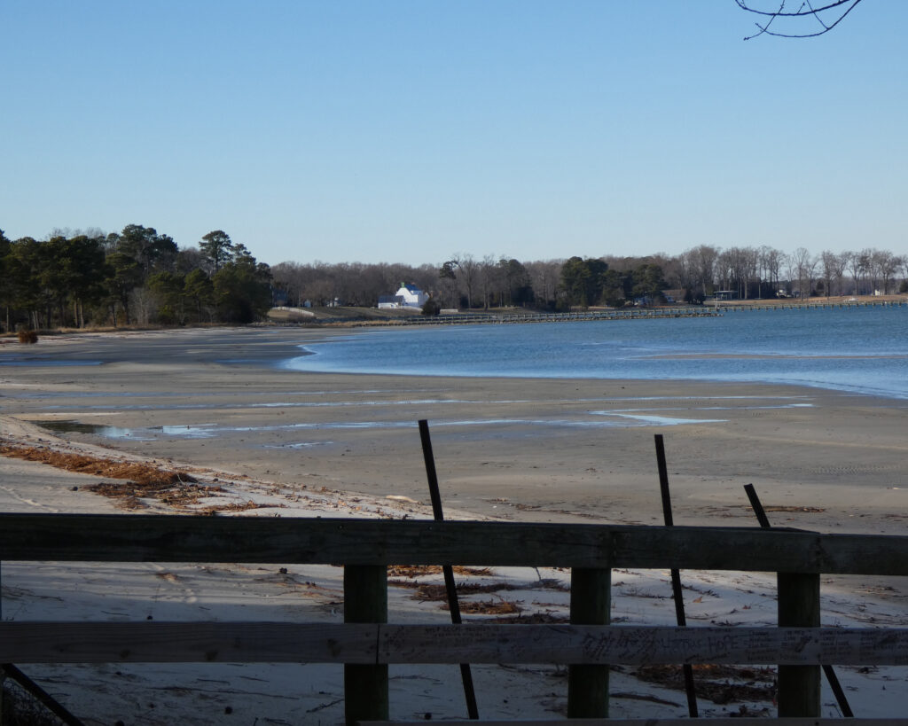
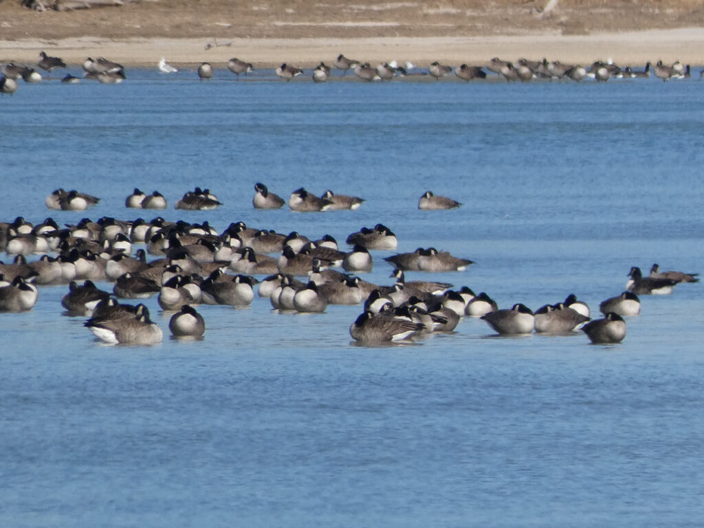
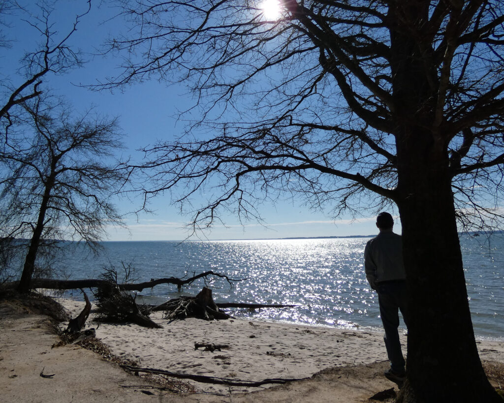
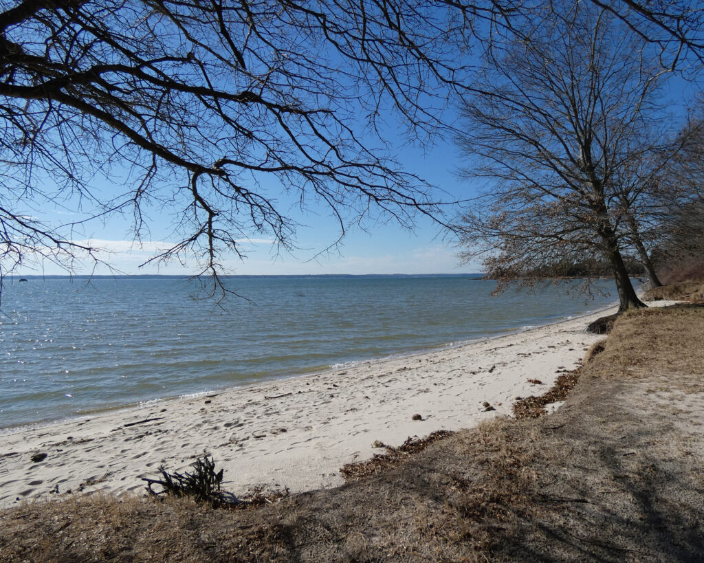
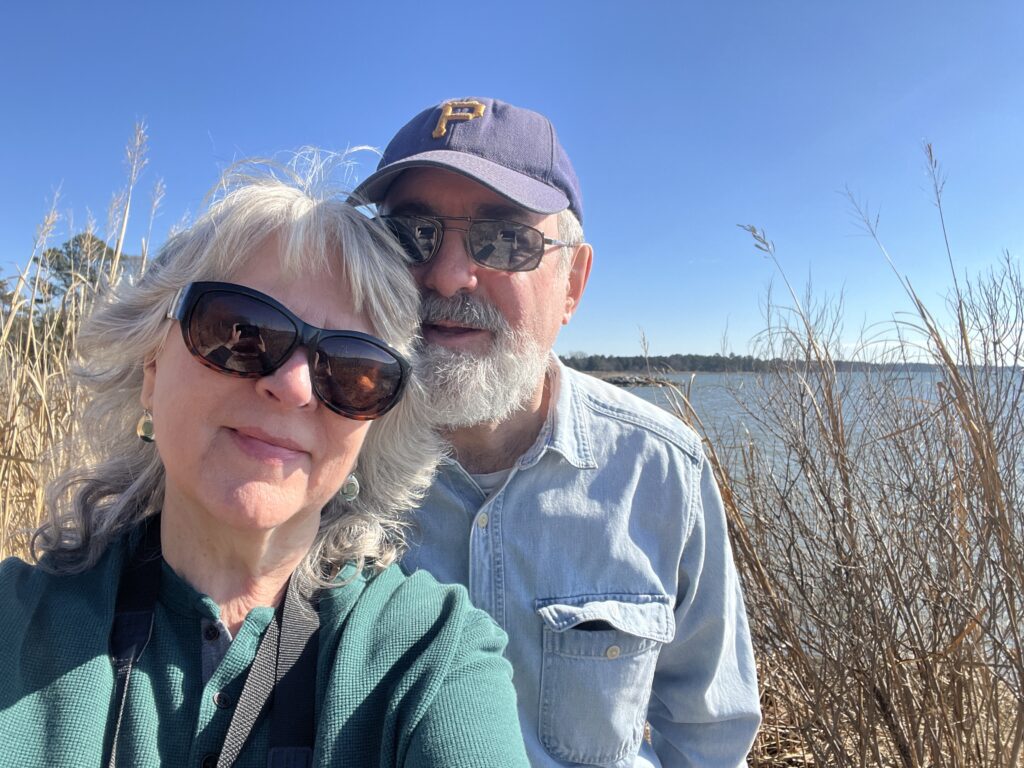
Before starting for home the next day, we drove just northeast of Kilmarnock to Hughlett Point Natural Area Preserve on the Chesapeake Bay. In the interest of time we just went straight to the beach, but trails there lead to a couple of observation decks in marshlands. Maybe on a future trip?
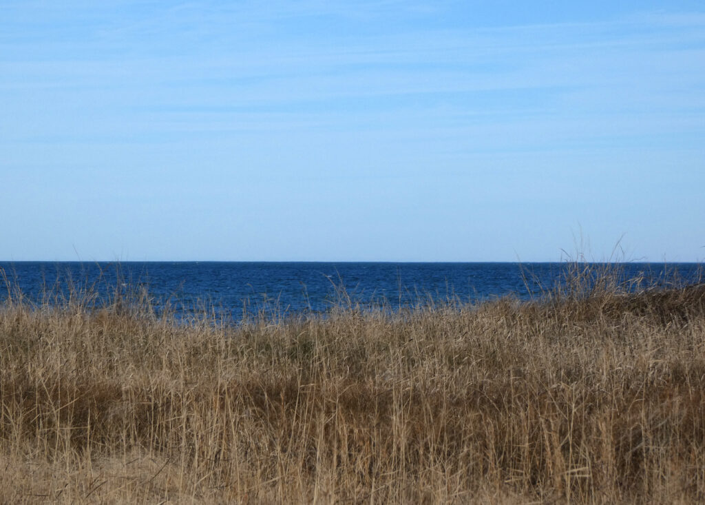
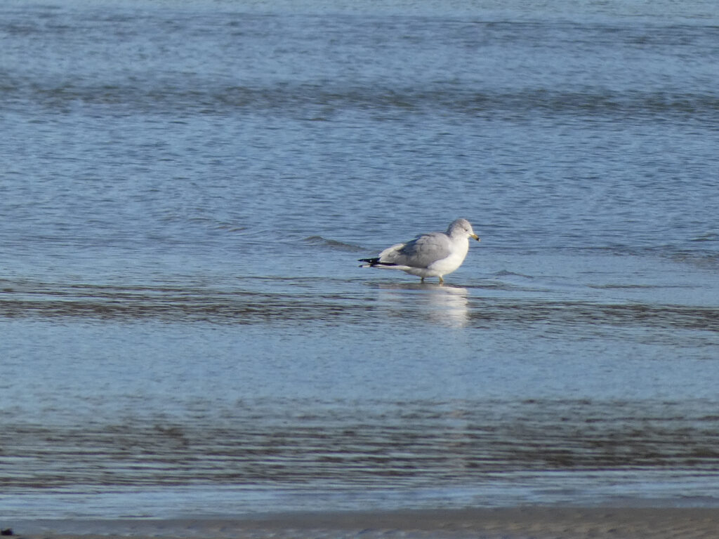
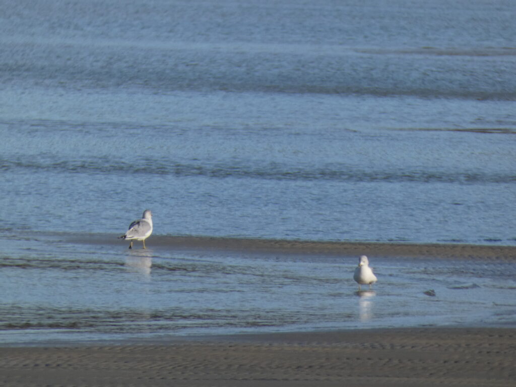
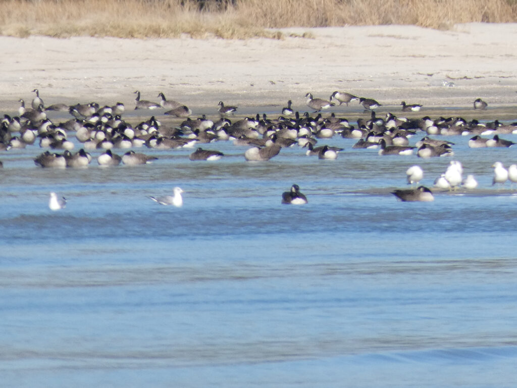
Hundreds of Canada Geese and seagulls were in the water to our left…
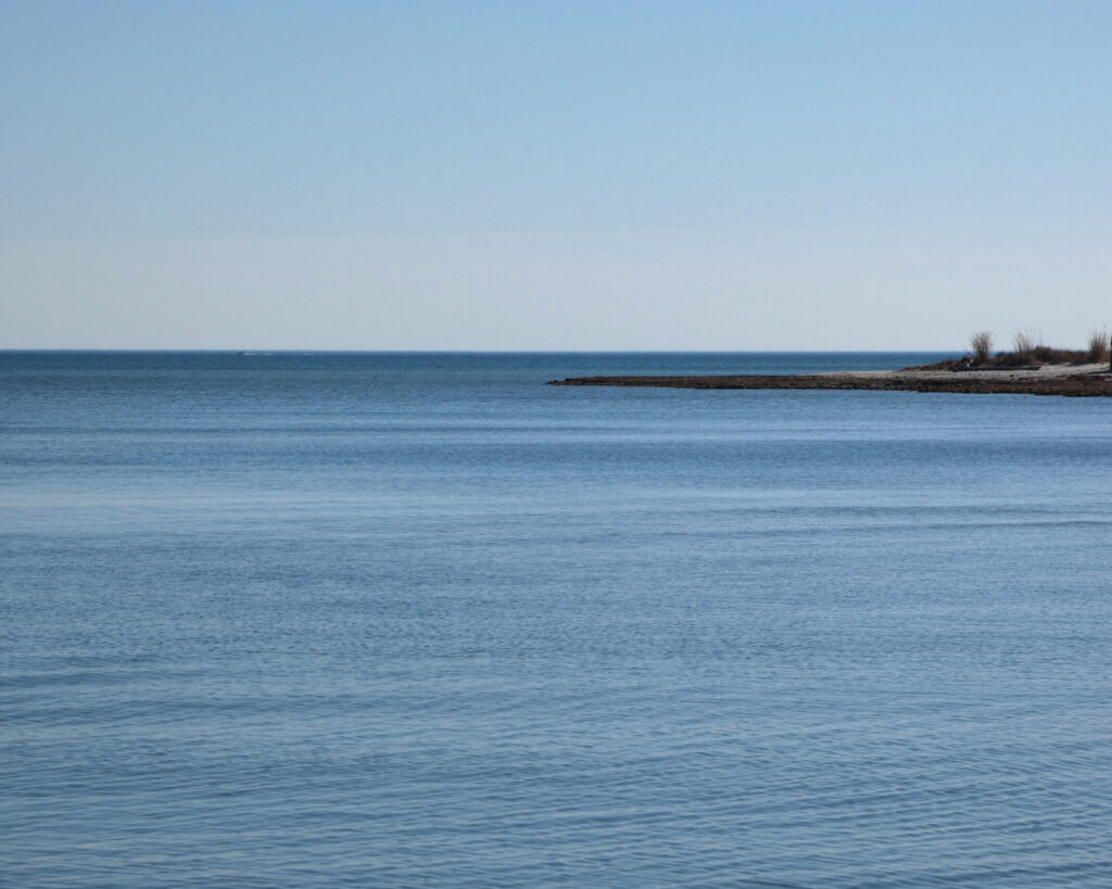
…with the Bay’s big, blue water to our right….
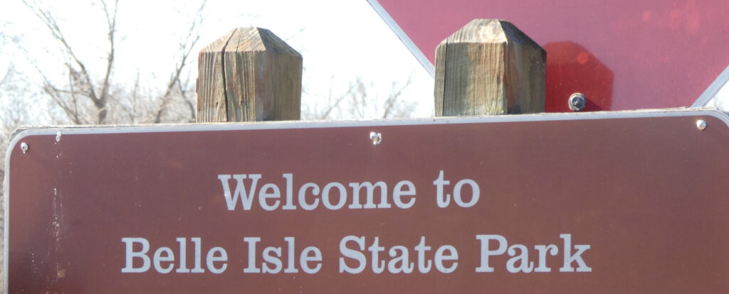
We were only about 50 miles from Westmoreland State Park on the Potomac River, and I thought that would be our next stop after leaving Hughlett Point. As we passed through Lively, VA, however, we saw a sign for Belle Isle State Park. Neither of us had ever been there and it was much closer than Westmoreland, so off we went!
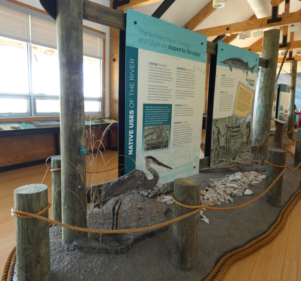
The visitor center is right on the Rappahannock River, and we enjoyed looking at the various exhibits.
The gate to the campground was closed so we weren’t able to drive through to see it, but a woman I met several years ago said it’s her favorite campground, so I’ve always been curious about it. Pictures of some of the campsites are featured here. Looks very nice!
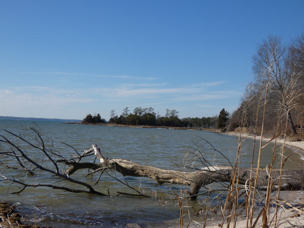
Such a beautiful day and such a beautiful state park!
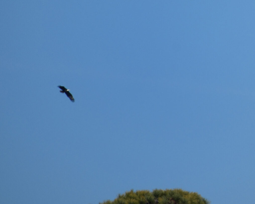
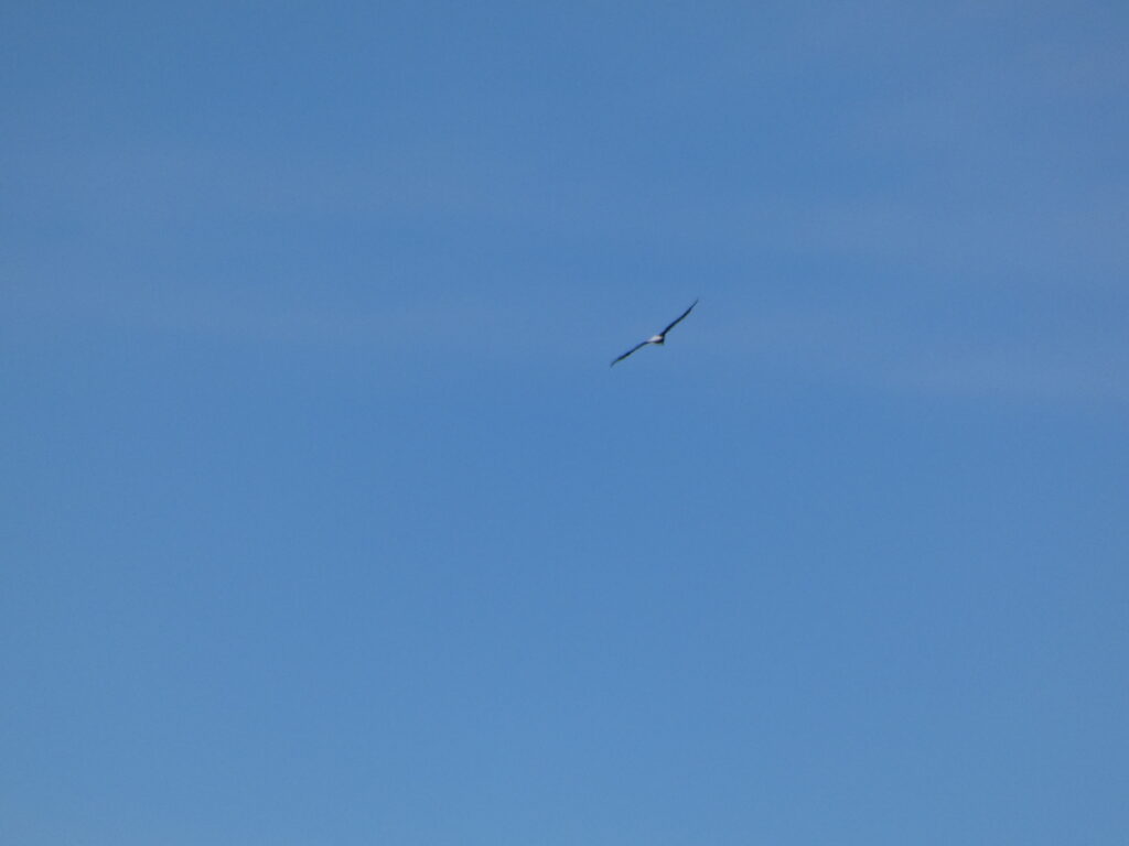
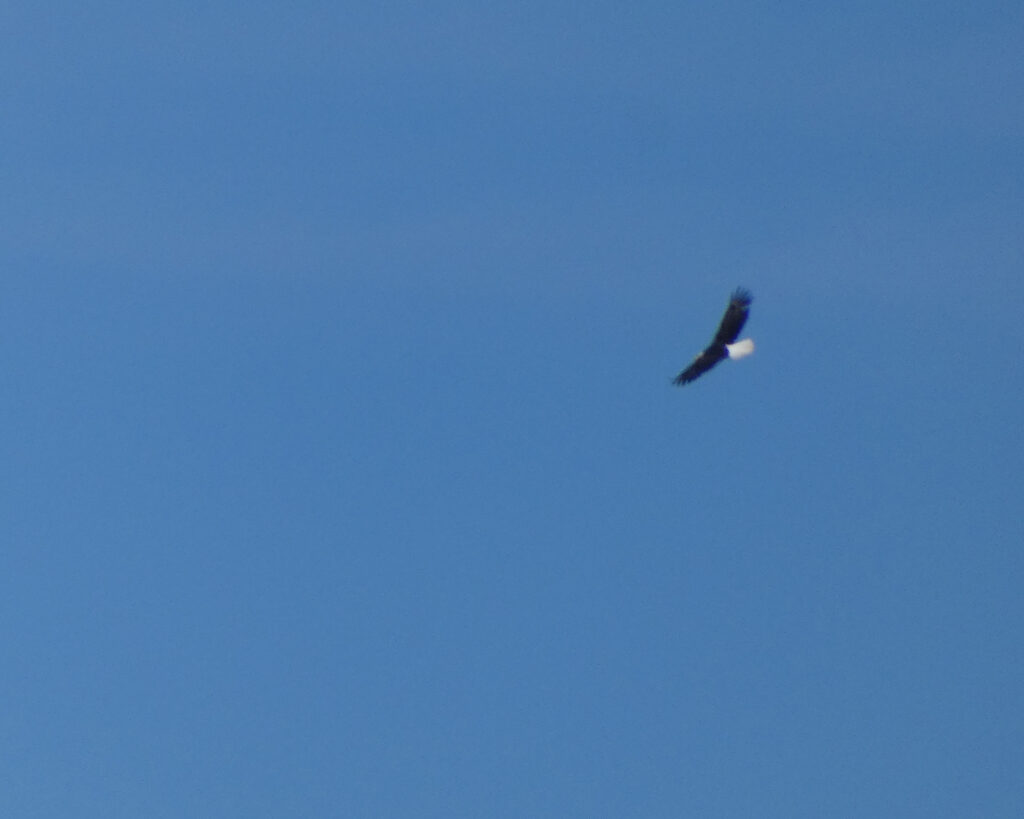
We saw several Bald Eagles at Belle Isle, but they were too far away to get good pictures. I could just see their white heads and white tail feathers…
So while I didn’t find all of the information on my Rhodes ancestor that I’d hoped to find, I actually learned quite a lot. And that sets me up for a visit to the courthouse in Orange, Virginia, to see what I can find out about Hezekiah Rhodes, Jr. who’s my 6th great grandfather!
I’m so thankful that we had the opportunity to do some genealogy research, to see new places, to visit new towns and restaurants, and to explore new roads in this beautiful and diverse state. Experiences like these are to be treasured. ❤️